MyTopo
Younts Peak Wyoming US Topo Map
Couldn't load pickup availability
Also explore the Younts Peak Forest Service Topo of this same quad for updated USFS data
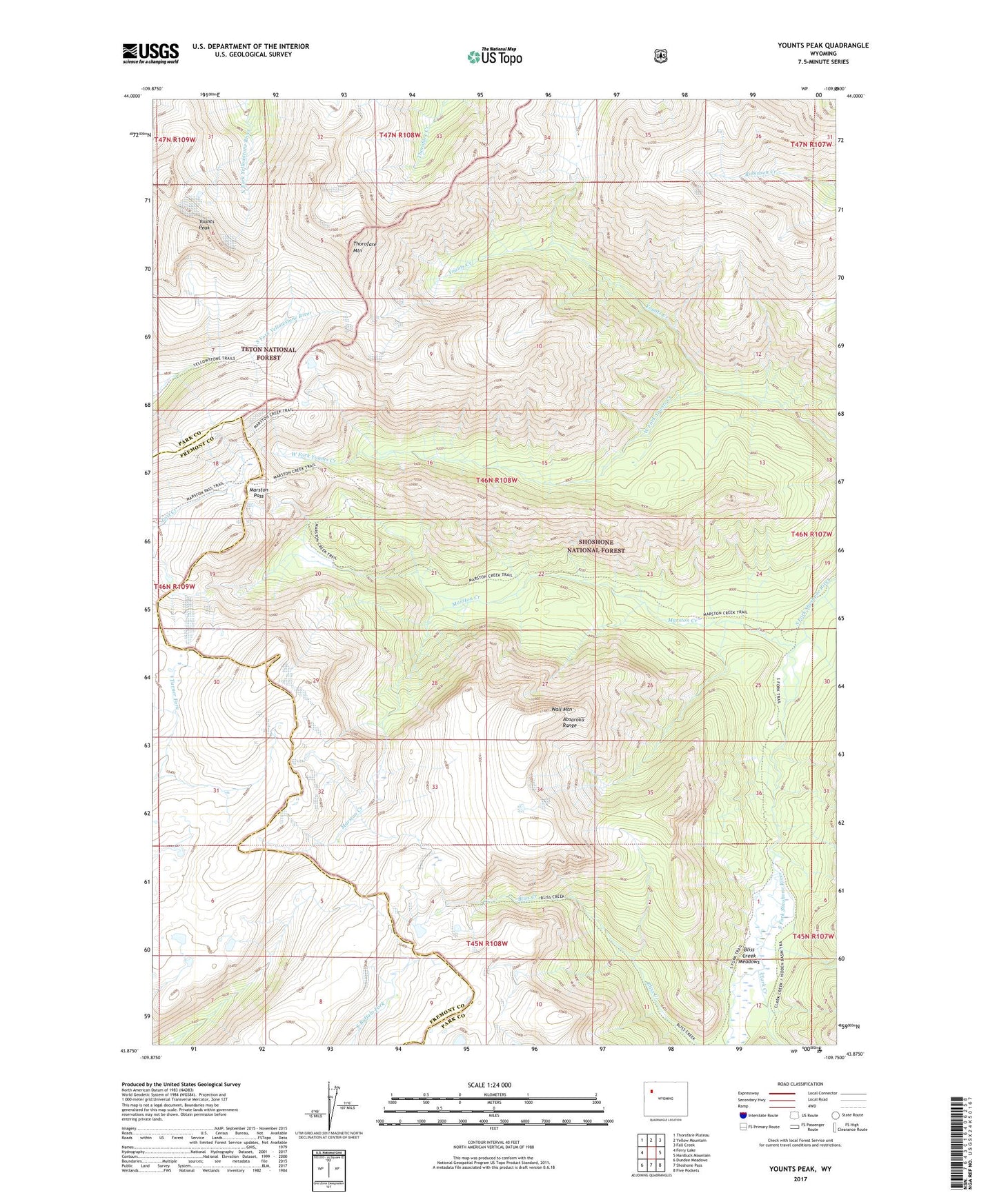
2021 topographic map quadrangle Younts Peak in the state of Wyoming. Scale: 1:24000. Based on the newly updated USGS 7.5' US Topo map series, this map is in the following counties: Park, Fremont. The map contains contour data, water features, and other items you are used to seeing on USGS maps, but also has updated roads and other features. This is the next generation of topographic maps. Printed on high-quality waterproof paper with UV fade-resistant inks.
Quads adjacent to this one:
West: Ferry Lake
Northwest: Thorofare Plateau
North: Yellow Mountain
Northeast: Fall Creek
East: Hardluck Mountain
Southeast: Five Pockets
South: Shoshone Pass
Southwest: Dundee Meadows
This map covers the same area as the classic USGS quad with code o43109h7.
Contains the following named places: Bliss Creek Meadows, Buffalo Plateau, Clark Creek, Marston Creek, Marston Pass, Thorofare Mountain, Wall Mountain, West Fork Younts Creek, Younts Peak