MyTopo
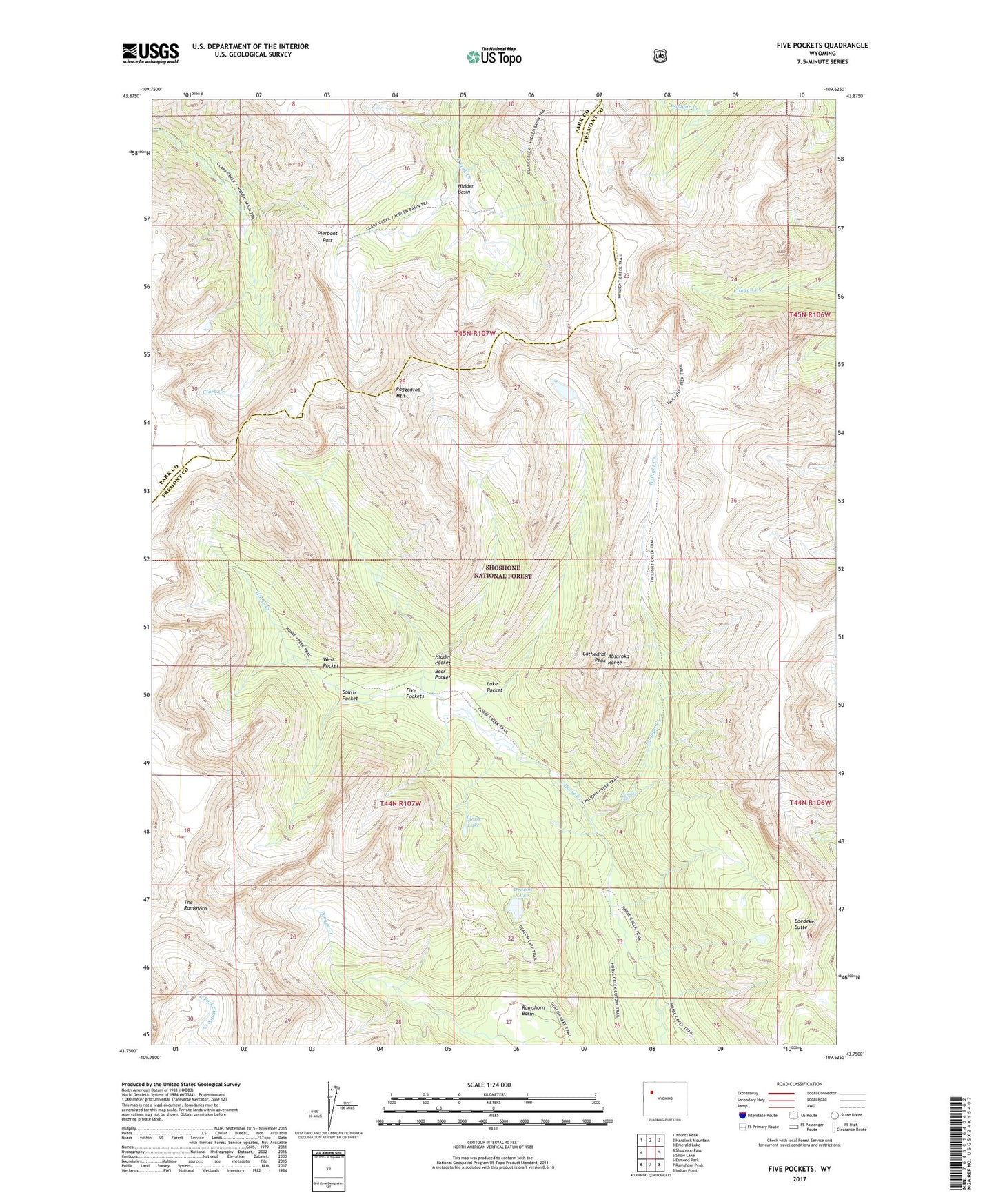
Five Pockets Wyoming US Topo Map
Couldn't load pickup availability
Also explore the Five Pockets Forest Service Topo of this same quad for updated USFS data
2021 topographic map quadrangle Five Pockets in the state of Wyoming. Scale: 1:24000. Based on the newly updated USGS 7.5' US Topo map series, this map is in the following counties: Fremont, Park. The map contains contour data, water features, and other items you are used to seeing on USGS maps, but also has updated roads and other features. This is the next generation of topographic maps. Printed on high-quality waterproof paper with UV fade-resistant inks.
Quads adjacent to this one:
West: Shoshone Pass
Northwest: Younts Peak
North: Hardluck Mountain
Northeast: Emerald Lake
East: Snow Lake
Southeast: Indian Point
South: Ramshorn Peak
Southwest: Esmond Park
This map covers the same area as the classic USGS quad with code o43109g6.
Contains the following named places: Bear Pocket, Boedeker Butte, Cathedral Peak, Deacon Lake, Eloise Lake, Five Pockets, Havely Rock Garden, Hidden Basin, Hidden Pocket, Lake Pocket, Pierpont Pass, Raggedtop Mountain, South Pocket, The Ramshorn, Twilight Creek, Twilight Creek Trail, Twilight Falls, West Pocket