MyTopo
Aliceville North Alabama US Topo Map
Couldn't load pickup availability
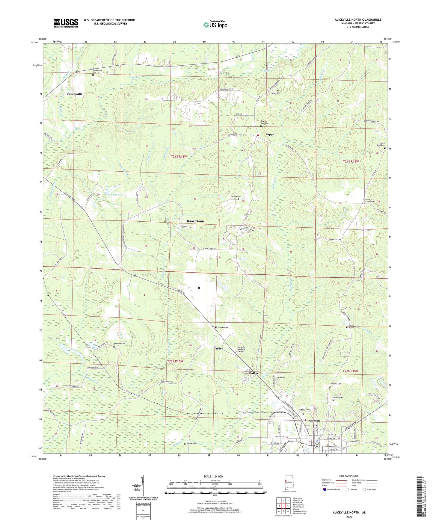
2024 topographic map quadrangle Aliceville North in the state of Alabama. Scale: 1:24000. Based on the newly updated USGS 7.5' US Topo map series, this map is in the following counties: Pickens. The map contains contour data, water features, and other items you are used to seeing on USGS maps, but also has updated roads and other features. This is the next generation of topographic maps. Printed on high-quality waterproof paper with UV fade-resistant inks.
Quads adjacent to this one:
West: Pickensville
Northwest: Forreston
North: Reform SW
Northeast: Carrollton
East: Cunningham
Southeast: Pleasant Ridge
South: Aliceville South
Southwest: Dancy
This map covers the same area as the classic USGS quad with code o33088b2.
Contains the following named places: Aliceville, Aliceville Baptist Church, Aliceville County Club, Aliceville Graded School, Aliceville Memorial Gardens, Aliceville Police Department, Aliceville Post Office, Aliceville Presbyterian Church, Aliceville Volunteer Fire Department, Beaver Town, Blubber Cemetery, Bradford Cemetery, Federal Correctional Institution Aliceville, Fleming Cemetery, Franconia, Franconia Cemetery, Garden, Garden Baptist Church, Garden Cemetery, Garden Spot, Hennon Branch, Kirksey High School, Little Creek, McMullen, Mount Hebron Cemetery, Mount Hebron Church, Mount Sinai Church, Mount Sinal Cemetery, New Cemetery, New Cumberland Cemetery, New Cumberland Church, New Wright Church, Oak Grove Church, Oak Hill Cemetery, Pilgrim Rest Cemetery, Pilgrims Rest Church, Pine Grove Church, Pleasant Hill Church, Sanders Dam, Sanders Lake, Sapps, Sapps - Union Chapel Volunteer Fire Department, Snake Creek, Solid Rock Church, Spiller Cemetery, Spirit and Truth Church, Taylor Creek, Town of McMullen, True Vine Church, Union Chapel, Union Chapel Cemetery, Westervelt Game Reserve