
MyTopo
Pickensville Alabama US Topo Map
Couldn't load pickup availability
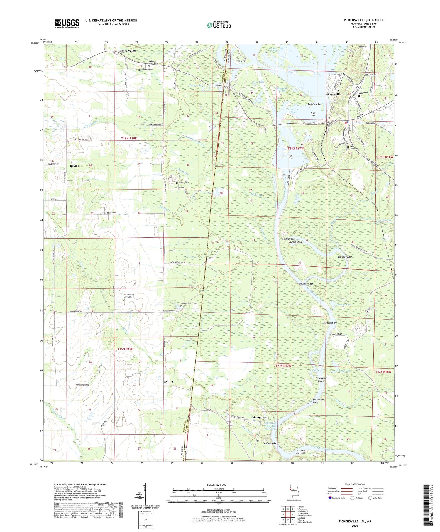
2024 topographic map quadrangle Pickensville in the states of Alabama, Mississippi. Scale: 1:24000. Based on the newly updated USGS 7.5' US Topo map series, this map is in the following counties: Pickens, Noxubee. The map contains contour data, water features, and other items you are used to seeing on USGS maps, but also has updated roads and other features. This is the next generation of topographic maps. Printed on high-quality waterproof paper with UV fade-resistant inks.
Quads adjacent to this one:
West: Cliftonville
Northwest: Trinity
North: Forreston
Northeast: Reform SW
East: Aliceville North
Southeast: Aliceville South
South: Dancy
Southwest: McLeod
Contains the following named places: Aliceville Lake, Aliceville Lock and Dam, Aubrey, Beaver Creek, Beebe Chapel, Bell Ford Bar, Big Creek, Big Creek Bar, Big Creek Landing, Bigbee Cemetery, Bigbee Church, Bigbee Valley, Bigbee Valley Access Area, Bigbee Valley Cemetery, Bigbee Valley Church, Bigbee Valley Post Office, Brazelia, Brewer Cemetery, Carraways Bluff, Christian Hill Church, Christian Love Church, Clear Lake, Coalfire Cut Off, Cockrell Plantation, Crow, Cypress Branch, Damsite Eastbank Public Use Area, Damsite West Bank Public Use Area, Ford Bar, Garnette Lake, Gavin Lake, Grantsville, Herdon Lake Dam, Indian Camp Creek, Ivie Bar, Ivies Landing, Jackson Ferry, Jacksons Landing, Krebbs Landing, Lower Cemetery, Mays Landing, McLarens Landing, Memphis, Memphis Access Area, Memphis Cemetery, Memphis Ferry, Montgomery, Nances Ferry, Old Christian Love Cemetery, Owl Creek, Parched Corn Bar, Pickens Ferry, Pickensville, Pickensville Cut Off, Pickensville Ferry, Pickensville Landing, Pickensville Lower Landing, Pickensville Recreation Area, Pickensville Volunteer Fire Department, Pine Knot Branch, Plantersville, Pulliams Landing, Ravine, Ravine Fire Department District 1, Ringgolds Bar, Ringo Bluff, Ringo Bluff Access Area, Roberson Cemetery, Rosewald School, Saint John Cemetery, Saint John Church, Sardis Church, Shylock Bar, Shylock Shoals, Spring Hill Church, Stepp Lake, Steps Lake, Tom Bevill Visitor Center, Town of Memphis, Town of Pickensville, Tucker Branch, Turnipseed Shoals, Upper Cemetery, Wallace Creek, Wallaces Bar, Wilkinson Bar, Woods Lake Dam


