MyTopo
Reform SW Alabama US Topo Map
Couldn't load pickup availability
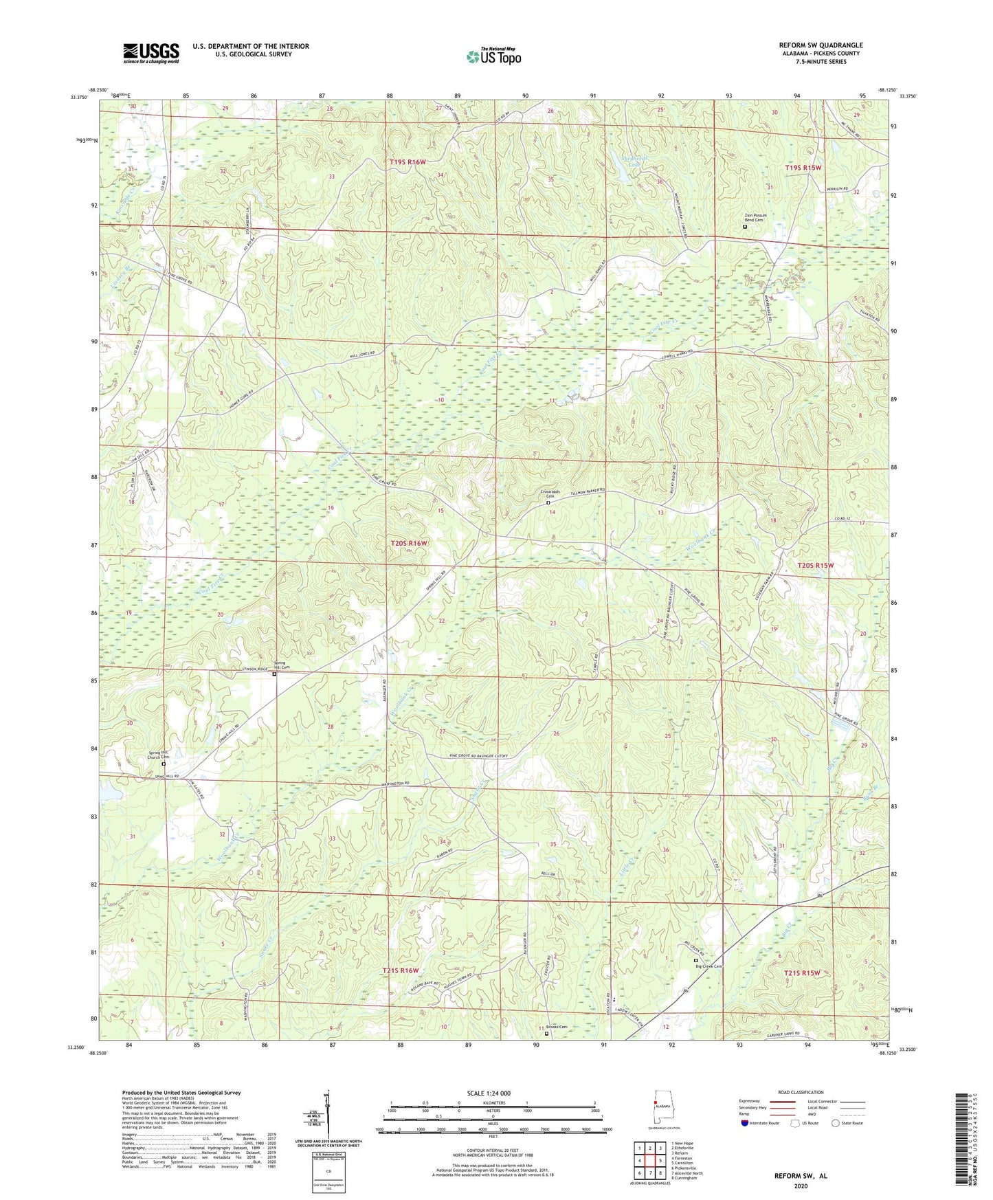
2024 topographic map quadrangle Reform SW in the state of Alabama. Scale: 1:24000. Based on the newly updated USGS 7.5' US Topo map series, this map is in the following counties: Pickens. The map contains contour data, water features, and other items you are used to seeing on USGS maps, but also has updated roads and other features. This is the next generation of topographic maps. Printed on high-quality waterproof paper with UV fade-resistant inks.
Quads adjacent to this one:
West: Forreston
Northwest: New Hope
North: Ethelsville
Northeast: Reform
East: Carrollton
Southeast: Cunningham
South: Aliceville North
Southwest: Pickensville
This map covers the same area as the classic USGS quad with code o33088c2.
Contains the following named places: Allen School, Archer, Big Creek Cemetery, Big Creek Missionary Baptist Church, Big Creek School, Brooks Cemetery, Bunk Branch, C W Ladow Center, Carrollton Division, Cross Roads Church, Crossroads Cemetery, Lintons Bridge, Mount Moriah School, Mount Pleasant Church, New Jerusalem Church, Pine Grove, Pine Grove Church, Shepherd Dam, Shepherds Lake, Shiloh Unity Church, Spring Hill Baptist Church, Spring Hill Cemetery, Spring Hill Church, Spring Hill Church Cemetery, Woolbank Creek Gas Field, Zion Possum Bend Cemetery, ZIP Code: 35447