MyTopo
Atmore Alabama US Topo Map
Couldn't load pickup availability
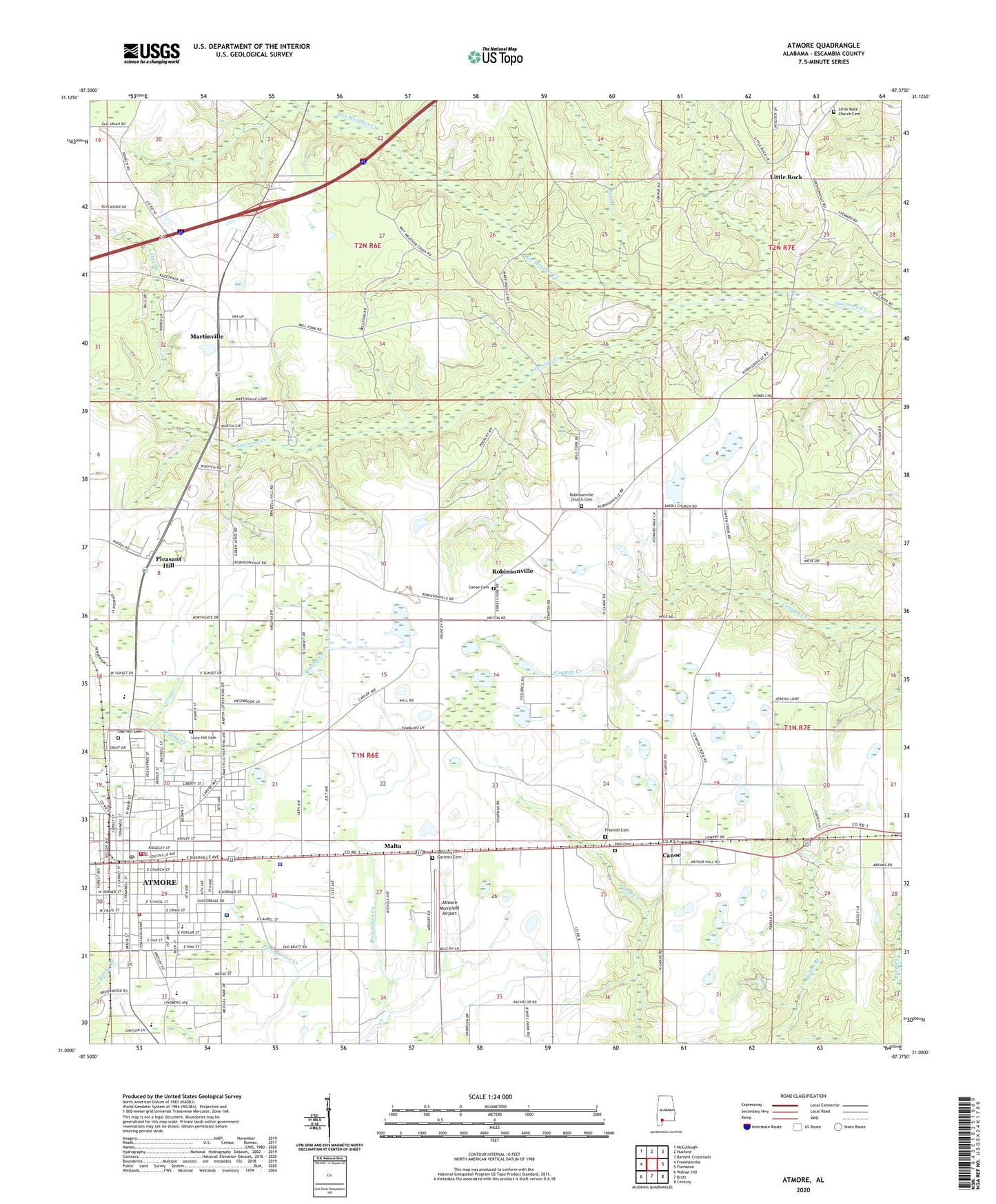
2024 topographic map quadrangle Atmore in the state of Alabama. Scale: 1:24000. Based on the newly updated USGS 7.5' US Topo map series, this map is in the following counties: Escambia. The map contains contour data, water features, and other items you are used to seeing on USGS maps, but also has updated roads and other features. This is the next generation of topographic maps. Printed on high-quality waterproof paper with UV fade-resistant inks.
Quads adjacent to this one:
West: Freemanville
Northwest: McCullough
North: Huxford
Northeast: Barnett Crossroads
East: Flomaton
Southeast: Century
South: Bratt
Southwest: Walnut Hill
This map covers the same area as the classic USGS quad with code o31087a4.
Contains the following named places: A C Moore Elementary School, Atmore, Atmore City Hall, Atmore Community Hospital, Atmore Division, Atmore Fire Department Station 1, Atmore Fire Department Station 2, Atmore Health Center, Atmore Municipal Airport, Atmore Nursing Center, Atmore Plaza Shopping Center, Atmore Police Department, Atmore Post Office, Atmore Public Library, Atmore State Technical College, Bachelor Field, Bethel Church, Big Escambia Creek Gas Field, Briar Lake Estates, Brooke Memorial Baptist Church, Brooks Memorial Church, Brown Street Seventh Day Adventist Church, Canoe, Canoe Cemetery, Canoe Elementary School, Church of Christ, Douglas Chapel Church, Escambia County High School, Escambia County Middle School, Escambia County Satellite Office at Atmore, Escambia County Sheriff's Office, Escambia County Training School, First Assembly of God Church, First Baptist Church, First Freewill Baptist Church, First Methodist Church, First Pentecostal Holiness Church of Christ, First Presbyterian Church, Freemanville School, Freewill Cemetery, Greenlawn Hospital, Hall Cemetery, Hog Branch, Langhams African Methodist Episcopal Chapel, Little Rock, Little Rock Church Cemetery, Little Rock Church of Assembly of the Lord Jesus Christ, Little Rock Gas Field, Little Rock School, Little Rock Volunteer Fire Department, Lucy Hill Cemetery, Malta, Martinville, Martinville Church, Martinville School, McRae Street Methodist Church, Missionary Baptist Church, Mount Olive Baptist Church, Mount Triumph Baptist Church Number Two, New Home Church, North Eighth Avenue City Park, Oak Hill Cemetery, Old Ship Church, Pine Level Primitive Baptist Church, Pleasant Hill, Pleasant Hill Baptist Church, Pleasant Hill Church, Pond Creek, Racheal-Patterson School, Rivercane Number 3 Industrial Park, Robinsonville, Robinsonville Baptist Church, Robinsonville Church Cemetery, Saint Roberts Catholic Church, Serenity Gardens Cemetery, South Eighth Avenue City Park, Southern Estates, The Meadows Nursing Home, Trinity Episcopal Church, Veterans Memorial Park, WATM-AM (Atmore), Westside Park, Wet Weather Creek, WSKR-FM (Atmore), Zion Star African Methodist Episcopal Church