MyTopo
Barnett Crossroads Alabama US Topo Map
Couldn't load pickup availability
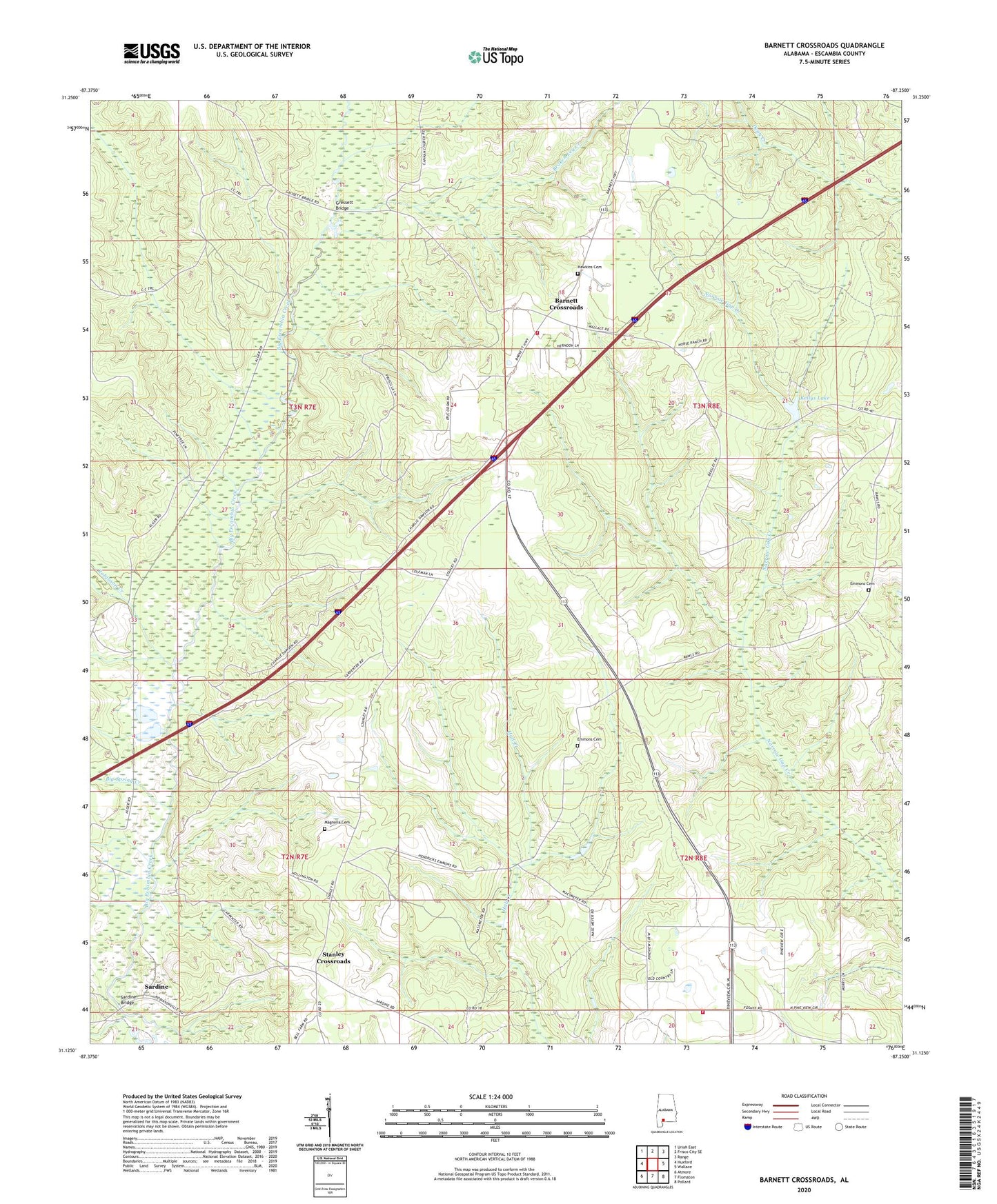
2024 topographic map quadrangle Barnett Crossroads in the state of Alabama. Scale: 1:24000. Based on the newly updated USGS 7.5' US Topo map series, this map is in the following counties: Escambia. The map contains contour data, water features, and other items you are used to seeing on USGS maps, but also has updated roads and other features. This is the next generation of topographic maps. Printed on high-quality waterproof paper with UV fade-resistant inks.
Quads adjacent to this one:
West: Huxford
Northwest: Uriah East
North: Frisco City SE
Northeast: Range
East: Wallace
Southeast: Pollard
South: Flomaton
Southwest: Atmore
This map covers the same area as the classic USGS quad with code o31087b3.
Contains the following named places: Barnett Crossroads, Barnett Crossroads Volunteer Fire Department, Big Spring Creek, Broken Leg Creek, Canaan Church, Emmons Cemetery, Gravel Hill Church, Gressett Bridge, Hawkins Cemetery, Kellys Lake, Magnolia Baptist Church, Magnolia Cemetery, Maschmeyer Lookout Tower, New Bethlehem Baptist Church, Pineview, Pineview - Foshee Volunteer Fire Department, Pineview Church, Robinson Creek, Sardine, Sardine Bridge, Smiths Church, Stanley Crossroads, Stewart, Stewart School