MyTopo
Walnut Hill Florida US Topo Map
Couldn't load pickup availability
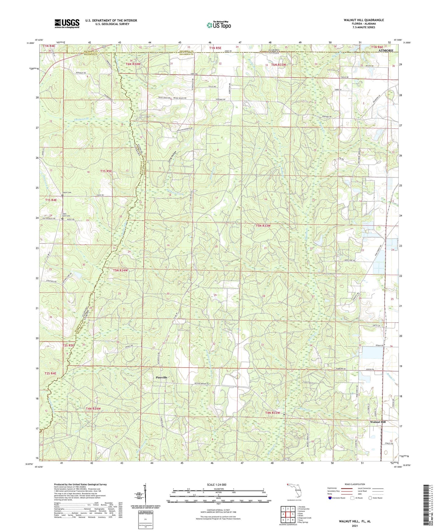
2024 topographic map quadrangle Walnut Hill in the states of Florida, Alabama. Scale: 1:24000. Based on the newly updated USGS 7.5' US Topo map series, this map is in the following counties: Escambia, Baldwin. The map contains contour data, water features, and other items you are used to seeing on USGS maps, but also has updated roads and other features. This is the next generation of topographic maps. Printed on high-quality waterproof paper with UV fade-resistant inks.
Quads adjacent to this one:
West: Dyas
Northwest: Perdido
North: Freemanville
Northeast: Atmore
East: Bratt
Southeast: Bay Springs
South: Enon
Southwest: Dogwood Creek
This map covers the same area as the classic USGS quad with code o30087h5.
Contains the following named places: Antioch Church, Dutch Cemetery, Halls Fork Cemetery, Halls Fork Church, Halls Fork School, Hubbard Creek, Long Hollow, Nakomis School, Pineville, Ramsey's Mobile Home Park, Reedy Branch, Rocky Branch, Rocky Creek, Thompson Branch, Walnut Hill, Walnut Hill Lookout Tower