
MyTopo
Bishop Alabama US Topo Map
Couldn't load pickup availability
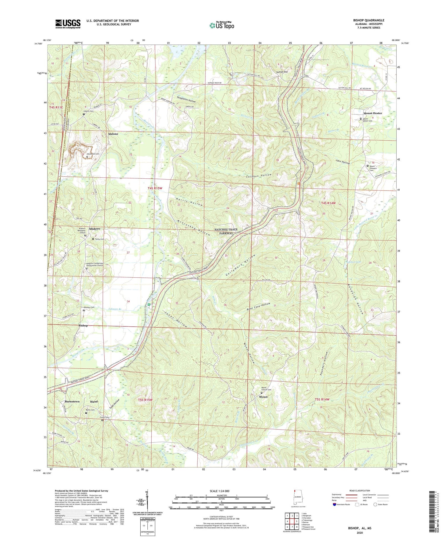
2024 topographic map quadrangle Bishop in the states of Alabama, Mississippi. Scale: 1:24000. Based on the newly updated USGS 7.5' US Topo map series, this map is in the following counties: Colbert, Tishomingo. The map contains contour data, water features, and other items you are used to seeing on USGS maps, but also has updated roads and other features. This is the next generation of topographic maps. Printed on high-quality waterproof paper with UV fade-resistant inks.
Quads adjacent to this one:
West: Tishomingo
Northwest: Iuka
North: Margerum
Northeast: Cherokee
East: Barton
Southeast: Pleasant Grove
South: Pleasant Site
Southwest: Belmont
Contains the following named places: Allsboro, Allsboro Church, Allsboro Junior High School, Alsobrook Cemetery, Alsobrook Church, Alsobrook School, Asphalt Lake, Asphalt Rock Baptist Church, Bishop, Boldin Mill Branch, Bone Cave Hollow, Browns Branch, Burnstown, Calhoun Hollow, Cherokee Division, Cripple Deer Creek, Finley Cemetery, Gallymore Hollow, Gibbs Branch, Good Springs, Good Springs Methodist Church, Haake Hollow Branch, Harris Hollow, Henderson Branch, Hester Branch, Jake Hollow, Johnson Branch, Johnson Cemetery, Jones Hollow, Liberty Cemetery, Liberty Methodist Episcopal Church, Liberty Missionary Baptist Church, Liberty School, Lindsey Branch, Malone, Maud, Maud - Burns Cemetery, McCluskey Hollow, Mount Hester, Mount Hester Cemetery, Mount Hester Cumberland Presbyterian Church, Mount Hester School, Mount Pleasant Cemetery, Mynot, Mynot Cemetery, Mynot Church of Christ, Mynot Hollow, Mynot School, Mynott Chapel Missionary Baptist Church, Natchez Trace Monument, Pounders Hollow, Randolph Hollow, Rock Creek, Sutton Hill, Tanyard Branch, Templeton Hollow, Todd Hollow, Twitty Cemetery, Weaver Branch, West Colbert Sportsman Club, Wills Creek, ZIP Code: 35616


