MyTopo
Pleasant Grove Alabama US Topo Map
Couldn't load pickup availability
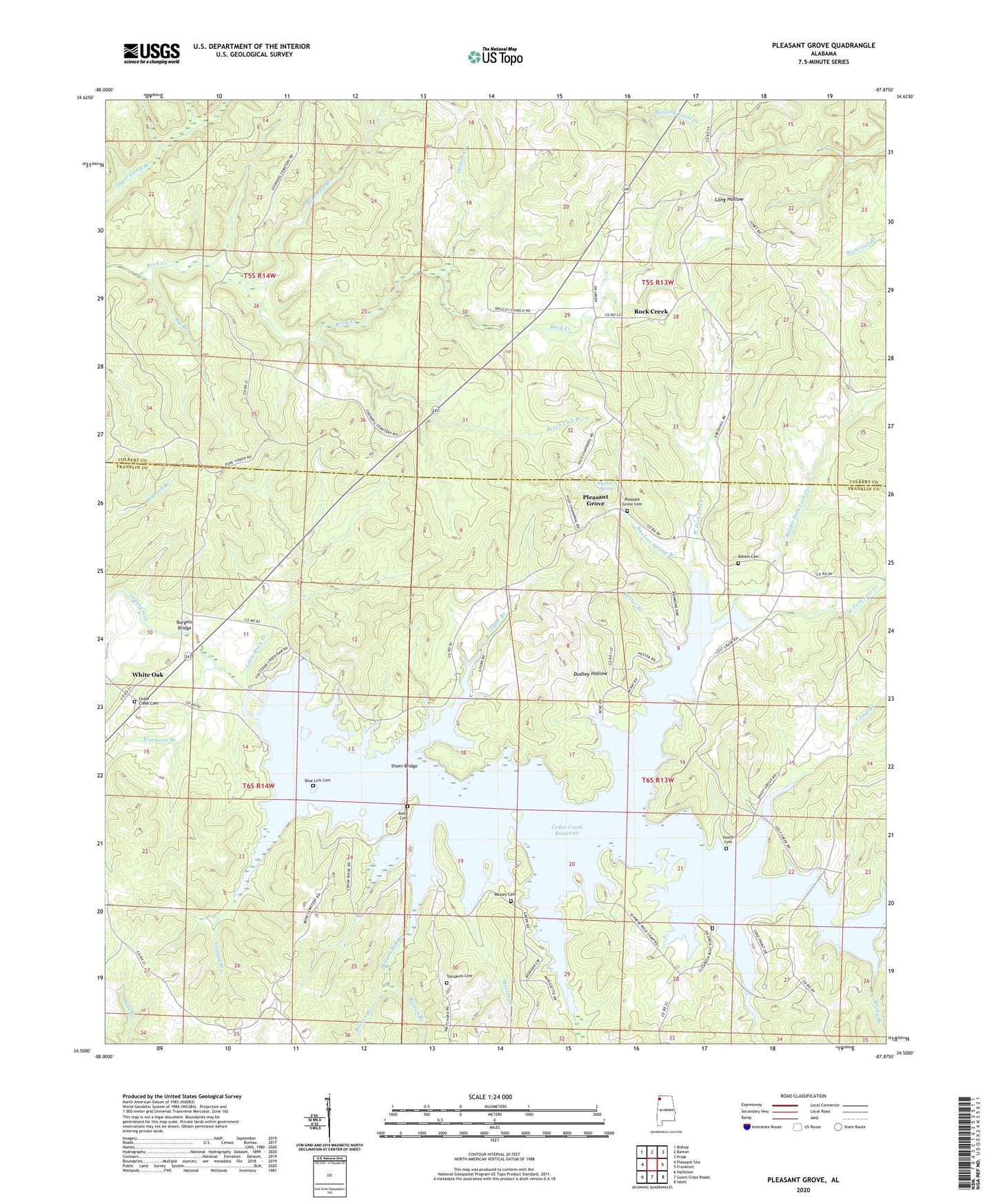
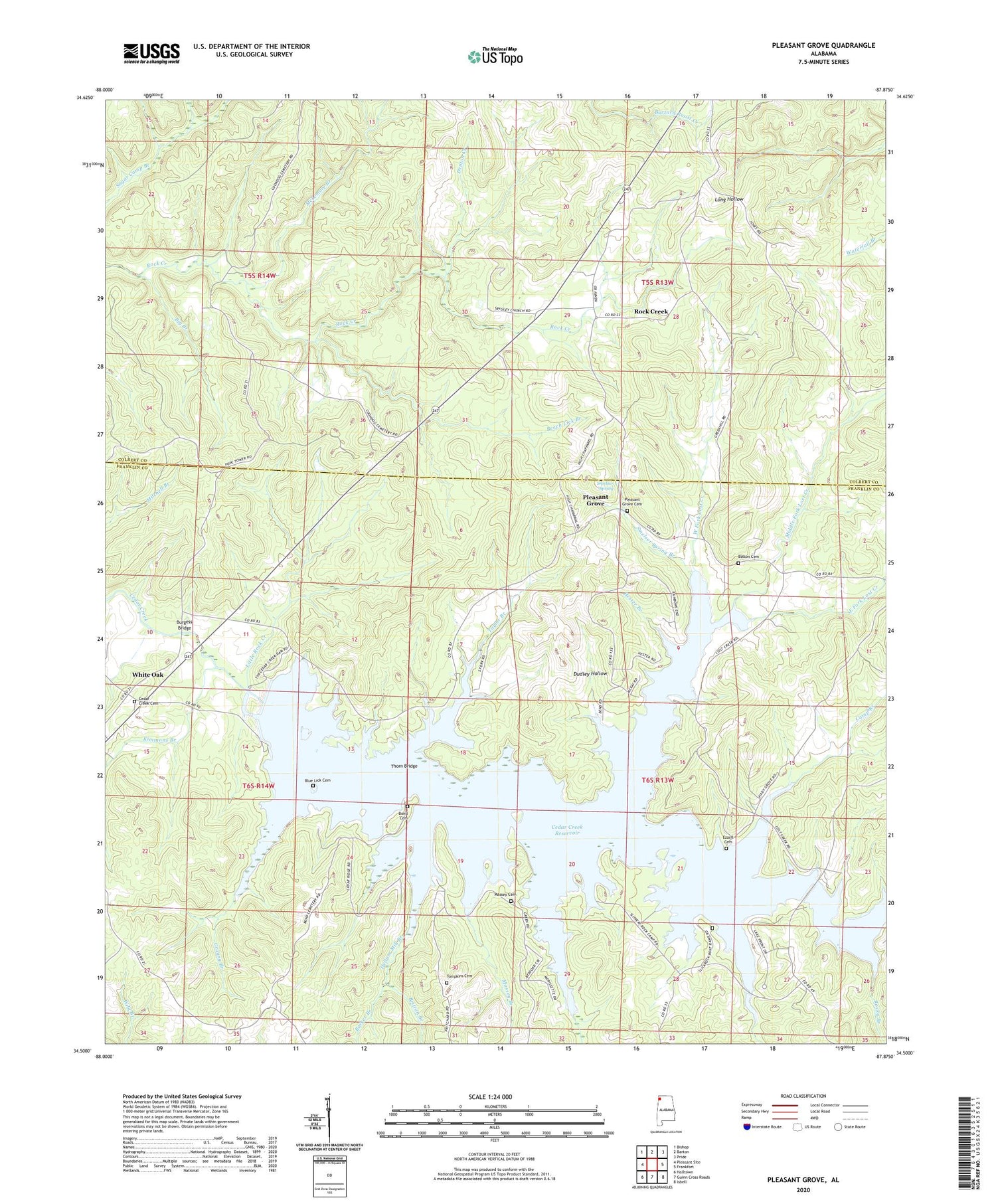
2024 topographic map quadrangle Pleasant Grove in the state of Alabama. Scale: 1:24000. Based on the newly updated USGS 7.5' US Topo map series, this map is in the following counties: Franklin, Colbert. The map contains contour data, water features, and other items you are used to seeing on USGS maps, but also has updated roads and other features. This is the next generation of topographic maps. Printed on high-quality waterproof paper with UV fade-resistant inks.
Quads adjacent to this one:
West: Pleasant Site
Northwest: Bishop
North: Barton
Northeast: Pride
East: Frankfort
Southeast: Isbell
South: Guinn Cross Roads
Southwest: Halltown
This map covers the same area as the classic USGS quad with code o34087e8.
Contains the following named places: Barker Branch, Beech Lick Branch, Big Branch, Blue Lick Branch, Blue Lick Cemetery, Bolton Cemetery, Bond Cemetery, Britton Branch, Burgess Bridge, Camp Branch, Cedar Creek and White Oak Cemetery, Cedar Creek Church, Cedar Creek Dam, Cedar Creek Reservoir, Denton, Denton Creek, Dudley Hollow, East Fork Lost Creek, Evening Shade Baptist Church, Ezzell Bridge, Ezzell Cemetery, Ezzell Ford, Granny Branch, Greenhill Cemetery, Hellum Mill Branch, Hester Branch, Hub, Kimmons Branch, Liberty Church, Lick Creek, Little Rock Creek, Lost Creek, Massey Branch, Massey Cemetery, McLemore Branch, Middle Fork Lost Creek, Mint Springs, Mount Pleasant Church, Nance Store, Oak Grove School, Pleasant Grove, Pleasant Grove Cemetery, Posey School, Punkin Center Church, Rock Creek, Rock Creek Church of Christ, Rock Creek School, Rocky Branch, Slickrock Ford, Smelser Spring, Smelser Spring Branch, Srygley Church of Christ, Taylor Branch, Thorn Bridge, Thorn School, Waites Bridge, West Fork Lost Creek, White Oak, Whiteoak School, Wolf Den Branch