MyTopo
Iuka Mississippi US Topo Map
Couldn't load pickup availability
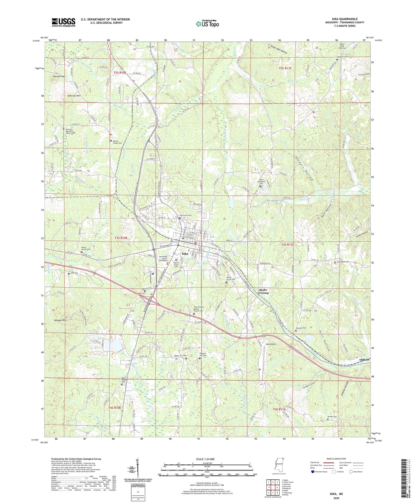
2024 topographic map quadrangle Iuka in the state of Mississippi. Scale: 1:24000. Based on the newly updated USGS 7.5' US Topo map series, this map is in the following counties: Tishomingo. The map contains contour data, water features, and other items you are used to seeing on USGS maps, but also has updated roads and other features. This is the next generation of topographic maps. Printed on high-quality waterproof paper with UV fade-resistant inks.
Quads adjacent to this one:
West: Burnsville
Northwest: Doskie
North: Yellow Creek
Northeast: Waterloo
East: Margerum
Southeast: Bishop
South: Tishomingo
Southwest: Paden
This map covers the same area as the classic USGS quad with code o34088g2.
Contains the following named places: Akers Branch, Apostolic Church of Jesus Christ, Ashcraft Mountain, Bacon Springs, Bennett Chapel School, Blythe Crossing, Brinkley Lake Dam, Brown Branch, Castleberry Hollow, Central Elementary School, City of Iuka, Como Lake, Dark Hollow, Dean Branch, Eastport Mill Creek Fire Department, Eastport School, Fifth Street Baptist Church, First Pentecostal Church, Friendship School, Goyer Cemetery, Gravel Siding, Harmony Branch, Harmony Central Volunteer Fire Department, Harmony Church, Harwell Mountain, Holt Hollow, Hopewell School, Iuka, Iuka Airport, Iuka Baptist Church, Iuka Church of Christ, Iuka City Hall, Iuka Elementary School, Iuka Fire Department, Iuka High School, Iuka Normal Institute, Iuka Police Department, Iuka Post Office, Iuka Public Library, Iuka Sewage Lagoon Dam, Iuka United Methodist Church, John M Stone Memorial Marker, Kirk Branch, Kirk Cemetery, Martin School, Mineral Springs Park, Moore Church, Moores Chapel Cemetery, Moser Pond, Mount Evergreen Cemetery, Mount Evergreen Church, Mount Joy Cemetery, Mount Joy Church, Mount Moriah Cemetery, Mount Moriah Church, New Prospect Cemetery, New Prospect Church, North Mississippi Medical Center, Nunley Cemetery, Oak Grove Cemetery, Oldham, Oldham Hollow, Pickens Branch, Pinedale, Pleasant Hill Cemetery, Pleasant Hill Church, Pleasant Hill School, Ramsey Branch, Rhodes Branch, Robbins Branch, Rocky Spring Church, Rocky Springs School, Rowin Branch, Saint Marys Catholic Church, Sanders Hollow, Segars Airport, Shady Grove Cemetery, Snowdown Cemetery, Snowdown Church, Snowdown Pleasant Hill Fire Department, Snowdown School, Supervisor District 3, Tishomingo County Courthouse, Tishomingo County Fire Department, Tishomingo County Sheriff's Office, Woodall Mountain, WTIB-FM (Iuka), WVOM-AM (Iuka), ZIP Code: 38852