MyTopo
Blacksher Alabama US Topo Map
Couldn't load pickup availability
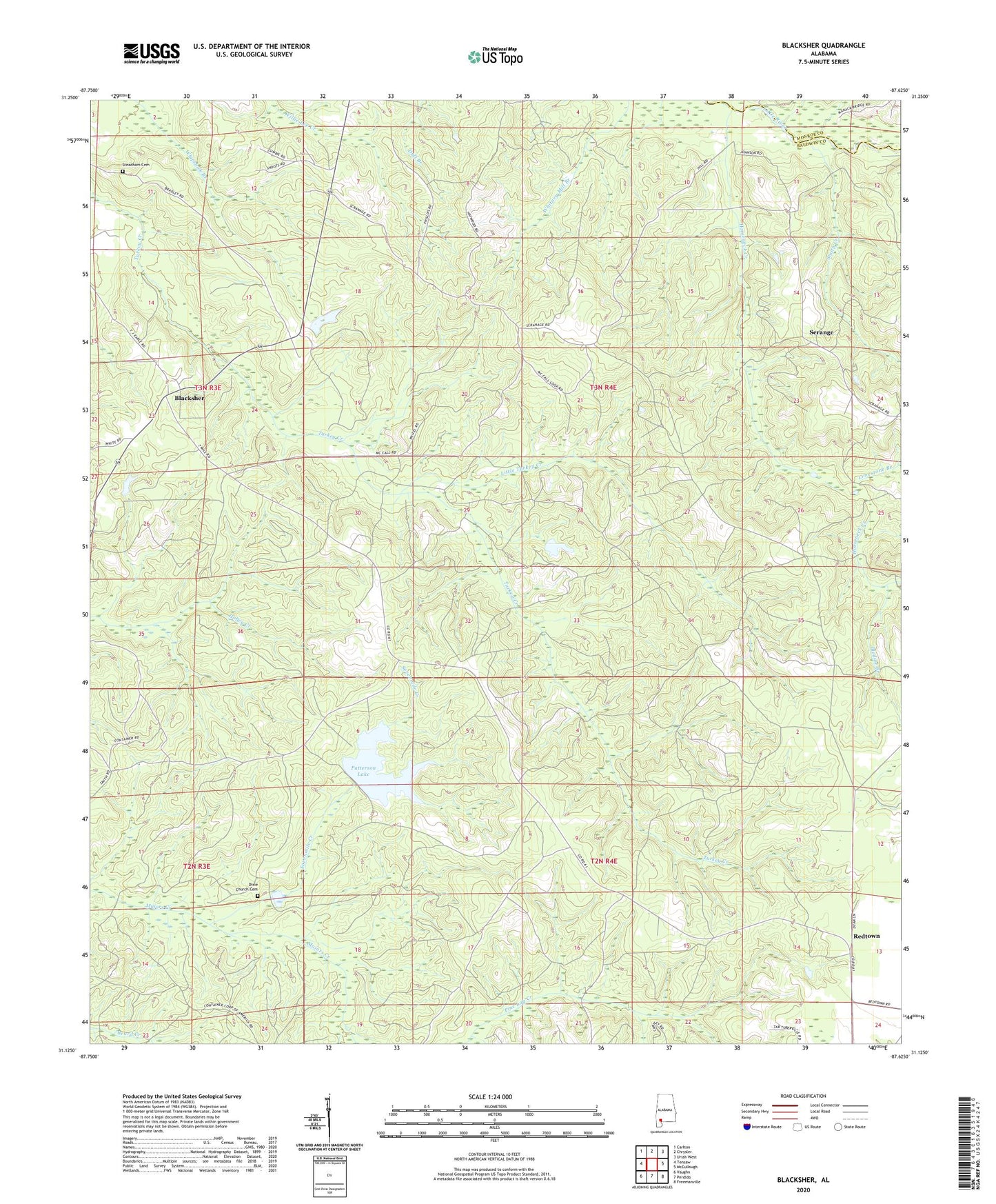
2024 topographic map quadrangle Blacksher in the state of Alabama. Scale: 1:24000. Based on the newly updated USGS 7.5' US Topo map series, this map is in the following counties: Baldwin, Monroe. The map contains contour data, water features, and other items you are used to seeing on USGS maps, but also has updated roads and other features. This is the next generation of topographic maps. Printed on high-quality waterproof paper with UV fade-resistant inks.
Quads adjacent to this one:
West: Tensaw
Northwest: Carlton
North: Chrysler
Northeast: Uriah West
East: McCullough
Southeast: Freemanville
South: Perdido
Southwest: Vaughn
This map covers the same area as the classic USGS quad with code o31087b6.
Contains the following named places: Beaverdam Creek, Blacks Mill, Blacksher, Blacksher Oil Field, Bledsoe Branch, Brown Crosby Camp, Dixie Church Cemetery, Horseneck Creek, Limestone Branch, Little River Oil Field, Little Turkey Creek, Lottie Lookout Tower, Montpelier, Patterson Dam, Patterson Lake, Redtown, Serange, Sevenmile Creek, Smith Creek, Southern Pine Hills, Steadham Cemetery, Tate Creek Missionary Baptist Church, ZIP Code: 36550