MyTopo
Carlton Alabama US Topo Map
Couldn't load pickup availability
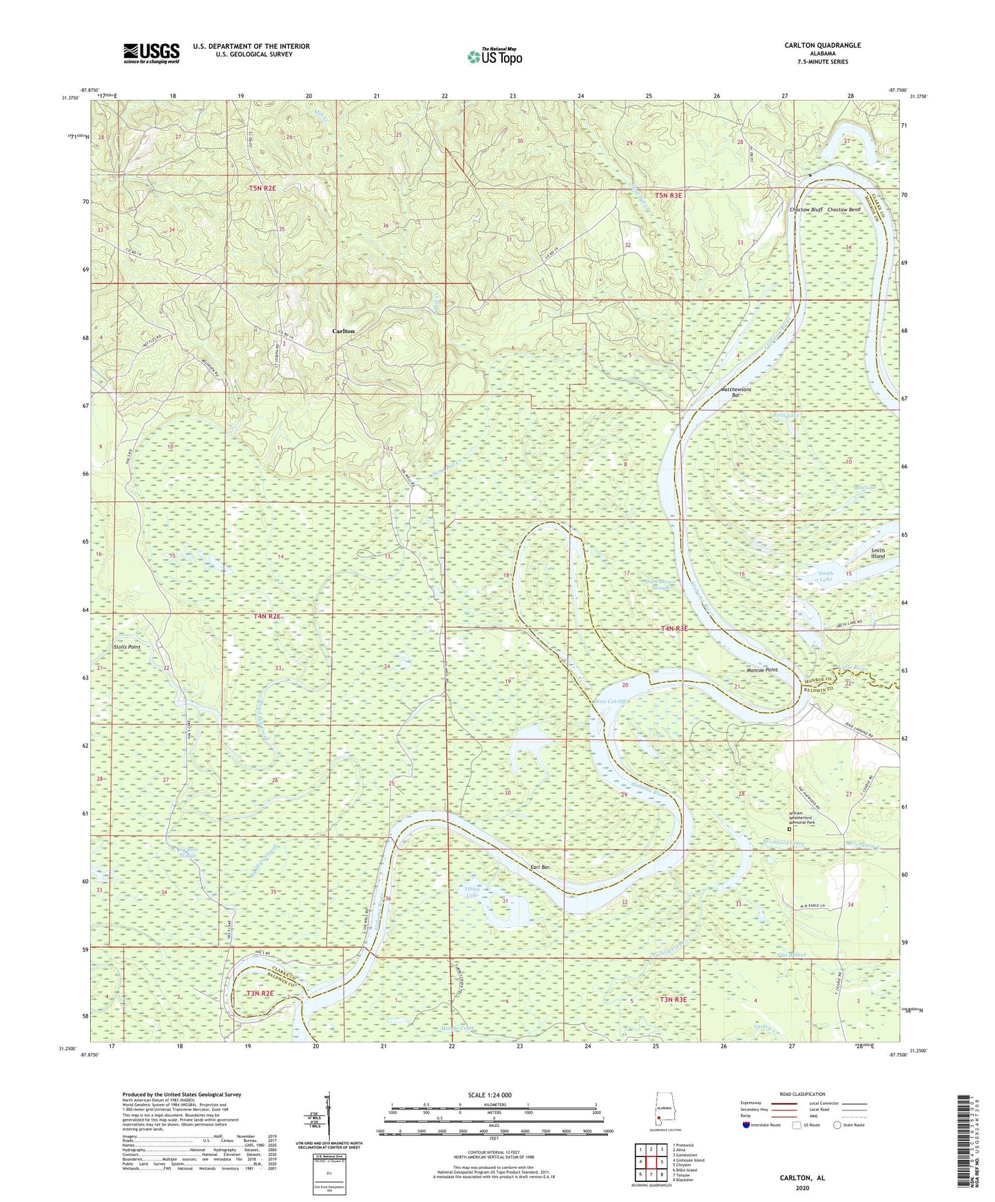
2024 topographic map quadrangle Carlton in the state of Alabama. Scale: 1:24000. Based on the newly updated USGS 7.5' US Topo map series, this map is in the following counties: Clarke, Baldwin, Monroe. The map contains contour data, water features, and other items you are used to seeing on USGS maps, but also has updated roads and other features. This is the next generation of topographic maps. Printed on high-quality waterproof paper with UV fade-resistant inks.
Quads adjacent to this one:
West: Ginhouse Island
Northwest: Prestwick
North: Alma
Northeast: Gainestown
East: Chrysler
Southeast: Blacksher
South: Tensaw
Southwest: Bilbo Island
This map covers the same area as the classic USGS quad with code o31087c7.
Contains the following named places: Big Hole Slough, Brickyard Creek, Brickyard Lake, Carlton, Carlton Census Designated Place, Choctaw Bend, Choctaw Bluff, Choctaw Lake, Church of God, Colton Pond, Dallas Landing, Dark Brown Slough, Davis Landing, Dead Lake, Dead River, Dixie Cut-Off, Dixie Landing, Driesbach Lake, Earl Bar, Earle Landing, Fells Lake, Flat Branch, Fort Stonewall, H G Davis Lodge, Joe David Landing, Little River, Little River School, Lower Madison Lodge, Madison Church, Malone Creek, Matthewson Sawmill, Matthewsons Bar, Mill Creek, Monroe Point, Moore Landing, Mount Gillerd Baptist Church, Mount Nebo Church, Red Eagle Landing, Saint Joe Baptist Church, Saint Pauls Church, Sand Hill Creek, Sibley Lake, Smith Island, Smith Lake, Stolls Point, Tate Chapel African Methodist Episcopal Church, Tate Chapel Community Center, Tate Church, Tate Creek Baptist Church, Turkey Creek, Upper Madison Landing, Whipstock Branch, William Weatherford Memorial Park, Willie Lee Creek, Wilson Landing