MyTopo
Uriah West Alabama US Topo Map
Couldn't load pickup availability
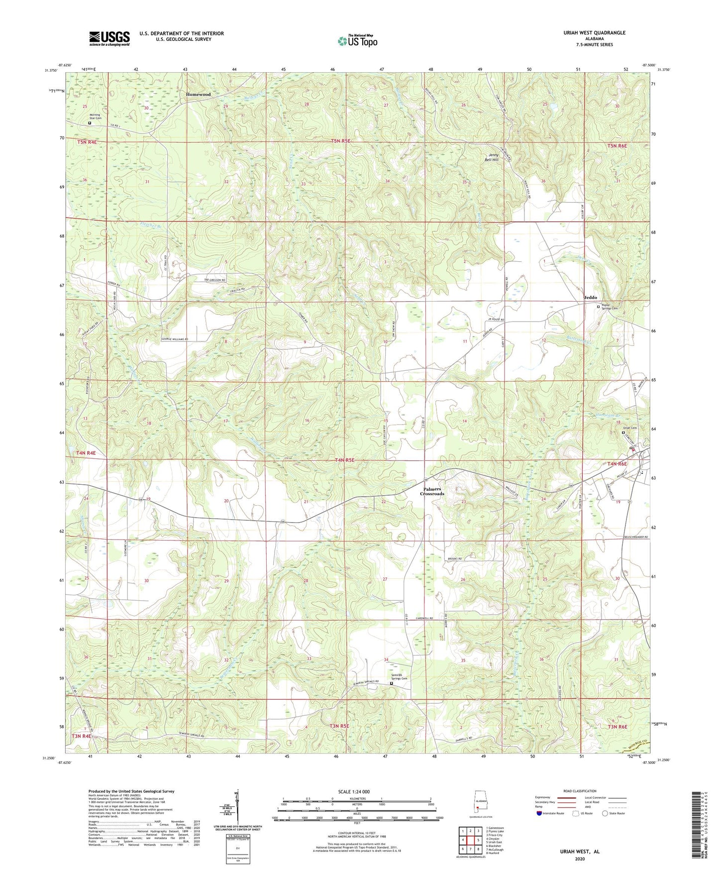
2024 topographic map quadrangle Uriah West in the state of Alabama. Scale: 1:24000. Based on the newly updated USGS 7.5' US Topo map series, this map is in the following counties: Monroe, Escambia. The map contains contour data, water features, and other items you are used to seeing on USGS maps, but also has updated roads and other features. This is the next generation of topographic maps. Printed on high-quality waterproof paper with UV fade-resistant inks.
Quads adjacent to this one:
West: Chrysler
Northwest: Gainestown
North: Flynns Lake
Northeast: Frisco City
East: Uriah East
Southeast: Huxford
South: McCullough
Southwest: Blacksher
This map covers the same area as the classic USGS quad with code o31087c5.
Contains the following named places: Blacksher Lookout Tower, Blacksher School, Homewood, Hurricane Branch, Jeddo, Jenny Bell Hill, Morning Star Baptist Church, Morning Star Cemetery, Palmers Crossroads, Poplar Springs Baptist Church, Poplar Springs Cemetery, Saint Paul Church, Sand Creek, Semirah Springs Cemetery, Semirah Springs Freewill Baptist Church, Uriah, Uriah Cemetery, Uriah Division, Uriah First Baptist Church, Uriah Oil Field, Uriah Post Office, Uriah United Methodist Church, Uriah Volunteer Fire Department, Wallers Creek Oil Field, ZIP Code: 36480