MyTopo
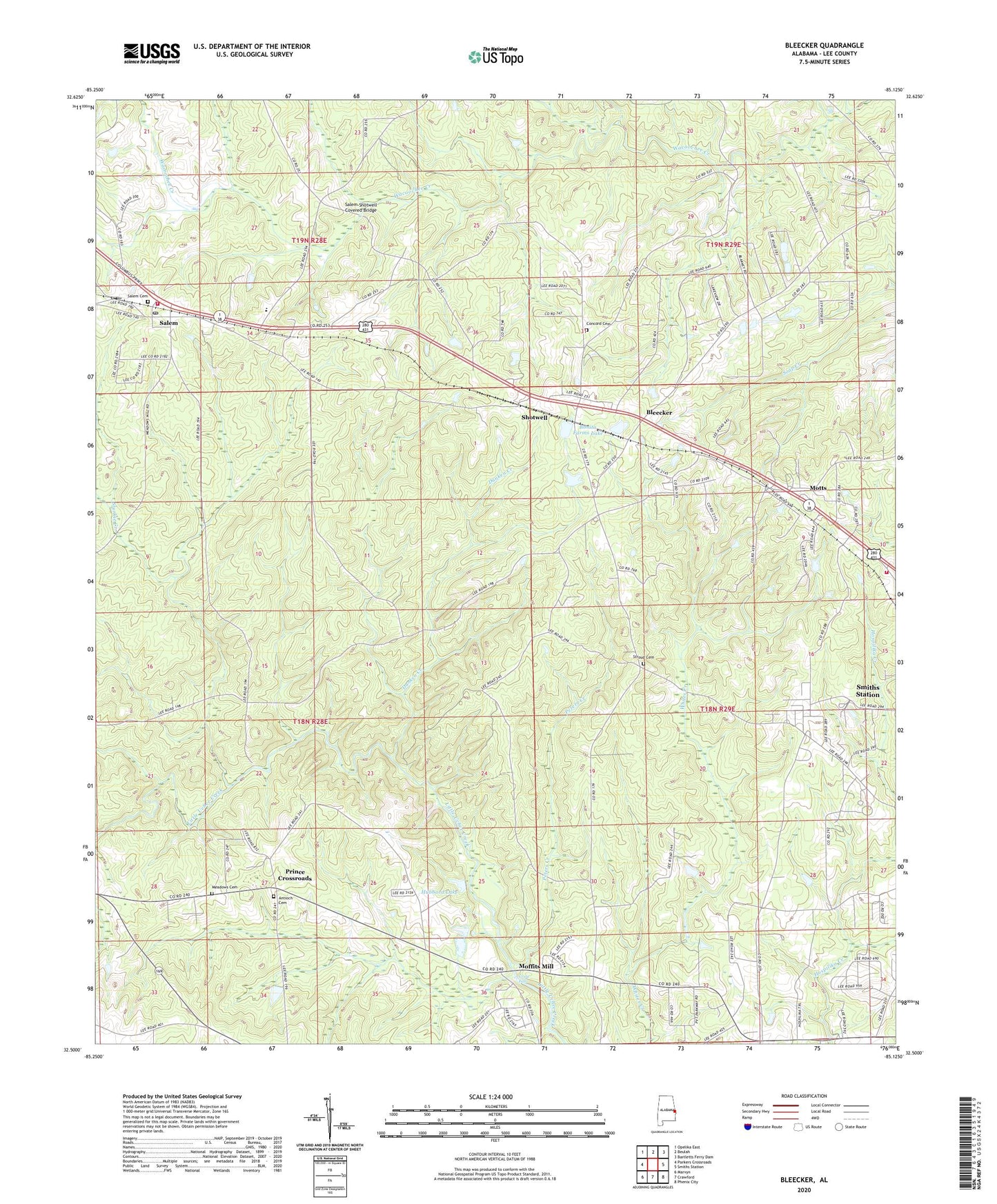
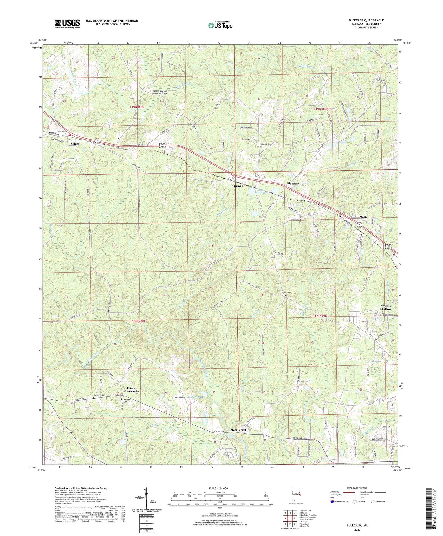
Bleecker Alabama US Topo Map
Couldn't load pickup availability
2024 topographic map quadrangle Bleecker in the state of Alabama. Scale: 1:24000. Based on the newly updated USGS 7.5' US Topo map series, this map is in the following counties: Lee. The map contains contour data, water features, and other items you are used to seeing on USGS maps, but also has updated roads and other features. This is the next generation of topographic maps. Printed on high-quality waterproof paper with UV fade-resistant inks.
Quads adjacent to this one:
West: Parkers Crossroads
Northwest: Opelika East
North: Beulah
Northeast: Bartletts Ferry Dam
East: Smiths Station
Southeast: Phenix City
South: Crawford
Southwest: Marvyn
This map covers the same area as the classic USGS quad with code o32085e2.
Contains the following named places: Alnoname Two Dam, Antioch Cemetery, Antioch Methodist Church, Bethelpore Church, Bleecker, Bonita Farms Lake, Church of Christ, Concord Baptist Church, Concord Cemetery, Concord Church, Dunken Creek, Good Hope Church, Goodhope School, Great Falls, Gullatte Dam, Hubbard Dam, Hubbard Lake, Jerusalem Church, Meadows Cemetery, Meadows Crossroads, Moffits Mill, Motts, Mount Gilead Church, New Hope Church, Peters Creek, Pleasant View Church, Prince Crossroads, Saint Marks Church, Saint Peter School, Saint Peters Church, Salem, Salem Cemetery, Salem Church, Salem Post Office, Salem School, Salem United Methodist Church, Salem Volunteer Fire Department, Salem-Shotwell Covered Bridge, Self Dam, Shotwell, Smiths Station Division, Smiths Station Fire and Rescue Station 1, Stroud Cemetery, Strouds Cross Road, Sturkie Creek, W B Cogdell Dam, Wacoochee High School, Wetumpka Council House, ZIP Code: 36874