MyTopo
Crawford Alabama US Topo Map
Couldn't load pickup availability
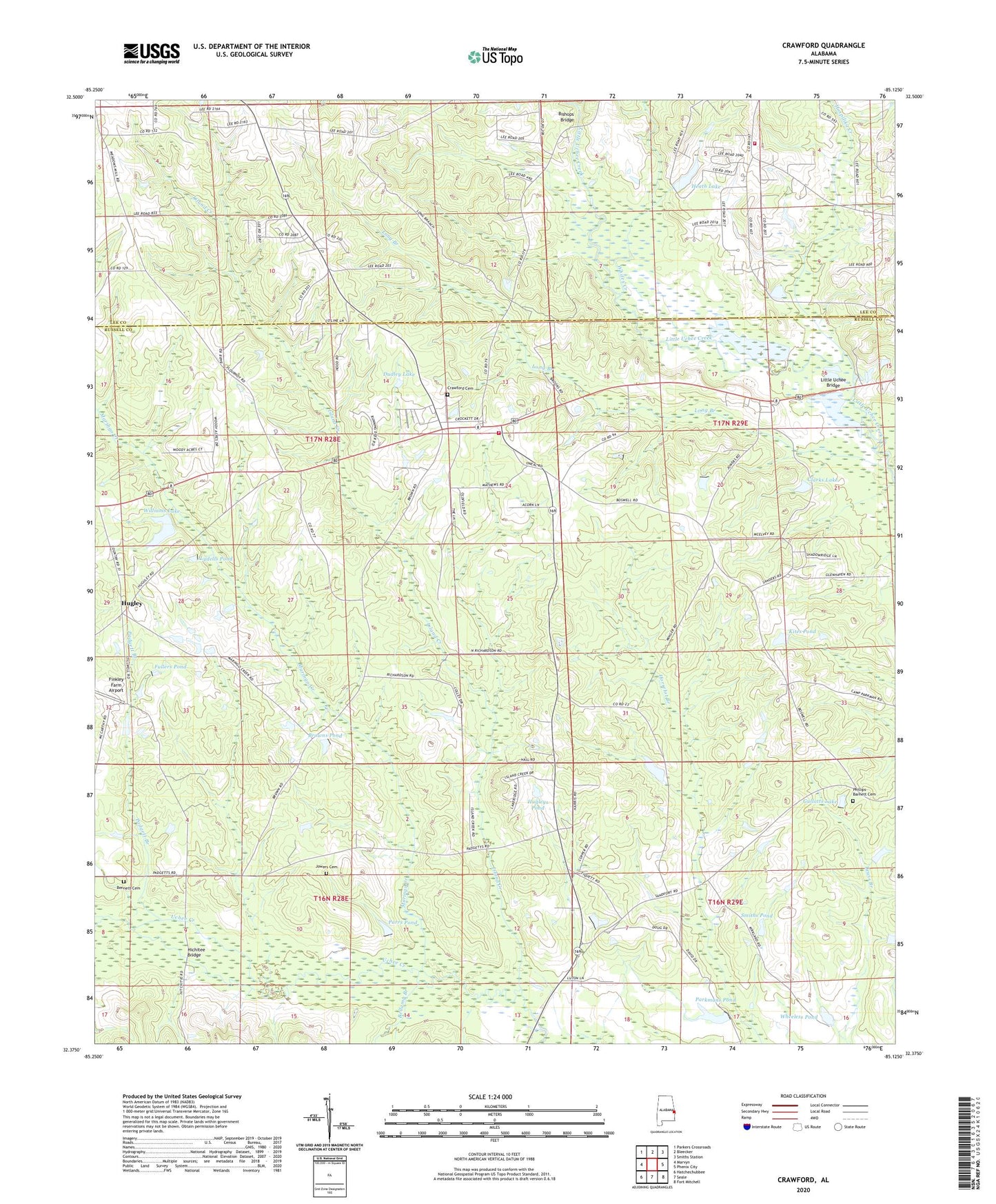
2024 topographic map quadrangle Crawford in the state of Alabama. Scale: 1:24000. Based on the newly updated USGS 7.5' US Topo map series, this map is in the following counties: Russell, Lee. The map contains contour data, water features, and other items you are used to seeing on USGS maps, but also has updated roads and other features. This is the next generation of topographic maps. Printed on high-quality waterproof paper with UV fade-resistant inks.
Quads adjacent to this one:
West: Marvyn
Northwest: Parkers Crossroads
North: Bleecker
Northeast: Smiths Station
East: Phenix City
Southeast: Fort Mitchell
South: Seale
Southwest: Hatchechubbee
This map covers the same area as the classic USGS quad with code o32085d2.
Contains the following named places: Adams Branch, Bellamy Branch, Bennett Cemetery, Bishops Bridge, Browns Pond, Clarks Lake, Crawford, Crawford Cemetery, Crawford Division, Crawford Road Church, Crawford Volunteer Fire Department, Crouch Pond Dam, Dudley Lake, East Alabama Motor Speedway, Faith Temple, Finkley Farm Airport, Fullers Pond, Goodwill Church, Gullatts Lake, Heath Dam, Heath Lake, Hichitee Bridge, Hospilika Creek, Hugley, Hugleys Pond, Island Creek, Jowers Cemetery, Kites Pond, Little Uchee Bridge, Lydells Pond, Maringo Creek, Moffatt School, Padgett Branch, Parkman Pond Dam, Parkmans Pond, Parkmanville, Parrs Pond, Phillips - Barnett Cemetery, Pleasant Hill Church, Saint Johns Church, Saint Pauls Church, Smiths Pond, Uchee Chapel, Uchee School, Wheeless Pond, Whites Creek, Williams Lake, Williams Lake Dam