MyTopo
Brassell Alabama US Topo Map
Couldn't load pickup availability
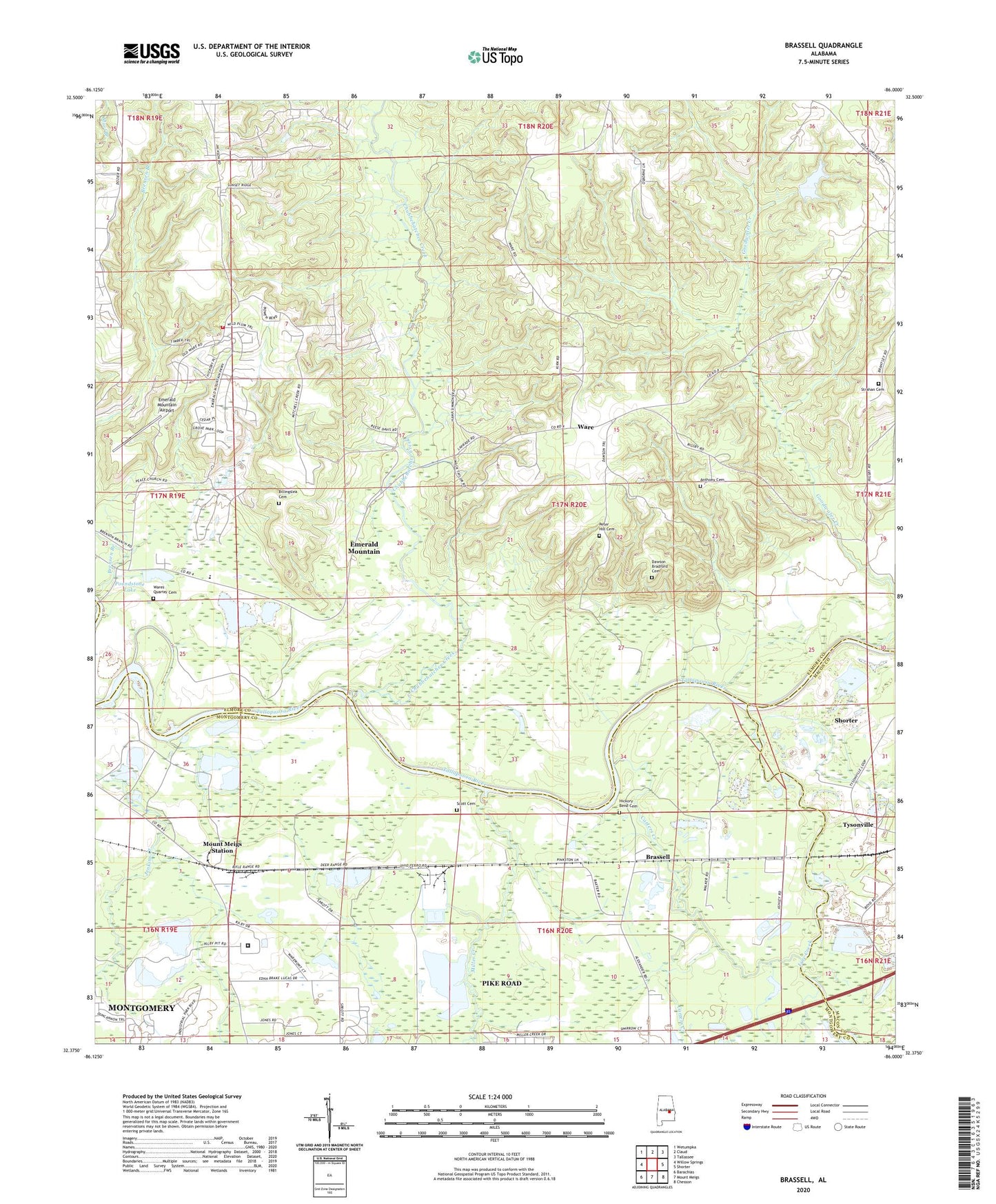
2024 topographic map quadrangle Brassell in the state of Alabama. Scale: 1:24000. Based on the newly updated USGS 7.5' US Topo map series, this map is in the following counties: Elmore, Montgomery, Macon. The map contains contour data, water features, and other items you are used to seeing on USGS maps, but also has updated roads and other features. This is the next generation of topographic maps. Printed on high-quality waterproof paper with UV fade-resistant inks.
Quads adjacent to this one:
West: Willow Springs
Northwest: Wetumpka
North: Claud
Northeast: Tallassee
East: Shorter
Southeast: Chesson
South: Mount Meigs
Southwest: Barachias
This map covers the same area as the classic USGS quad with code o32086d1.
Contains the following named places: Alabama Industrial School, Anthony Cemetery, Bethany Church, Billingslea Cemetery, Brassell, Carters Creek, Cathmagby Church, Cathmagby School, Chubbehatchee Creek, Dawson Bradford Cemetery, Emerald Mountain Airport, Emerald Mountain Census Designated Place, Emerald Mountain Volunteer Fire Department, Fusihatchi, Goodwater Creek, Hickory Bend Cemetery, Hoithlewalli, Jenkins Creek, Kilby Correctional Facility, Line Creek, Miller Creek, Mount Meigs Medical and Diagnostic Center, Mount Meigs Station, New Hope Church, Peace Church, Peace School, Peter Hill Cemetery, Poundstone Dam, Poundstone Lake, Redland Church, Rehoboth Church, Rosenwald School, Saint Johns Church, Scott Cemetery, Sharp Branch, Strahan Cemetery, Tysonville Ferry, Ware, Ware Ferry, Wares Quarter Cemetery