MyTopo
Mount Meigs Alabama US Topo Map
Couldn't load pickup availability
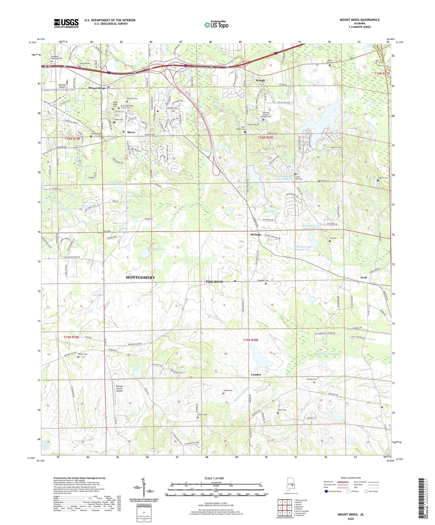
2024 topographic map quadrangle Mount Meigs in the state of Alabama. Scale: 1:24000. Based on the newly updated USGS 7.5' US Topo map series, this map is in the following counties: Montgomery, Macon. The map contains contour data, water features, and other items you are used to seeing on USGS maps, but also has updated roads and other features. This is the next generation of topographic maps. Printed on high-quality waterproof paper with UV fade-resistant inks.
Quads adjacent to this one:
West: Barachias
Northwest: Willow Springs
North: Brassell
Northeast: Shorter
East: Chesson
Southeast: Fitzpatrick
South: Teasleys Mill
Southwest: Davis Crossroads
This map covers the same area as the classic USGS quad with code o32086c1.
Contains the following named places: Antioch Baptist Church, Antioch Cemetery, Ashurst Cemetery, Barkley Dam, Barkley Lake, Barnett Cemetery, Bartlett Ranch Airport, Belser Dam, Belser Lake, Birch Hill Cemetery, Boykin Dam, Brewer Memorial Church, Brighter Cemetery, Camp Belser, Cecil, Eastwood Villa, Foxchase, Foxwood Trace, Frank Rutland Lake Number 1, Frank Rutland Lake Number Two, Frank Rutland Number 1 Dam, Frank Rutland Number 2 Dam, Freeman Dam, Freeman Lake, Freeport, Georgia Washington School, Gerald Wallace Lake Number One, Gerald Wallace Lake Number Two, Gerald Wallace Number 1 Dam, Gerald Wallace Number 2 Dam, Gilder Cemetery, Gilmer Cemetery, Gilmer School, Glory Hill Church, Grace Church, Grace Episcopal Church Cemetery, Hardt Cemetery, Harris School, Hill Cemetery, Judkins Cemetery, Kershaw Airport, Knollwood, Lilly Hill Church, Little Rock Church, London, Lucas Hill Cemetery, Lydia Hill Church, Lydia Hill School, Manning Springs - McDade Cemetery, Mathews, Mathews Church, Mathews Post Office, Mathis Cemetery, McClurkin Lake Number Three, McClurkin Lake Number Two, McClurkin Number 2 Dam, McClurkin Number 3 Dam, McClurkin School, McDade, Merry, Mitchell Cemetery, Mount Meigs, Mount Meigs Cemetery, Mount Meigs Division, Mount Meigs Post Office, Mount Olive Church, Mount Pleasant Church, Mount Pleasant School, Murdock Church, Peace Church, Pike Road, Pike Road Church, Pike Road Fire Department Station 1, Pike Road Fire Department Station 3, Pike Road Post Office, Pike Road Volunteer Fire Department Station 2, Pike Road Volunteer Fire Department Station 5, Saint James Cemetery, Saint Matthew Church, Saint Paul Church, Saint Pauls Church, Shirley Dam, Shirley Lake, Timberlane, Town of Pike Road, Waugh, Weeping Willow Church, Woodland United Methodist Church, ZIP Code: 36064