MyTopo
Brundidge Alabama US Topo Map
Couldn't load pickup availability
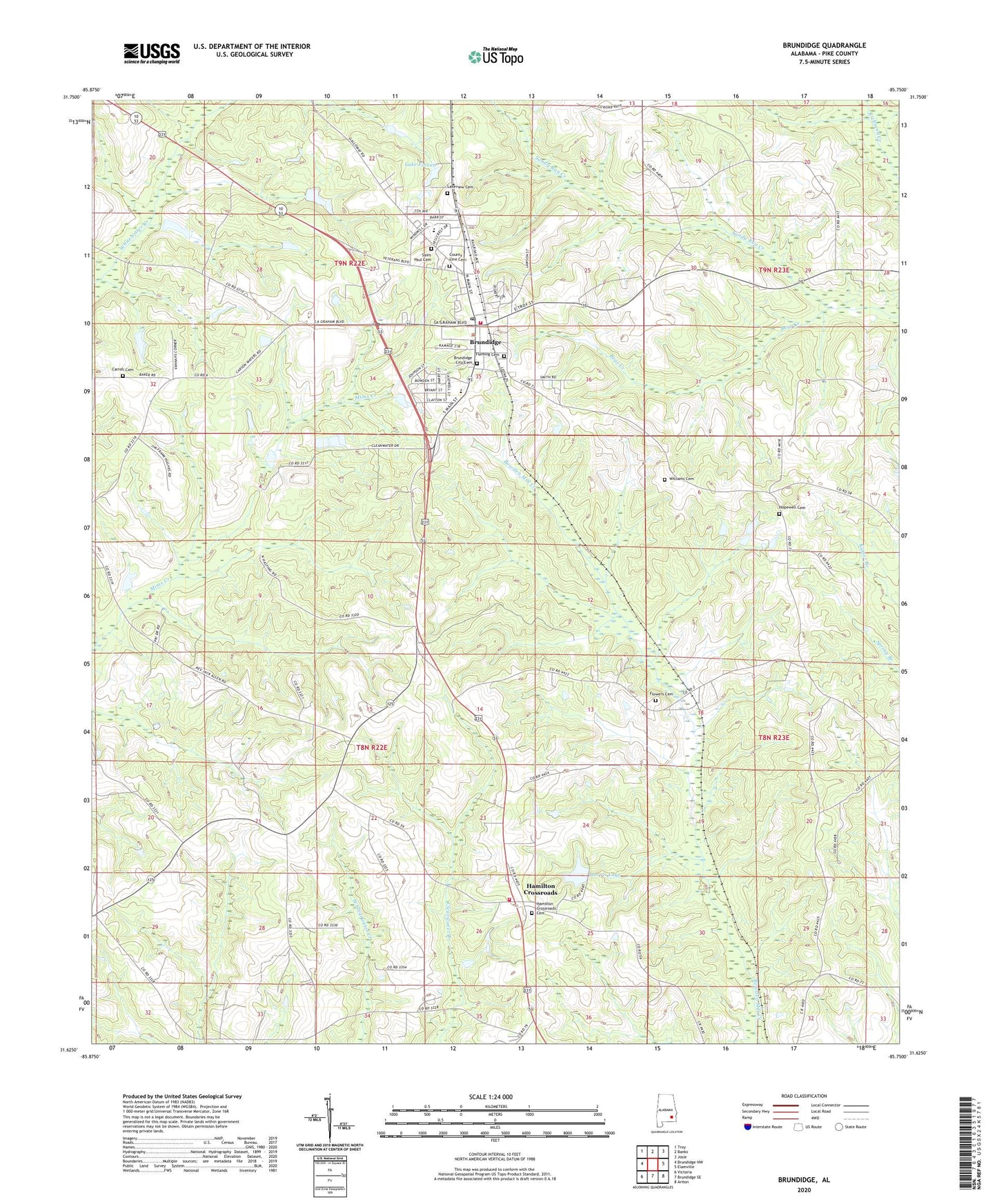
2024 topographic map quadrangle Brundidge in the state of Alabama. Scale: 1:24000. Based on the newly updated USGS 7.5' US Topo map series, this map is in the following counties: Pike. The map contains contour data, water features, and other items you are used to seeing on USGS maps, but also has updated roads and other features. This is the next generation of topographic maps. Printed on high-quality waterproof paper with UV fade-resistant inks.
Quads adjacent to this one:
West: Brundidge NW
Northwest: Troy
North: Banks
Northeast: Josie
East: Elamville
Southeast: Ariton
South: Brundidge SE
Southwest: Victoria
This map covers the same area as the classic USGS quad with code o31085f7.
Contains the following named places: Abundant Life Center Church, Armory Park, Bear Creek, Beaver Pond Branch, Broad View, Brundidge, Brundidge Church of Christ, Brundidge Church of God, Brundidge City Cemetery, Brundidge City Hall, Brundidge Country Club, Brundidge Division, Brundidge High School, Brundidge Medical Center, Brundidge Municipal Airport, Brundidge Post Office, Brundidge Pre-School, Brundidge Public Library, Brundidge Recreational Park, Brundidge United Methodist Church, Brundidge Volunteer Fire Department, Carroll Cemetery, City of Brundidge, Community Church of God in Christ, County Line Baptist Church, County Line Cemetery, Fleming Cemetery, Flowers Cemetery, Friendship Church, Galloway Park, Green Ridge, Hamilton Cross Roads Church of Christ, Hamilton Crossroads, Hamilton Crossroads Cemetery, Hamilton Crossroads Fire Rescue Department, Hamilton Crossroads School, Harris Lake, Harris Lake Dam, Hillcrest, Hopewell Cemetery, Hopewell Church, Lake Foreen, Lake Foreen Dam, Lakeview Cemetery, Lily Hill Baptist Church, Mount Olive Church, New Hope Missionary Baptist Church, New Jerusalem Holiness Church, New Zion Church, New Zion School, Pea River School, Philadelphia Presbyterian Church, Pike County Elementary School, Pike County High School, Pleasant Hill Church, Reeves Crossroads School, Saint Paul Cemetery, Saint Paul United Methodist Church, Salem Baptist Church, Shady Grove Church, Shiloh Church, Springfield Church, Walter Bass Dam, Walter Bass Pond, Williams Cemetery, Williams Chapel Methodist Church, Windmill Hills, ZIP Code: 36010