
MyTopo
Brundidge NW Alabama US Topo Map
Couldn't load pickup availability
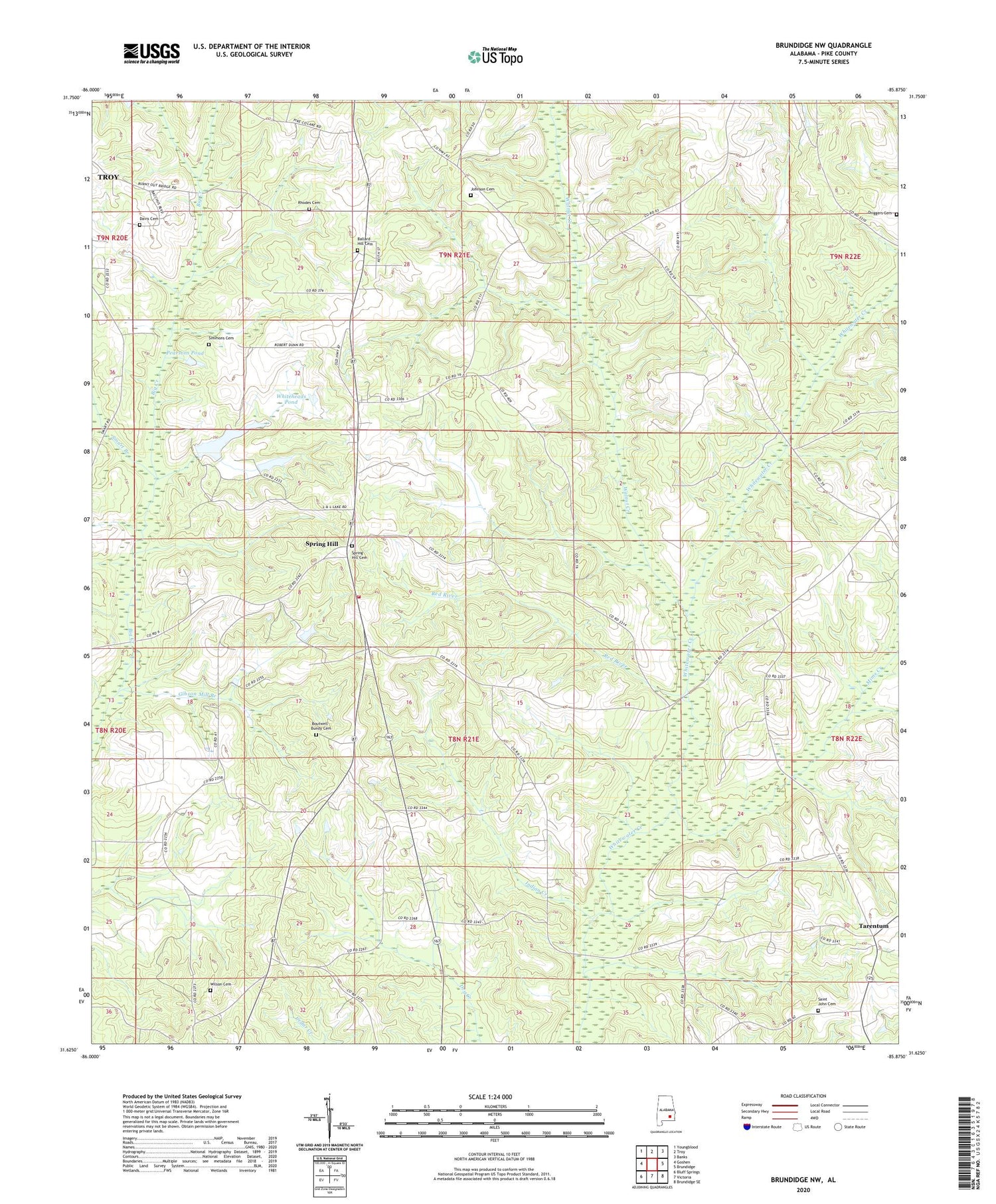
2024 topographic map quadrangle Brundidge NW in the state of Alabama. Scale: 1:24000. Based on the newly updated USGS 7.5' US Topo map series, this map is in the following counties: Pike. The map contains contour data, water features, and other items you are used to seeing on USGS maps, but also has updated roads and other features. This is the next generation of topographic maps. Printed on high-quality waterproof paper with UV fade-resistant inks.
Quads adjacent to this one:
West: Goshen
Northwest: Youngblood
North: Troy
Northeast: Banks
East: Brundidge
Southeast: Brundidge SE
South: Victoria
Southwest: Bluff Springs
This map covers the same area as the classic USGS quad with code o31085f8.
Contains the following named places: Antioch Missionary Baptist Church, Ballard Hill Cemetery, Bethlehem Church, Boutwell - Bundy Cemetery, Center Ridge Church, Centre Ridge, Davis Cemetery, Driggers Cemetery, Elam Church, Elam Elementary School, Gibson Mill Branch, Hillards Cross Roads, Holly Spring Church, Indian Creek, Johnson Cemetery, Milo Post Office, Mims Creek, Mossy Grove Estates, Mossy Grove Village, Mount Olive Church, Pearsons Pond, Red River, Rhodes Cemetery, Saint John Cemetery, Saint Johns Church, Shady Grove Church, Simmons Cemetery, Smart Branch, Spring Hill, Spring Hill Cemetery, Spring Hill Church, Spring Hill Elementary School, Spring Hill Volunteer Fire Department, Star Muskogee Creek State Designated Tribal Statistical Area, Tarentum, Tarentum School, Turner Chapel, Union School, Union Springs Primitive Baptist Church, Walnut Creek, White Rock Church, Whiteheads Pond, Whitewater Church, Whitewater School, Wilson Cemetery


