
MyTopo
Ariton Alabama US Topo Map
Couldn't load pickup availability
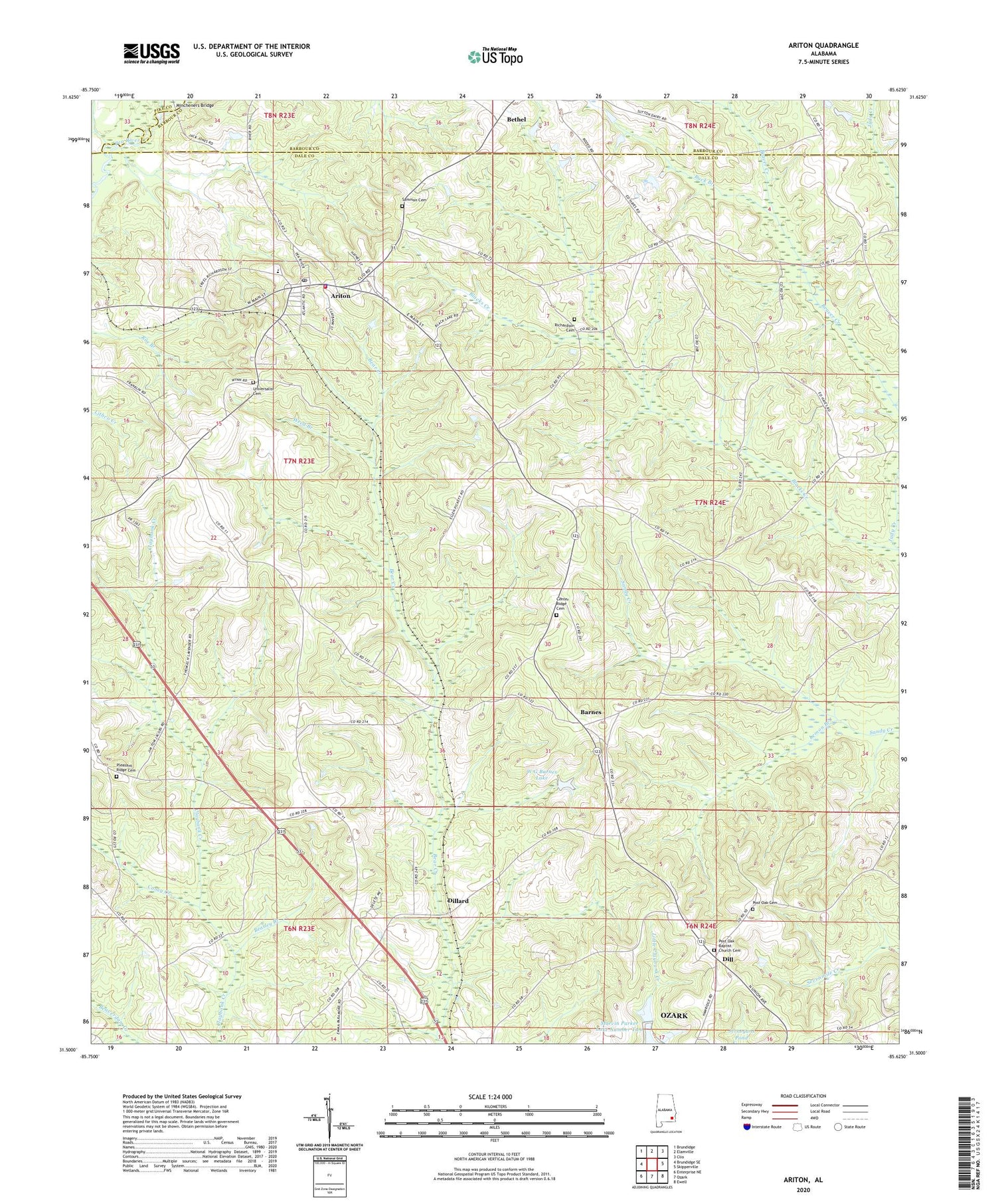
2024 topographic map quadrangle Ariton in the state of Alabama. Scale: 1:24000. Based on the newly updated USGS 7.5' US Topo map series, this map is in the following counties: Dale, Barbour, Pike. The map contains contour data, water features, and other items you are used to seeing on USGS maps, but also has updated roads and other features. This is the next generation of topographic maps. Printed on high-quality waterproof paper with UV fade-resistant inks.
Quads adjacent to this one:
West: Brundidge SE
Northwest: Brundidge
North: Elamville
Northeast: Clio
East: Skipperville
Southeast: Ewell
South: Ozark
Southwest: Enterprise NE
This map covers the same area as the classic USGS quad with code o31085e6.
Contains the following named places: Ariton, Ariton Fire Rescue, Ariton High School, Ariton Police Department, Ariton Post Office, Ariton United Methodist Church, Barnes, Beasley Branch, Beaver Creek, Bethel Assembly of God Church, Bruces Mill Creek, Buck Branch, Caney Creek, Center Ridge Baptist Church, Center Ridge Cemetery, Dill, Dillard, Evergreen Church, Holy Faith Mission Full Gospel Church, Lemon Branch, Marvin Parker Lake Dam Number Two, Marvin Parker Lake Number Two, Mincheners Bridge, Mount Olive Church, Ozark Division, Pleasant Grove Baptist Church, Pleasant Ridge Cemetery, Post Oak Baptist Church, Post Oak Cemetery, Post Oak United Methodist Church, Powell School, Richardson Cemetery, Rocky Mount School, Sammon Cemetery, Shanghai School, Town of Ariton, Universalist Cemetery, W G Barnes Dam, W G Barnes Lake, Weed Branch, ZIP Code: 36311


