MyTopo
Alma Alabama US Topo Map
Couldn't load pickup availability
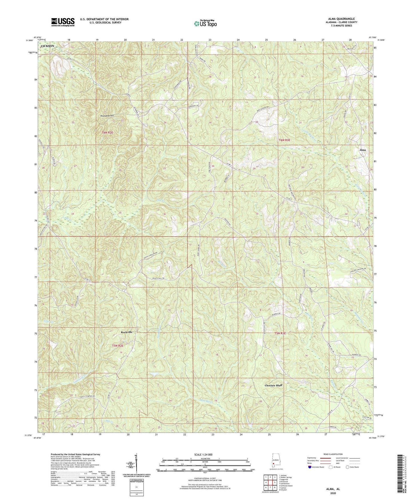
2024 topographic map quadrangle Alma in the state of Alabama. Scale: 1:24000. Based on the newly updated USGS 7.5' US Topo map series, this map is in the following counties: Clarke. The map contains contour data, water features, and other items you are used to seeing on USGS maps, but also has updated roads and other features. This is the next generation of topographic maps. Printed on high-quality waterproof paper with UV fade-resistant inks.
Quads adjacent to this one:
West: Prestwick
Northwest: Jackson
North: Walker Springs
Northeast: Suggsville
East: Gainestown
Southeast: Chrysler
South: Carlton
Southwest: Ginhouse Island
This map covers the same area as the classic USGS quad with code o31087d7.
Contains the following named places: Alma, Choctaw Bluff, Choctaw Bluff Church, Fred T Stimpson State Game Sanctuary, Gainestown Road Landfill, Jones Chapel Methodist Protestant Church, Lilly Valley School, Mount Sinai Number 1 Church, New Canaan Church, New Saint Mathew Church, Oak Grove School, Old Mount Sinai Church, Perry Chapel, Rockville, Rockville Baptist Church, Rockville Census Designated Place, Roundtop Hill, Saint Matthews Church, Walker Springs Division, ZIP Code: 36545