MyTopo
Clayton South Alabama US Topo Map
Couldn't load pickup availability
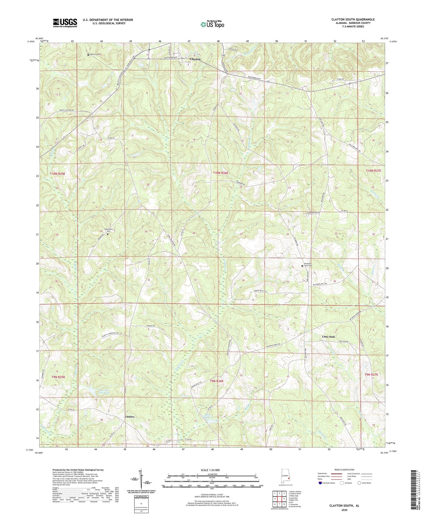
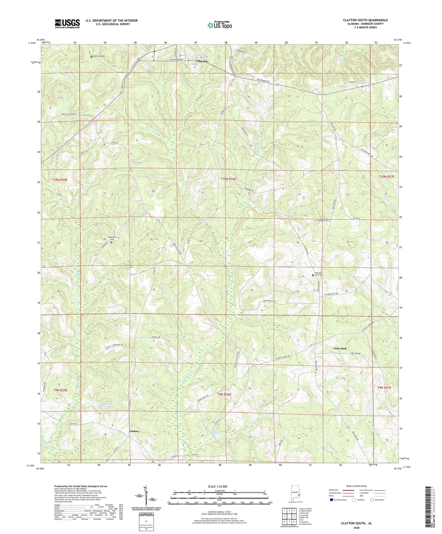
2024 topographic map quadrangle Clayton South in the state of Alabama. Scale: 1:24000. Based on the newly updated USGS 7.5' US Topo map series, this map is in the following counties: Barbour. The map contains contour data, water features, and other items you are used to seeing on USGS maps, but also has updated roads and other features. This is the next generation of topographic maps. Printed on high-quality waterproof paper with UV fade-resistant inks.
Quads adjacent to this one:
West: Louisville
Northwest: Mount Andrew
North: Clayton North
Northeast: White Oak
East: Baker Hill
Southeast: Lawrenceville
South: Texasville
Southwest: Clio
This map covers the same area as the classic USGS quad with code o31085g4.
Contains the following named places: Adams Mill Pond Dam, Adams Millpond, Antioch Church, Barbour County, Cox Mill, Floyds Mill, Floyds School, Henry De Lamar Clayton House, Horn School, Huttos Store, Jackson Creek, Lime Sink, Lindsey, Lords Church, Louisville Club Pond, Louisville Club Pond Dam, Mercers Store, Mill Branch, Millers Ford, Mount Mariah Church, Mount Scilla Church, Mount Zion Church, Norton School, Pauls Creek, Pleasant Plains Church, Pleasant View Cemetery, Pleasant View Presbyterian Church, Prospect Baptist Church, Richards Mill, Saint Marks Church, Saint Peters Church, Smith Branch, Spring Hill Church, Tabernacle Cemetery, Union Baptist Church, Walker Temple Church, Wallace High School, Warren Cemetery, Wesleyan Methodist Protestant Church, ZIP Code: 36016