MyTopo
Mount Andrew Alabama US Topo Map
Couldn't load pickup availability
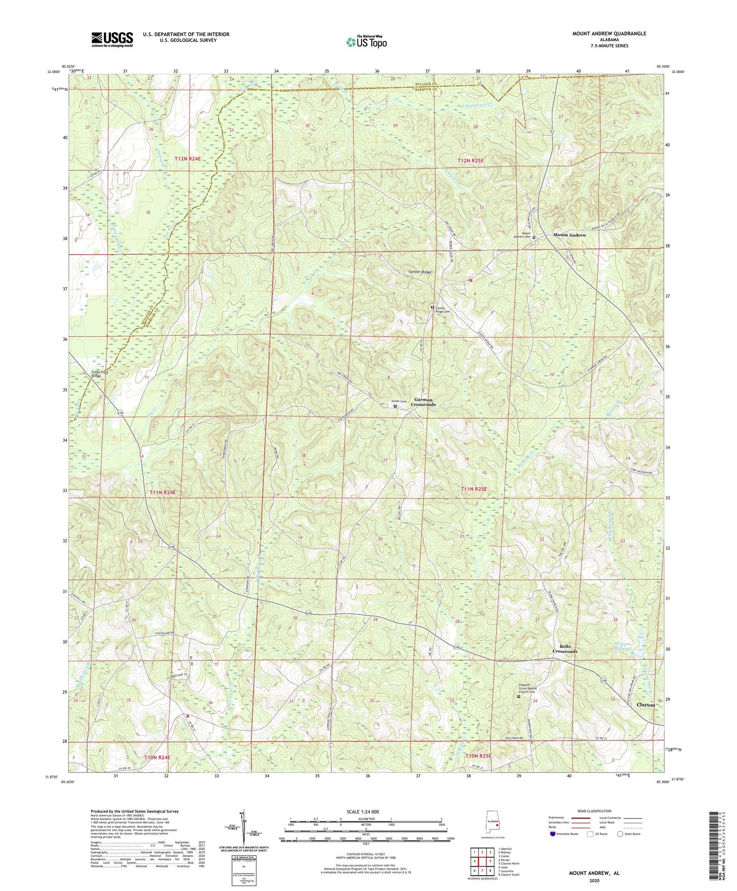
2024 topographic map quadrangle Mount Andrew in the state of Alabama. Scale: 1:24000. Based on the newly updated USGS 7.5' US Topo map series, this map is in the following counties: Barbour, Bullock. The map contains contour data, water features, and other items you are used to seeing on USGS maps, but also has updated roads and other features. This is the next generation of topographic maps. Printed on high-quality waterproof paper with UV fade-resistant inks.
Quads adjacent to this one:
West: Perote
Northwest: Aberfoil
North: Midway
Northeast: Comer
East: Clayton North
Southeast: Clayton South
South: Louisville
Southwest: Josie
This map covers the same area as the classic USGS quad with code o31085h5.
Contains the following named places: Anglins Bridge, Barkers School, Bells Crossroads, Bethsaida Church, Bickleys Mill, Center Ridge, Center Ridge Cemetery, Center Ridge Church, Center Ridge School, Cooks Ford Bridge, Dickle Mill, Elam Church, Evergreen Baptist Church, Garmon Crossroads, Greens Crossroad Volunteer Fire Department, Greens Crossroads, Laurel Grove, Little Indian Creek, McClains School, Mount Andrew, Mount Andrew Cemetery, Mount Andrew Volunteer Fire Department, North Fork Little Creek, Pleasant Grove Baptist Church, Pleasant Grove Baptist Church Cemetery, Polecat Branch, Robinson School, Sanders Store, Shady Grove Church, Shady Grove Elementary School, Shiloh African Methodist Episcopal Church, Shiloh Cemetery, Spires Store, Spring Creek, Street Memorial United Methodist Church, Williams Millpond, Willis Store