MyTopo
Texasville Alabama US Topo Map
Couldn't load pickup availability
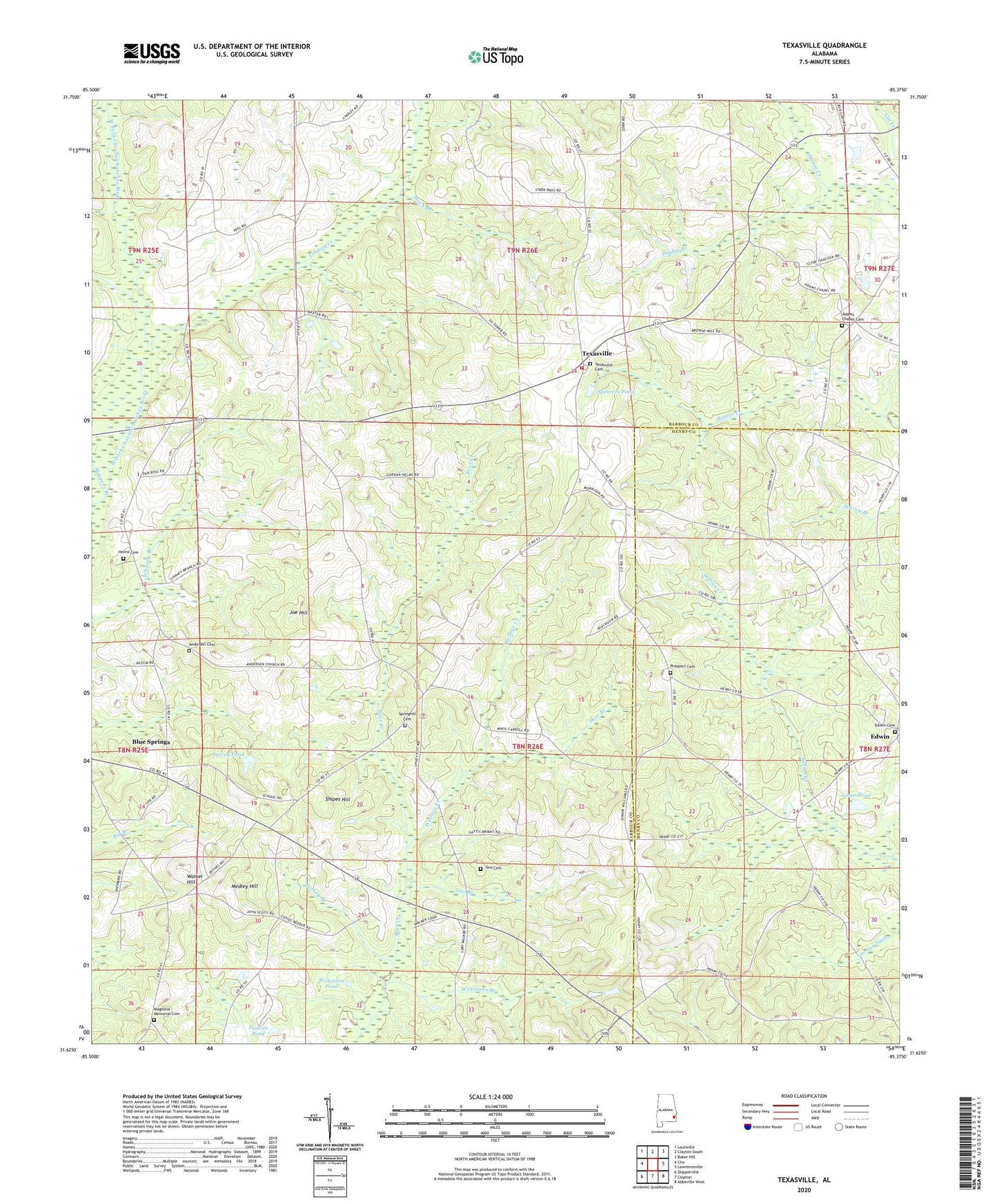
2024 topographic map quadrangle Texasville in the state of Alabama. Scale: 1:24000. Based on the newly updated USGS 7.5' US Topo map series, this map is in the following counties: Barbour, Henry. The map contains contour data, water features, and other items you are used to seeing on USGS maps, but also has updated roads and other features. This is the next generation of topographic maps. Printed on high-quality waterproof paper with UV fade-resistant inks.
Quads adjacent to this one:
West: Clio
Northwest: Louisville
North: Clayton South
Northeast: Baker Hill
East: Lawrenceville
Southeast: Abbeville West
South: Clopton
Southwest: Skipperville
This map covers the same area as the classic USGS quad with code o31085f4.
Contains the following named places: Adams Chapel Cemetery, Adams Chapel United Methodist Church, Anderson Baptist Church, Anderson Cemetery, Anderson School, Andrews Store, Bethel Church, Black Branch, Black Gum Corners, Blue Springs High School, Boyds Store, Browns Mill, Clopton Church, Corinth Baptist Church, Corinth School, Deer Branch, Double Branch, Duncan Pond, Edwin, Edwin Cemetery, Fuqua Gin, Grice Store, Helms Cemetery, Joe Hill, Jordan Ditch, Lindsey Creek, Lingo Pond, Magnolia Memorial Cemetery, Magnolia United Methodist Church, Medley Hill, Mount Enon Church, New Bethel Church, New Prospect Freewill Baptist Church, Prospect Cemetery, Saint Michaels Church, Saint Peters Church, Salem Church, Shipes Hill, Skippers Branch, Spencers Pond, Spio, Spivey Pond, Springhill Baptist Church, Springhill Cemetery, Tew, Tew Branch, Tew Cemetery, Texasville, Texasville Cemetery, Texasville United Methodist Church, Texasville Volunteer Fire Department, Triumph Church, Turkey Branch, Walker Hill, Wallace Creek, WGIQ-TV (Louisville), Wilkinson Branch, Wilkinson Pond, Wilson Gin, ZIP Code: 36317