MyTopo
Dutton Alabama US Topo Map
Couldn't load pickup availability
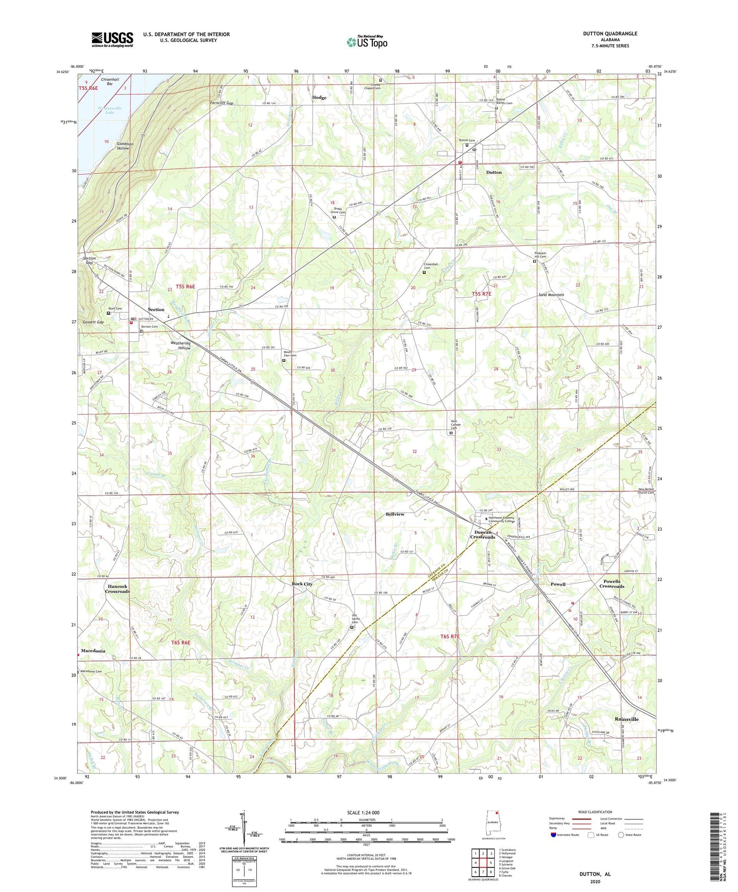
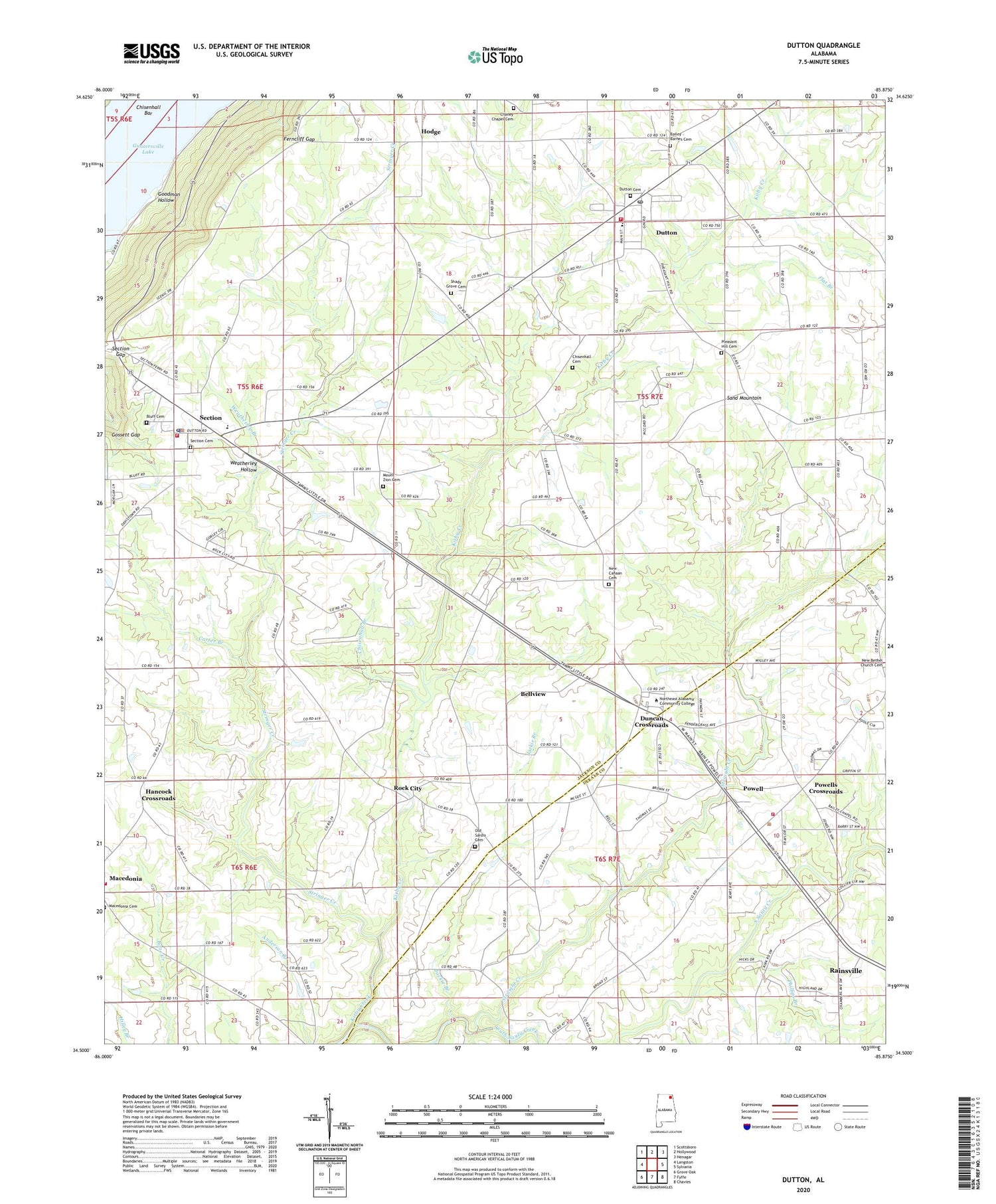
2024 topographic map quadrangle Dutton in the state of Alabama. Scale: 1:24000. Based on the newly updated USGS 7.5' US Topo map series, this map is in the following counties: Jackson, DeKalb. The map contains contour data, water features, and other items you are used to seeing on USGS maps, but also has updated roads and other features. This is the next generation of topographic maps. Printed on high-quality waterproof paper with UV fade-resistant inks.
Quads adjacent to this one:
West: Langston
Northwest: Scottsboro
North: Hollywood
Northeast: Henagar
East: Sylvania
Southeast: Chavies
South: Fyffe
Southwest: Grove Oak
This map covers the same area as the classic USGS quad with code o34085e8.
Contains the following named places: Bailey Chapel, Bellview, Bellview School, Bethany Church, Bluff Cemetery, Callahan School, Carter Branch, Carter Chapel, Chaney Chapel Cemetery, Chaney Chapel Church, Chisenhall Bar, Chisenhall Branch, Dawson School, Duncan Crossroads, Dutton, Dutton Post Office, Dutton Volunteer Fire Department, Ferncliff, Ferncliff Gap, Flat Branch, Flowers Saw Mill, Goodman Hollow, Gossett Gap, Hancock Church, Hancock Crossroads, Hannah, Happy Hill Church, Hodge, Hodge Church, Jackie Branch, Kirby Creek, Lake Shore Drive Cabin Site Area, Macedonia Volunteer Fire Department, Mount Zion Church, New Bethel Church, New Canaan Church, New Sardis Church, New Shady Grove Church, Northeast Alabama State Junior College, Old Brown Mill, Old Sardis Cemetery, Old Sardis Church, Old Shady Grove Church, Patterson School, Phillips Branch, Pleasant Hill Church, Powell Volunteer Fire Department, Powells Crossroads, Rock City, Sand Mountain Church, Section, Section Division, Section Gap, Section High School, Section Police Department, Section Post Office, Section United Methodist Church, Section Volunteer Fire Department, Straight Creek, Straight Creek Church, Stringer Creek, Stringers Mill, Talley, Tomlin School, Town of Dutton, Town of Powell, Town of Section, Weatherley Branch, Weatherley Hollow, White Mill, WKEA-FM (Scottsboro), ZIP Code: 35744