MyTopo
Chavies Alabama US Topo Map
Couldn't load pickup availability
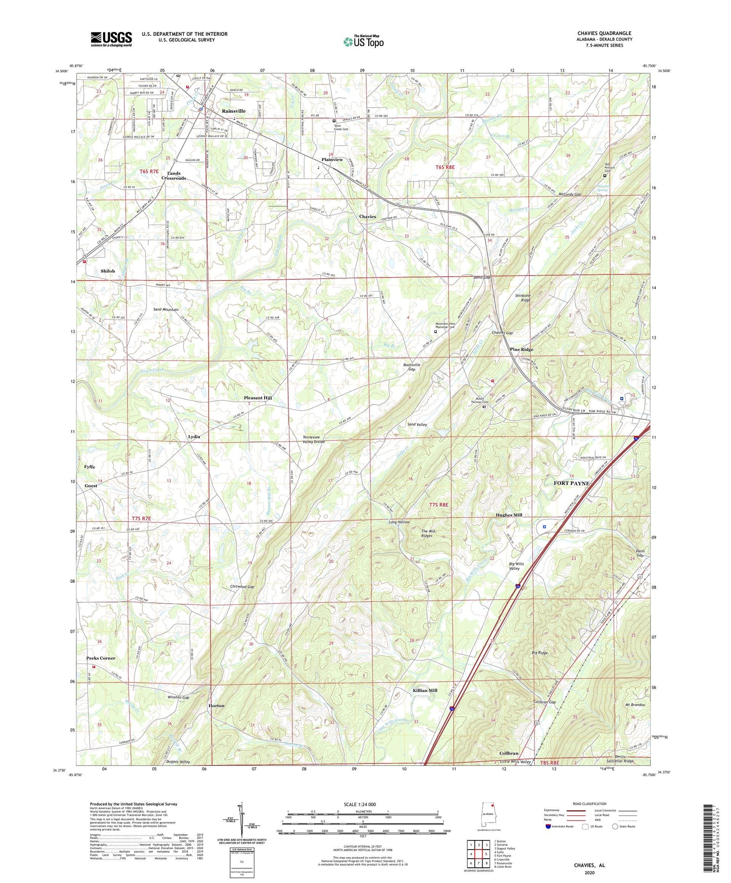
2024 topographic map quadrangle Chavies in the state of Alabama. Scale: 1:24000. Based on the newly updated USGS 7.5' US Topo map series, this map is in the following counties: DeKalb. The map contains contour data, water features, and other items you are used to seeing on USGS maps, but also has updated roads and other features. This is the next generation of topographic maps. Printed on high-quality waterproof paper with UV fade-resistant inks.
Quads adjacent to this one:
West: Fyffe
Northwest: Dutton
North: Sylvania
Northeast: Dugout Valley
East: Fort Payne
Southeast: Little River
South: Portersville
Southwest: Crossville
This map covers the same area as the classic USGS quad with code o34085d7.
Contains the following named places: Beasons Mill, Big Branch, Big Ridge, Blake Junior High School, Bohannon Ford, Bootsville, Bootsville Gap, Broadway Church, Brown Branch, Brown Church, Brown School, Bynum Mill Branch, Caney Creek, Chavies, Chavies Church, Chavies Gap, Chitwood Gap, City of Rainsville, Collbran, Collbran Gap, Davis Chapel, Davis Gap, De Kalb Annex School, De Kalb Vocational School, DeKalb County, Dekalb County Sheriff's Office, Dekalb Regional Medical Center, Fort Payne Water Works, Franklin Ford, Goza Church, Gravel Hill Church, Grove Church, Guest, Guest Church, Hawkins Spring, Horton, Hughes Mill, Ivy Creek, Jacks Creek, Killian Mill, Lands Crossroads, Little Wills Valley Branch, Log Cabin School, Long Hollow, Luna, Lydia, Macedonia Church, McCurdy Gap, Miller Chapel, Morgan Creek, Mount Brandon, Mount Herman Cemetery, Mount Herman Church, Mount Moriah Church, Mountain View Church, Mountain View Memorial Cemetery, Old Antioch Cemetery, Peeks Corner, Peeks Corner Fire Department, Peeks Corner School, Pine Ridge, Pine Ridge Church, Pine Ridge Fire Protection, Plainview, Plainview School, Pleasant Hill, Pleasant Hill Church, Rainsville, Rainsville Church, Rainsville Civic Center, Rainsville Fire Department, Rainsville Post Office, Robertson Chapel United Methodist Church, Shankle Branch, Shiloh Church, Shiloh Fire Department, Shinbone Ridge, Sparks Branch, Suttell Ford, Swindell Gap, The Middle Ridges, Town Creek Cemetery, Town Creek Church, Town of Pine Ridge, Winston Gap, Wooten Branch, WVSM-AM (Rainsville), WZOB-AM (Fort Payne)