MyTopo
Fort Gaines Georgia US Topo Map
Couldn't load pickup availability
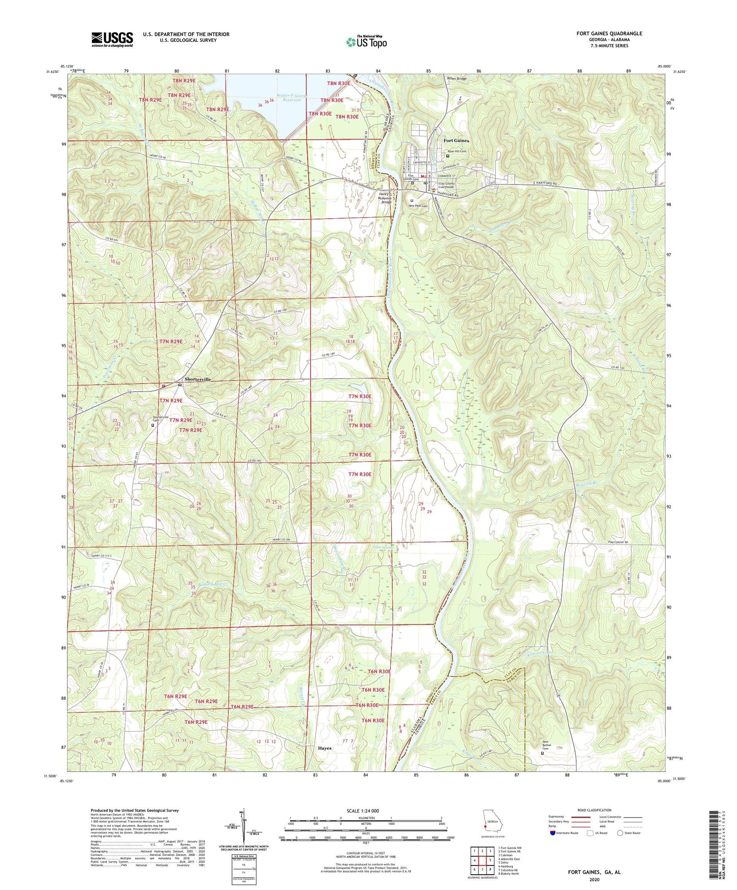
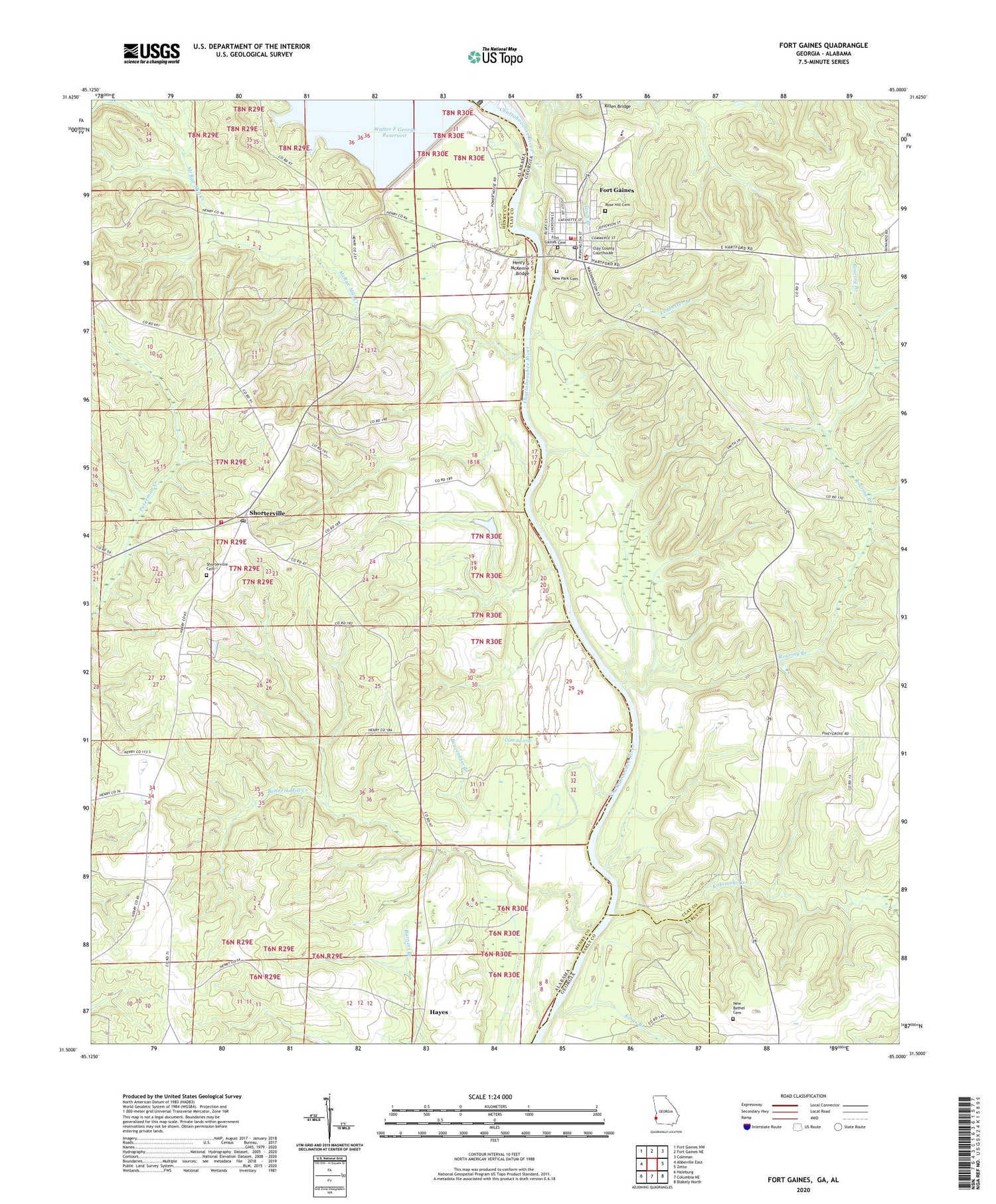
2024 topographic map quadrangle Fort Gaines in the states of Alabama, Georgia. Scale: 1:24000. Based on the newly updated USGS 7.5' US Topo map series, this map is in the following counties: Clay, Henry, Early. The map contains contour data, water features, and other items you are used to seeing on USGS maps, but also has updated roads and other features. This is the next generation of topographic maps. Printed on high-quality waterproof paper with UV fade-resistant inks.
Quads adjacent to this one:
West: Abbeville East
Northwest: Fort Gaines NW
North: Fort Gaines NE
Northeast: Coleman
East: Zetto
Southeast: Blakely North
South: Columbia NE
Southwest: Haleburg
This map covers the same area as the classic USGS quad with code o31085e1.
Contains the following named places: Aimwell Church, Beaverdam Branch, Bennett Mill Creek, Big Ditch, Cemochechobee Creek, City of Fort Gaines, Clay County Courthouse, Clay County High School, Clay County Sheriff's Office, Clay County Volunteer Fire Department, Faith Deliverance Full Gospel Church Number 1, Farmers Landing, First Baptist Church, Flat Creek, Fort Gaines, Fort Gaines Academy, Fort Gaines Baptist Church, Fort Gaines Cemetery, Fort Gaines Historic District, Fort Gaines Police Department, Fort Gaines Post Office, Fort Gaines Presbyterian Church, Fort Gaines United Methodist Church, Franklin, Greater Friendship Church, Gum Swamp, Hayes, Henry Clay Bridge, Henry G McKemie Bridge, Killen Bridge, Kings Branch, Kolomoki Creek, Lake Helen, Leamans Store, Ledbetter Branch, Marion Sanders Lake Dam, McRae Mill Creek, New Bethel Cemetery, New Bethel Church, New Park Cemetery, New Salem Church, Old Friendship African Methodist Episcopal Church, Old Salem Church, Pentecostal Gospel Church, Piney Grove Church, Poplar Springs Church, Roaring Branch, Rose Hill Cemetery, Shorterville, Shorterville Baptist Church, Shorterville Cemetery, Shorterville Post Office, Shorterville School, Shorterville Volunteer Fire Department, Speight High School, Springfield Missionary Baptist Church, Thompson Grove Church, Town Branch, W C Wills Dam, Walter F George Lock and Dam, West Bank Overlook, ZIP Code: 36373