MyTopo
Fort Morgan Alabama US Topo Map
Couldn't load pickup availability
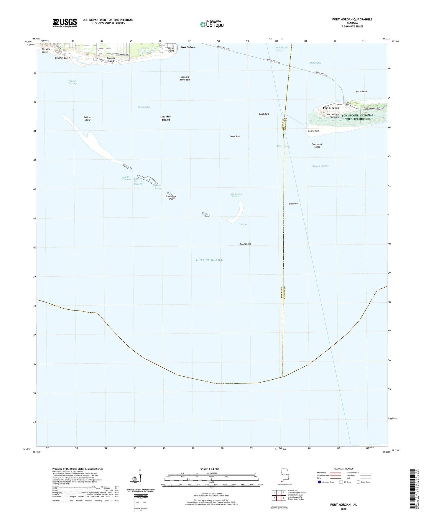
2025 topographic map quadrangle Fort Morgan in the state of Alabama. Scale: 1:24000. Based on the newly updated USGS 7.5' US Topo map series, this map is in the following counties: Baldwin, Mobile. The map contains contour data, water features, and other items you are used to seeing on USGS maps, but also has updated roads and other features. This is the next generation of topographic maps. Printed on high-quality waterproof paper with UV fade-resistant inks.
Quads adjacent to this one:
West: Fort Morgan NW
Northwest: Heron Bay
North: Little Dauphin Island
Northeast: Little Point Clear
East: Saint Andrews Bay
This map covers the same area as the classic USGS quad with code o30088b1.
Contains the following named places: Alligator Lake, Battery Dearborn, Battery Duportail, Battery Schenck, Battery Stanton, Battery Terrett, Battery Thomas, Bienville Beach, Coffee Island, Dauphin Beach, Dauphin Island Annex Brookley Air Force Base, Dauphin Island Sealab, Dauphin Island Spit, Dixey Bar, Fort Gaines, Fort Morgan, Fort Morgan Airport, Fort Morgan Museum, Front Range Light, Gulfside Golf Course, Isle Dauphin Country Club, Light House Battery, Little Pelican Channel, Main Channel, Middle Channel, Mobile Point, Mobile Point Light, Oleander Pond, Pelican Bay, Pelican Channel, Pelican Island, Pelican Passage, Pelican Point, Revenue Point, Sand Island, Sand Island Channel, Sand Island Lighthouse, Sand Island Shoal, South Bank, Southeast Shoal, Swash Channel, The Cut, West Bank