MyTopo
Little Dauphin Island Alabama US Topo Map
Couldn't load pickup availability
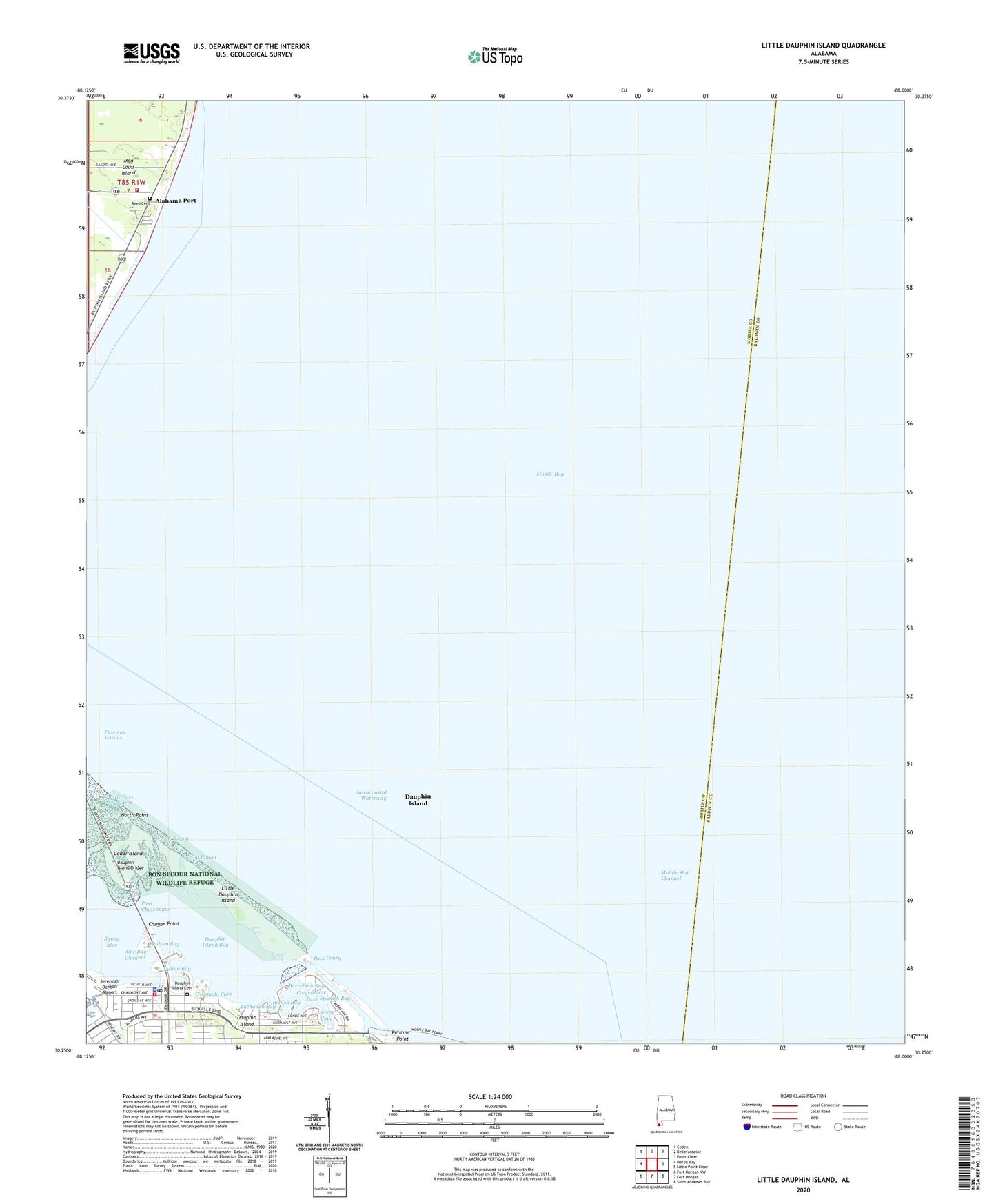
2024 topographic map quadrangle Little Dauphin Island in the state of Alabama. Scale: 1:24000. Based on the newly updated USGS 7.5' US Topo map series, this map is in the following counties: Mobile, Baldwin. The map contains contour data, water features, and other items you are used to seeing on USGS maps, but also has updated roads and other features. This is the next generation of topographic maps. Printed on high-quality waterproof paper with UV fade-resistant inks.
Quads adjacent to this one:
West: Heron Bay
Northwest: Coden
North: Bellefontaine
Northeast: Point Clear
East: Little Point Clear
Southeast: Saint Andrews Bay
South: Fort Morgan
Southwest: Fort Morgan NW
This map covers the same area as the classic USGS quad with code o30088c1.
Contains the following named places: Alabama Port, Alabama Port Cemetery, Alabama Port Volunteer Fire Department, Barcelona Bay, Bayou Aloe, British Bay, Buchanan Bay, Cadillac Square, Cedar Island, Chugae Point, Colony Cove, Colony Cove Yacht Club, Confederate Pass, Coronado Cove, Dauphin Island, Dauphin Island Baptist Church, Dauphin Island Bay, Dauphin Island Cemetery, Dauphin Island Elementary School, Dauphin Island Estuarium, Dauphin Island Fire and Rescue, Dauphin Island Marina, Dauphin Island Methodist Church, Dauphin Island Police Department, Dauphin Island Post Office, Dauphin Island Town Hall, Dauphin Island Water and Sewer Authority Water Treatment Facility, Dauphin Island Water Treatment Plant, Hudson Bay, Indian Bay, Indian Mound Park, Jefferies Park, Little Dauphin Island, Little Pass Margaret, North Point, Pass Chateaugue, Pass Drury, Reed Cemetery, Saint Edmund by the Sea Catholic Church, Saint Francis Episcopal Church, Spanish Bay, Spring Bayou, Trade Winds Trailer Park, Woods Bayou