MyTopo
Fort Payne Alabama US Topo Map
Couldn't load pickup availability
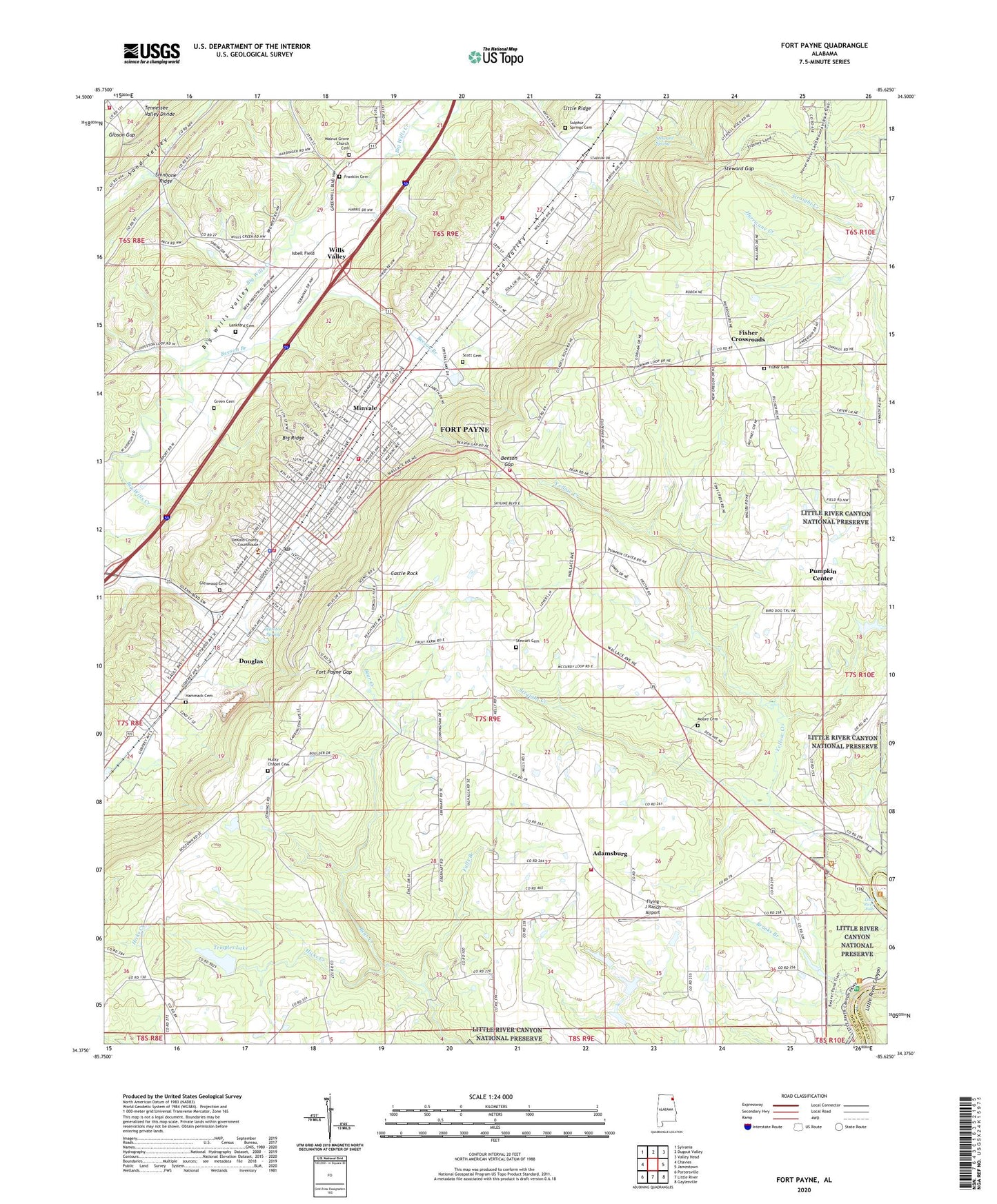
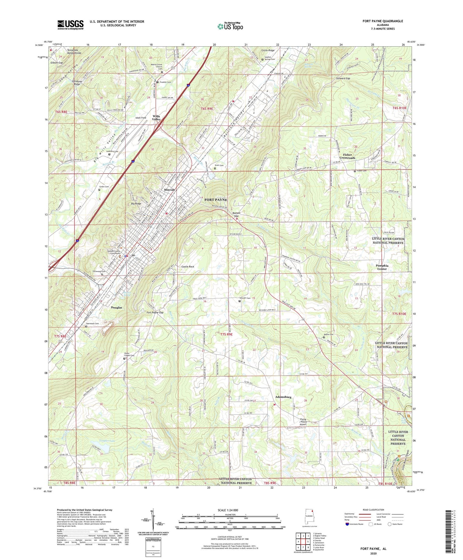
2024 topographic map quadrangle Fort Payne in the state of Alabama. Scale: 1:24000. Based on the newly updated USGS 7.5' US Topo map series, this map is in the following counties: DeKalb, Cherokee. The map contains contour data, water features, and other items you are used to seeing on USGS maps, but also has updated roads and other features. This is the next generation of topographic maps. Printed on high-quality waterproof paper with UV fade-resistant inks.
Quads adjacent to this one:
West: Chavies
Northwest: Sylvania
North: Dugout Valley
Northeast: Valley Head
East: Jamestown
Southeast: Gaylesville
South: Little River
Southwest: Portersville
This map covers the same area as the classic USGS quad with code o34085d6.
Contains the following named places: Adamsburg, Adamsburg Church, Adamsburg Junior High School, Adamsburg Volunteer Fire Department, Baptist Medical Center De Kalb, Beeson Branch, Beeson Gap, Bell School, Blake Volunteer Fire Department, Brooks Branch, Castle Rock, CED Mental Health Center, City of Fort Payne, City Park, Crystal Lake Church, DeKalb County Courthouse, DeKalb County Health Clinic, DeKalb County Library, Delma Church, Douglas, Edna Hill Church, Ellers Chapel, Falls Branch, Fisher Cemetery, Fisher Crossroads, Fisher School, Flying J Ranch Airport, Forest Avenue Elementary School, Fort Payne, Fort Payne Academy, Fort Payne Boom Town Historic District, Fort Payne City Auditorium, Fort Payne Division, Fort Payne Fire and Rescue Station 1, Fort Payne Fire and Rescue Station 2, Fort Payne Fire and Rescue Station 3, Fort Payne Fire and Rescue Station 4, Fort Payne Fire and Rescue Station 5, Fort Payne Gap, Fort Payne High School, Fort Payne Main Street Historic District, Fort Payne Post Office, Fort Payne Recreation Center, Fort Payne Residential Historic District, Franklin Cemetery, Gibson Gap, Glenwood Cemetery, Green Cemetery, Hammack Cemetery, Hicks Creek, Husky Chapel Cemetery, Isbell Field, Lankford Cemetery, Last Days Church, Liberty Hill Church, Little River Falls, Log Cabin Chapel, Manitou Park, Manitou Spring, Minvale, Moore Cemetery, Moore School, Mount Carmel Church, Mount Zion Church, New Oregon Church, Pleasant View Church, Pumpkin Center, Railroad Valley, Rawlingsville, Rotch and Cassidy Dam, Rotch and Cassidy Lake, Scott Cemetery, Steward Gap, Steward Spring, Stewart Cemetery, Straight Creek, Sulphur Springs Cemetery, Tate Hollow, Temple Dam, Temples Lake, Union Church, Union Hill Church, Walnut Grove Baptist Church, WFPA-AM (Fort Payne), Williams Avenue Athletic Facilities, Williams Avenue Junior High School, Wills Valley, Willstown Mission, Yellow Creek, ZIP Code: 35967