MyTopo
Gallion Alabama US Topo Map
Couldn't load pickup availability
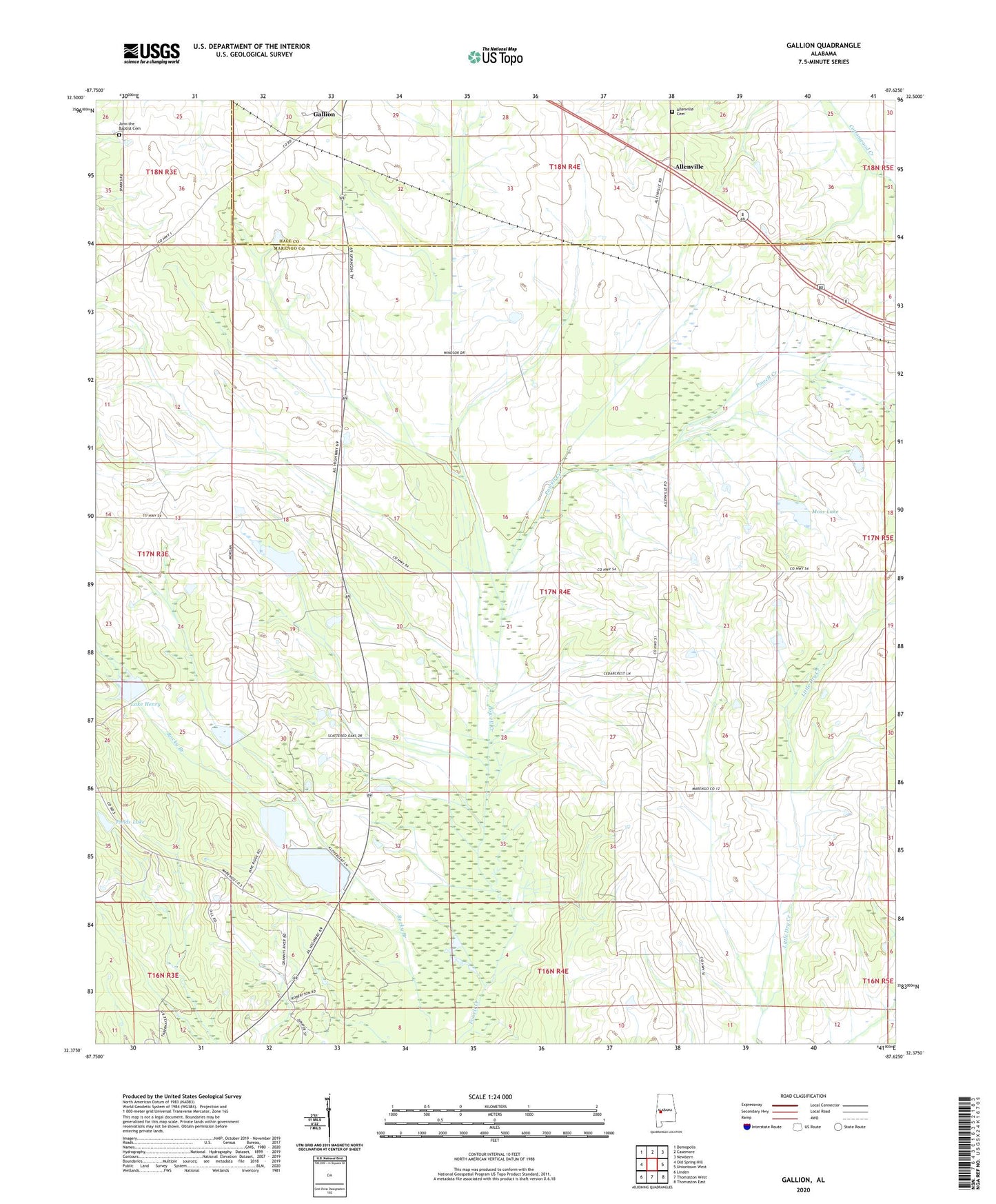
2024 topographic map quadrangle Gallion in the state of Alabama. Scale: 1:24000. Based on the newly updated USGS 7.5' US Topo map series, this map is in the following counties: Marengo, Hale. The map contains contour data, water features, and other items you are used to seeing on USGS maps, but also has updated roads and other features. This is the next generation of topographic maps. Printed on high-quality waterproof paper with UV fade-resistant inks.
Quads adjacent to this one:
West: Old Spring Hill
Northwest: Demopolis
North: Casemore
Northeast: Newbern
East: Uniontown West
Southeast: Thomaston East
South: Thomaston West
Southwest: Linden
This map covers the same area as the classic USGS quad with code o32087d6.
Contains the following named places: Allenville, Allenville Cemetery, Bethea Dam, Bethlehem Church, Cedarcrest Farms, Cuba Plantation, Fields Lake, Gallion, John the Baptist Cemetery, John the Baptist Church, Lake Henry, Moss Lake, Mount Horeb Church, N B Fields Lake Dam, Nazarea Galilee Church, Powell Creek Lake Number Eight, Powell Creek Number 7 Dam, Powell Creek Number 8 Dam, Saint James Church, Saint Pauls Church, Spencer Dam Number Two, Spencer Lake Two, Tombigbee, ZIP Code: 36742