MyTopo
Thomaston East Alabama US Topo Map
Couldn't load pickup availability
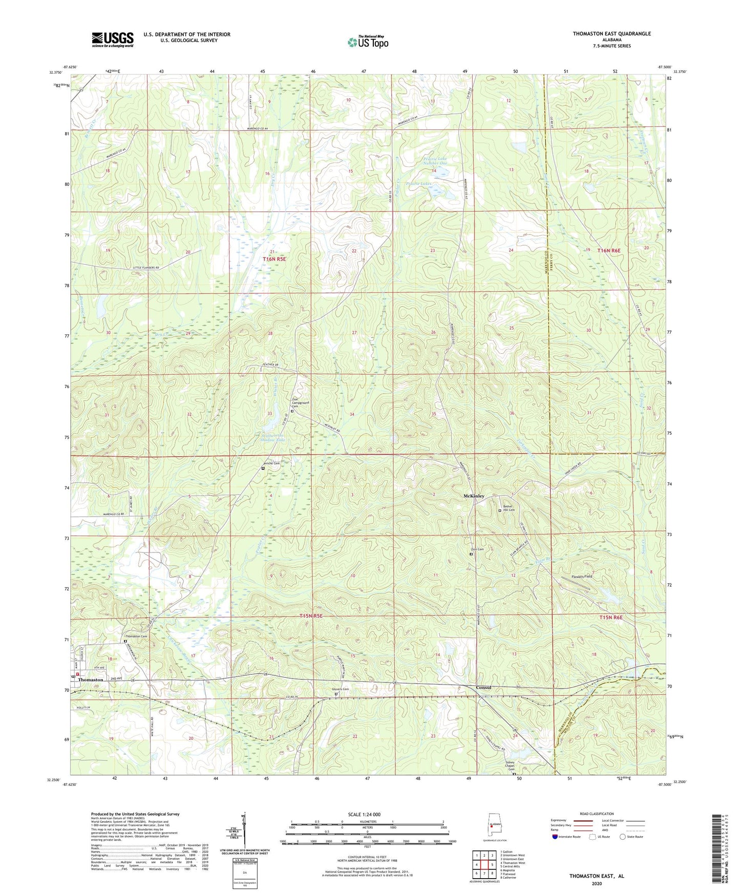
2024 topographic map quadrangle Thomaston East in the state of Alabama. Scale: 1:24000. Based on the newly updated USGS 7.5' US Topo map series, this map is in the following counties: Marengo, Perry, Wilcox. The map contains contour data, water features, and other items you are used to seeing on USGS maps, but also has updated roads and other features. This is the next generation of topographic maps. Printed on high-quality waterproof paper with UV fade-resistant inks.
Quads adjacent to this one:
West: Thomaston West
Northwest: Gallion
North: Uniontown West
Northeast: Uniontown East
East: Central Mills
Southeast: Catherine
South: Flatwood
Southwest: Magnolia
This map covers the same area as the classic USGS quad with code o32087c5.
Contains the following named places: Bethel Hill Cemetery, Bethel Hill Church, Bush Store, Camp Ground, Consul, Crenshaw, Crocker Dam, Crocker Lake, East Marengo Division, Elam Branch, First Baptist Church, Flowers Field, Glovers Cemetery, Glovers Primitive Baptist Church, Hebron Baptist Church, Jericho Cemetery, Jericho Church, Kings, Lyon, McCorkle, McKinley, Old White Hall, Poplar Creek, Prairie Dam Number One, Prairie Lake Dam Number Two, Prairie Lake Number One, Prairie Lake Number Two, Prairie Lakes, Saint John Church, Saint John Elementary School, Sidney Chapel Cemetery, Stallworth Dam, Stallworths Shadow Lake, Sugar Hill Plantation, Thomaston Post Office, Thomaston Volunteer Fire Department Station 1, Town of Thomaston, Turkeypen Creek, Whites Branch, Wootens, Zion Campground Cemetery, Zion Campground Church, Zion Cemetery, Zion Church