MyTopo
Gantt Alabama US Topo Map
Couldn't load pickup availability
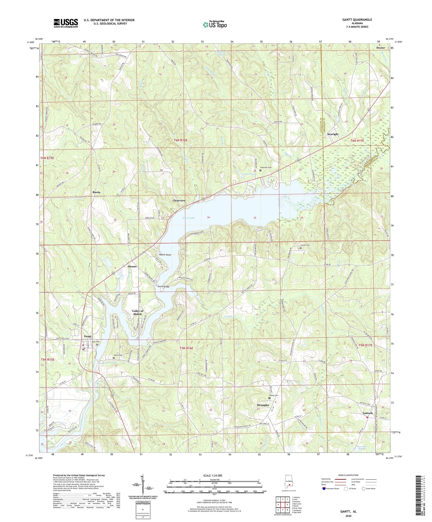
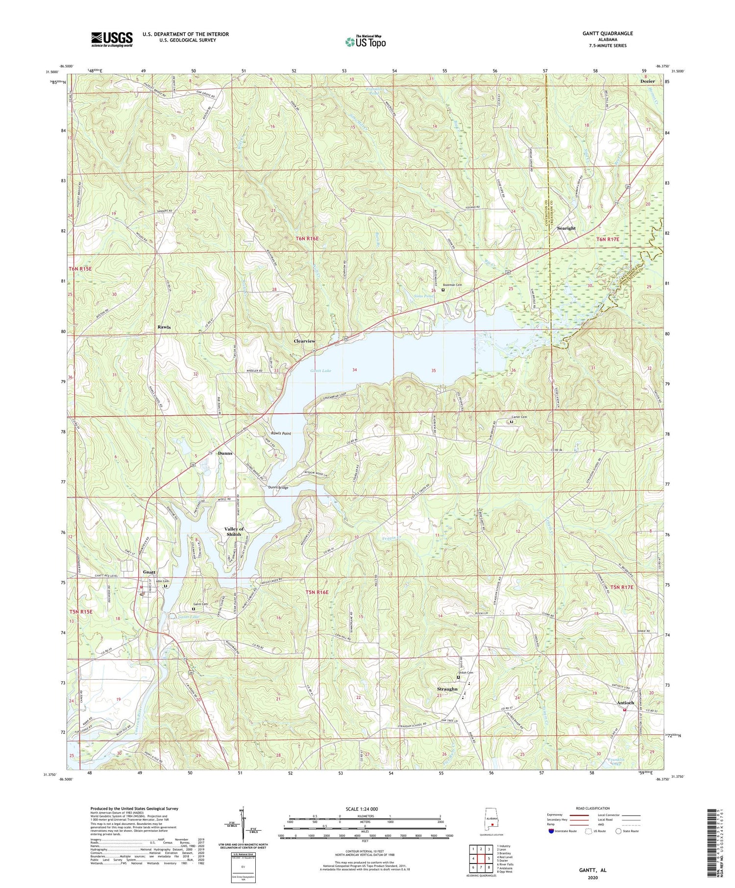
2024 topographic map quadrangle Gantt in the state of Alabama. Scale: 1:24000. Based on the newly updated USGS 7.5' US Topo map series, this map is in the following counties: Covington, Crenshaw. The map contains contour data, water features, and other items you are used to seeing on USGS maps, but also has updated roads and other features. This is the next generation of topographic maps. Printed on high-quality waterproof paper with UV fade-resistant inks.
Quads adjacent to this one:
West: Red Level
Northwest: Industry
North: Leon
Northeast: Brantley
East: Dozier
Southeast: Opp West
South: Andalusia
Southwest: River Falls
This map covers the same area as the classic USGS quad with code o31086d4.
Contains the following named places: Able Cemetery, Alabama Electric Cooperative McWilliams Plant, Antioch, Antioch Church, Antioch Fire Department, Bear Creek, Big Creek, Billy Carter Lake Dam, Boston, Bozeman Cemetery, Burn Branch, Carter Cemetery, Clearview, Cold Spring Church, Cold Spring School, Cold Water Church, Coldwater, Dunns, Dunns Bridge, Feagin Creek, Franklin Lake, Franklin Pond, Gantt, Gantt Area Rescue Squad, Gantt Area Volunteer Fire Department, Gantt Baptist Church, Gantt Cemetery, Gantt Dam, Gantt Lake, Gantt Millpond, Gantt Post Office, Jordan Grove Baptist Church, Mount Sinai Missionary Baptist Church, Mount Zion United Methodist Church, New Providence Church, Oak Grove Church, Rawls, Rawls Point, Rawls School, Rocky Creek, Roscoe Woorley Lake Dam, Rose Hill-Gantt Division, Searight, Shady Grove Church, Shiloh Cemetery, Shiloh Primitive Baptist Church, Sims Mill Creek, Sims Pond, Sina Creek, Straughn, Straughn High School, Town of Gantt, Valley of Shiloh, Volcano School, Wolf Creek, Zion Chapel, Zion Hill Church, ZIP Codes: 36028, 36038