MyTopo
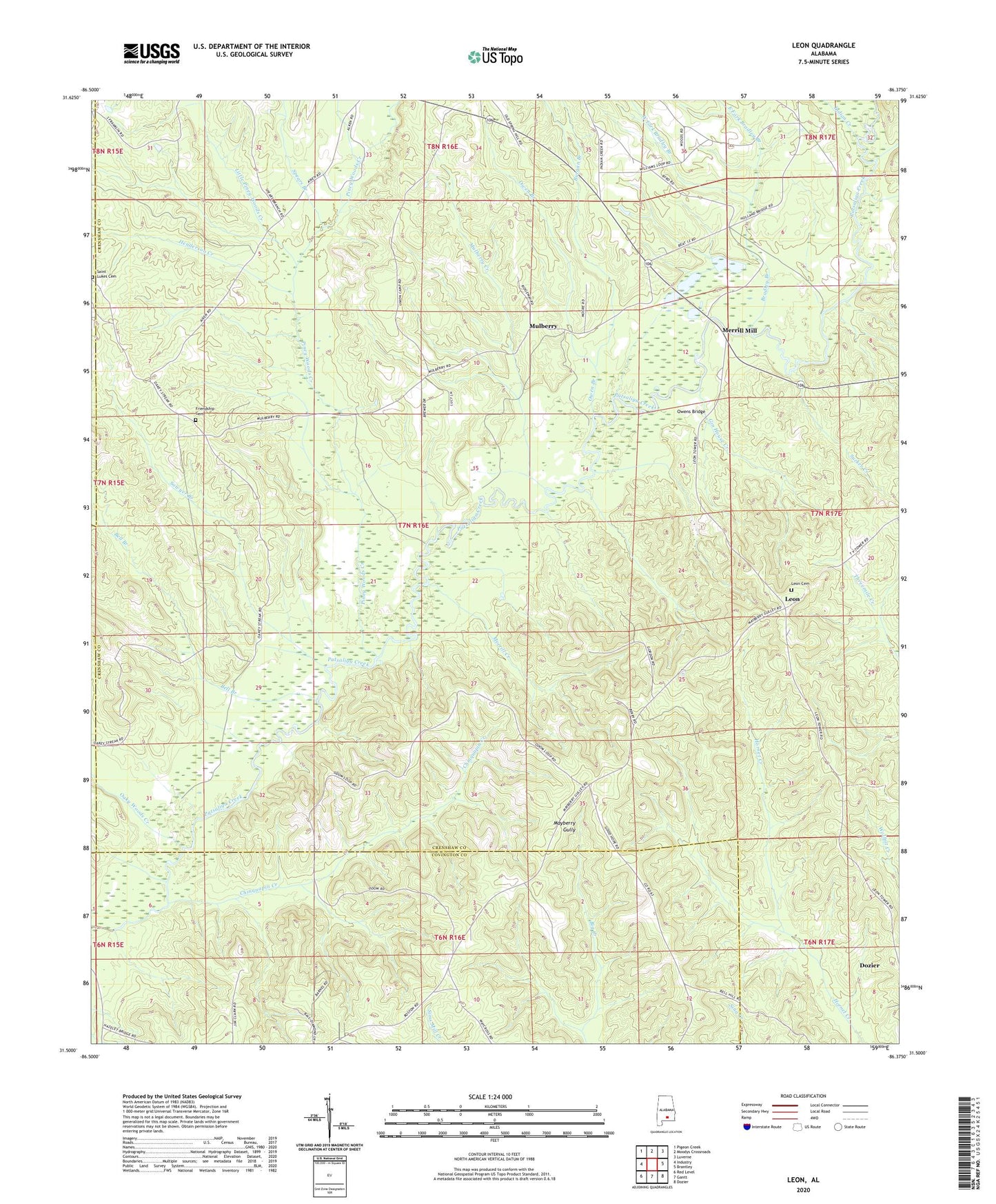
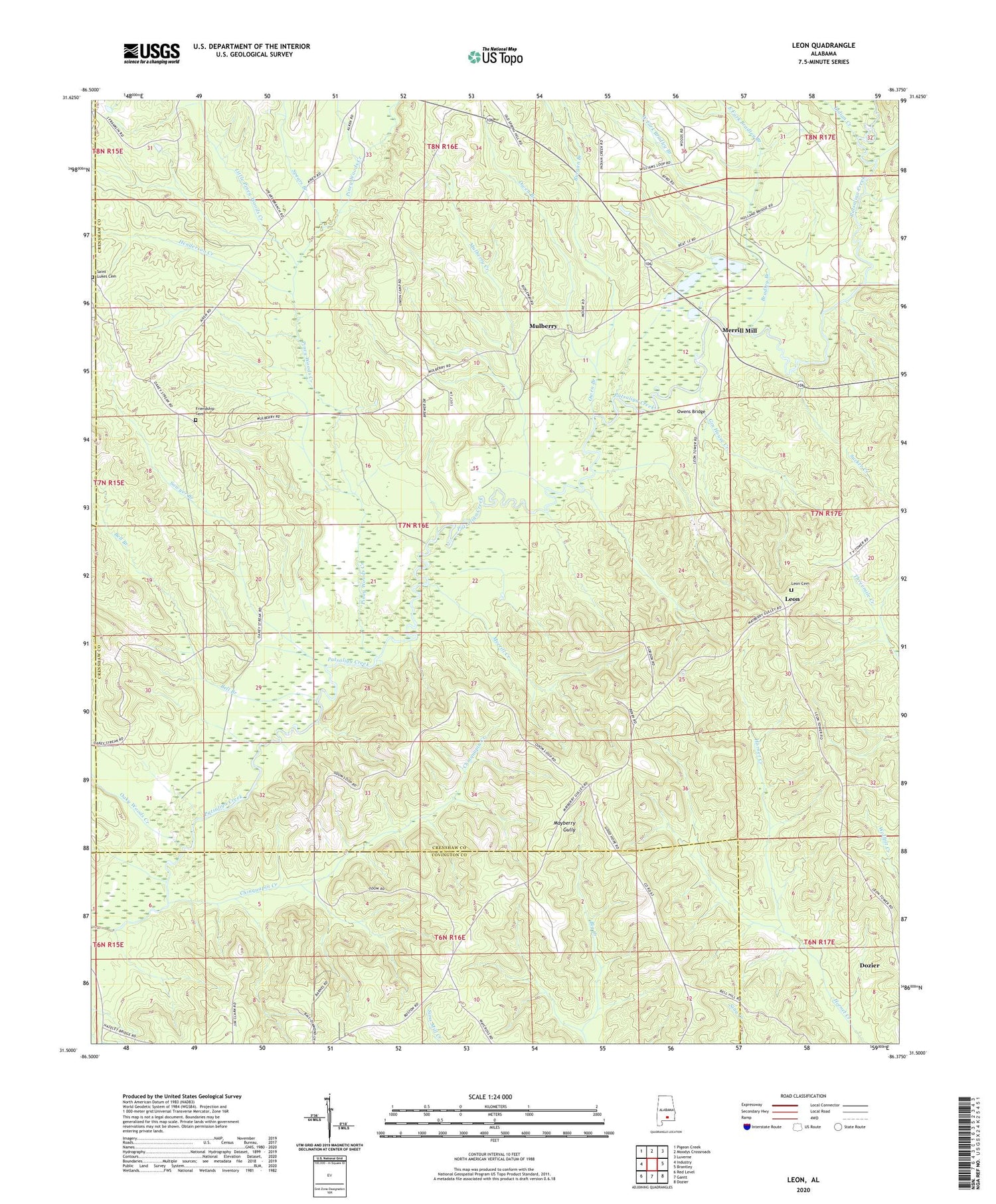
Leon Alabama US Topo Map
Couldn't load pickup availability
2024 topographic map quadrangle Leon in the state of Alabama. Scale: 1:24000. Based on the newly updated USGS 7.5' US Topo map series, this map is in the following counties: Crenshaw, Covington, Butler. The map contains contour data, water features, and other items you are used to seeing on USGS maps, but also has updated roads and other features. This is the next generation of topographic maps. Printed on high-quality waterproof paper with UV fade-resistant inks.
Quads adjacent to this one:
West: Industry
Northwest: Pigeon Creek
North: Moodys Crossroads
Northeast: Luverne
East: Brantley
Southeast: Dozier
South: Gantt
Southwest: Red Level
This map covers the same area as the classic USGS quad with code o31086e4.
Contains the following named places: Antioch Church, Antioch School, Bell Branch, Bradley Branch, Burgan Branch, Chinquapin Creek, County Line Church, Dozier Church, East Fork Bradley Branch, Friendship Cemetery, Gin House Creek, Goodhope Primitive Baptist Church, Henderson Creek, Indian Creek, Indian Creek Church, Indian Creek School, Leon, Leon Cemetery, Little Piney Woods Creek, Longs Bridge, Mayberry Gully, Merrill Creek, Merrill Mill, Mount Canaan Church, Mulberry, Mulberry Church, Mulberry Creek, New Hope Church, New Hope School, Oaky Woods Creek, Owen Branch, Owens Bridge, Piney Woods Creek, Rogers School, Saint Lukes Cemetery, Sawyer Branch, Spears Branch, Spring Hill Church, Sucker Creek, Valley Grove Church, WDIQ-TV (Dozier), West Fork Bradley Branch, Zion Church