MyTopo
River Falls Alabama US Topo Map
Couldn't load pickup availability
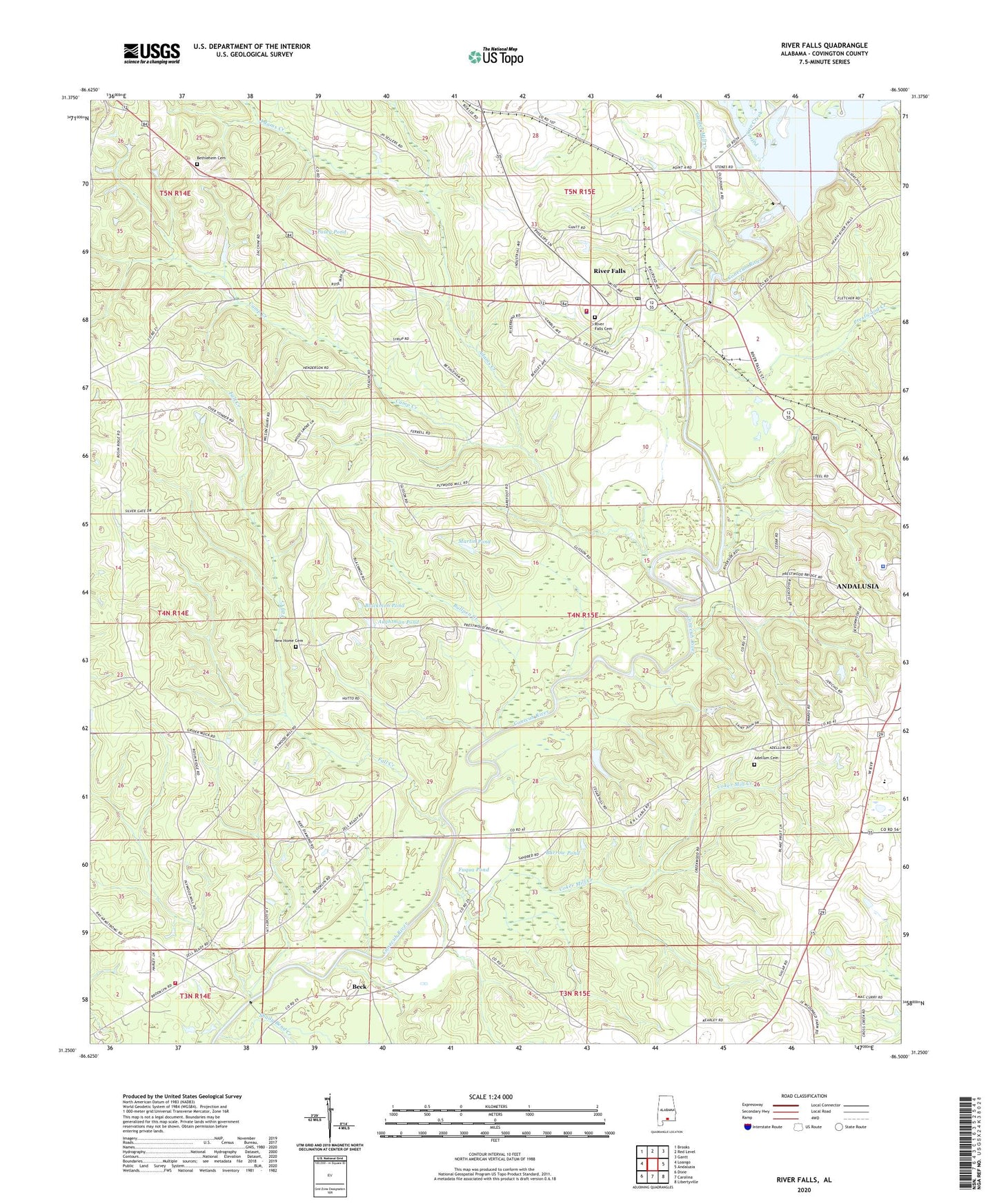
2024 topographic map quadrangle River Falls in the state of Alabama. Scale: 1:24000. Based on the newly updated USGS 7.5' US Topo map series, this map is in the following counties: Covington. The map contains contour data, water features, and other items you are used to seeing on USGS maps, but also has updated roads and other features. This is the next generation of topographic maps. Printed on high-quality waterproof paper with UV fade-resistant inks.
Quads adjacent to this one:
West: Loango
Northwest: Brooks
North: Red Level
Northeast: Gantt
East: Andalusia
Southeast: Libertyville
South: Carolina
Southwest: Dixie
This map covers the same area as the classic USGS quad with code o31086c5.
Contains the following named places: Adams Creek, Adellum Baptist Church, Adellum Cemetery, Andalusia Country Club, Andalusia Division, Andalusia Health Care Center, Aughtman Pond, Barrow Pond, Beck, Bethlehem Cemetery, Blackmon Pond, Bullpen Creek, Camp Creek, Cedar Grove Church of Christ, Center Hill School, Centerville Church, Coker Mill Creek, Columbia Regional Medical Center, Covington County Jail, Covington County Sheriff's Office, Dillon Church, Duns Mill, Fagins Mills, Fall Creek, First Bethlehem Baptist Church, Fuqua Pond, Gunter Mill Creek, Hopewell Baptist Church, Hopewell School, Hopewell Volunteer Fire Department, Martin Pond, Montezuma, Mount Moriah Church, Mount Olive Church, New Friendship Church, New Home Cemetery, New Home Church, New Sweet Home School, Oak Grove Church, Patsaliga Creek, Pine Level Church, Point A Dam, Point A Lake, Posey Pond, Presley Chapel, Prestwood Creek, River Falls, River Falls Baptist Church, River Falls Cemetery, River Falls Police Department, River Falls Post Office, River Falls Volunteer Fire Department, Shady Bend Creek, Town of River Falls, West Gate Plaza Shopping Center, West Highland Assembly of God Church, ZIP Codes: 36421, 36476