MyTopo
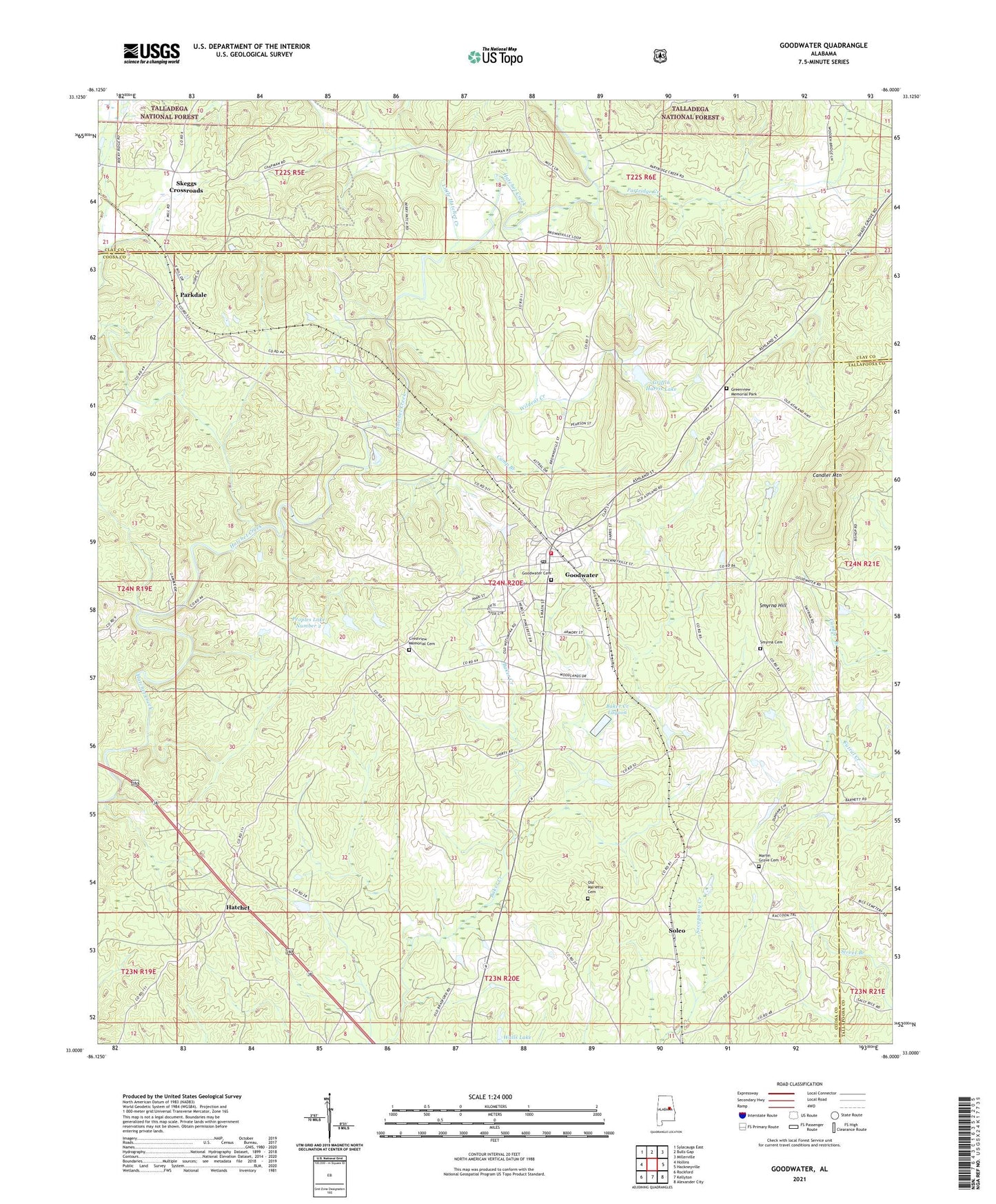
Goodwater Alabama US Topo Map
Couldn't load pickup availability
Also explore the Goodwater Forest Service Topo of this same quad for updated USFS data
2024 topographic map quadrangle Goodwater in the state of Alabama. Scale: 1:24000. Based on the newly updated USGS 7.5' US Topo map series, this map is in the following counties: Coosa, Clay, Tallapoosa. The map contains contour data, water features, and other items you are used to seeing on USGS maps, but also has updated roads and other features. This is the next generation of topographic maps. Printed on high-quality waterproof paper with UV fade-resistant inks.
Quads adjacent to this one:
West: Hollins
Northwest: Sylacauga East
North: Bulls Gap
Northeast: Millerville
East: Hackneyville
Southeast: Alexander City
South: Kellyton
Southwest: Rockford
This map covers the same area as the classic USGS quad with code o33086a1.
Contains the following named places: Bailey Dam, Bailey Lake, Baker Creek Lagoon, Baker Creek Lagoon Dam, Camp Branch, Candler Mountain, Church of God, Church of God of Prophecy, Coosa County Airport, Crestview Memorial Cemetery, Crossroads School, Goodwater, Goodwater Academy, Goodwater Cemetery, Goodwater Elementary School, Goodwater Fire Department and Ambulance Service, Goodwater High School, Goodwater Post Office, Greenview Memorial Park, Griffin Harris Lake, Griffin Harris Lake Dam, Hatchet, Hatchet Springs Church, Hatchet Springs School, Hatchett Creek Golf Club, Haynes Chapel, Little Hatchet Creek, Marietta Church, Marietta School, Martin Grove Cemetery, Mount Pleasant Church, Old Marietta Cemetery, Parkdale, Parkdale Church, Partridge Creek, Peoples Lake Dam, Peoples Lake Number 2, Peoples Lake Number 2 Dam, Ross Ford, Skeggs Crossroads, Smyrna Cemetery, Smyrna Hill, Smyrna Primitive Baptist Church, Soleo, Town of Goodwater, Wildcat Creek, ZIP Code: 35072