MyTopo
Graham Alabama US Topo Map
Couldn't load pickup availability
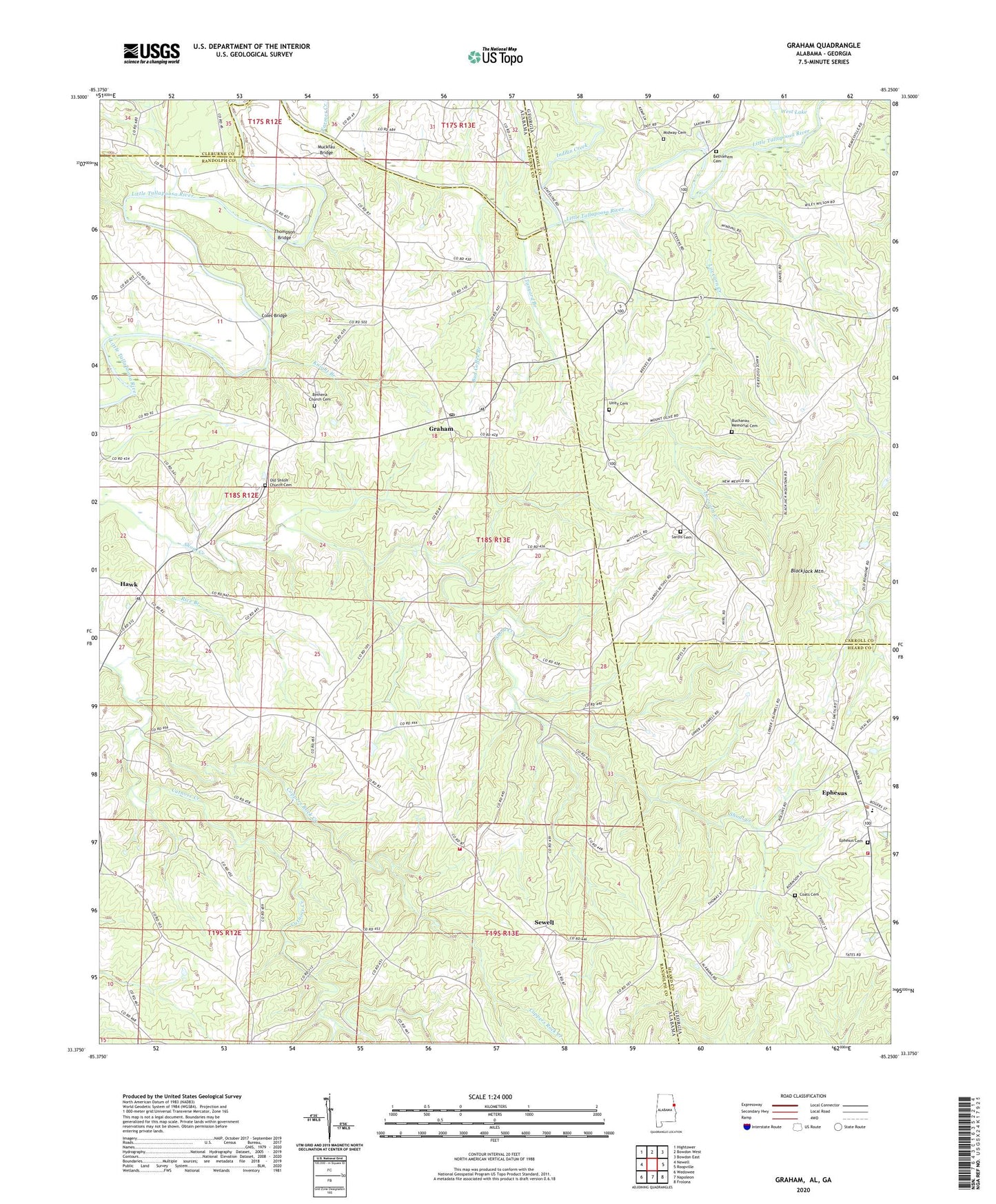
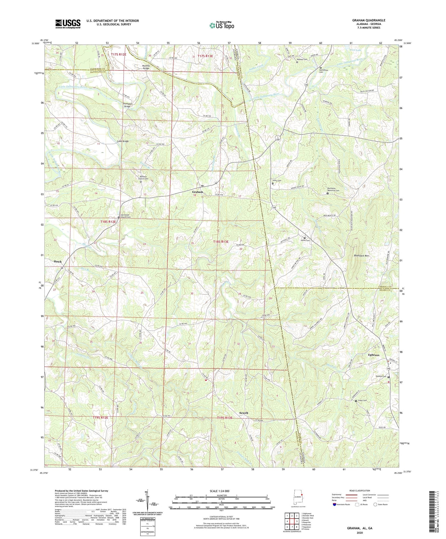
2024 topographic map quadrangle Graham in the states of Alabama, Georgia. Scale: 1:24000. Based on the newly updated USGS 7.5' US Topo map series, this map is in the following counties: Randolph, Carroll, Heard, Cleburne. The map contains contour data, water features, and other items you are used to seeing on USGS maps, but also has updated roads and other features. This is the next generation of topographic maps. Printed on high-quality waterproof paper with UV fade-resistant inks.
Quads adjacent to this one:
West: Newell
Northwest: Hightower
North: Bowdon West
Northeast: Bowdon East
East: Roopville
Southeast: Frolona
South: Napoleon
Southwest: Wedowee
Contains the following named places: Bethel, Bethel East Church, Bethel East Volunteer Fire Department, Bethelhem Church, Bethena United Methodist Church Cemetery, Bethlehem Camp Ground Church, Bethlehem Cemetery, Bethlehem Primitive Baptist Church, Blackjack Mountain, Buchanan Memorial Cemetery, Bucktown, Bud Coffee Branch, Burgess, City of Ephesus, Coats Cemetery, Coles Bridge, Coppers Rock Creek, Dot, Ephesus, Ephesus Baptist Church, Ephesus Cemetery, Ephesus Elementary School, Ephesus Fire Department Station 3, Farmer Creek, Friendship Church, Graham, Graham Census Designated Place, Graham Post Office, Hawk, Herrens Grove Church, Indian Creek, Kaylor, Knight Branch, Knokes Creek, Lovvorn Creek, Midway Cemetery, Midway Church, Midway School, Mount Oliver Church, Muckfau Bridge, New Mexico, Old Shiloh Church Cemetery, Prospect Congregational Methodist Church, Providence, Providence Church, Reeves School, Rice Branch, Saint James Church, Sardis Cemetery, Sardis Church, Saxon Crossroads, Sewell, Shiloh Church, Tanyard Branch, Thompson Bridge, Unity Cemetery, Unity of God Church, Victory Cathedral Church, West Lake, West Lake Dam, ZIP Code: 36263