
MyTopo
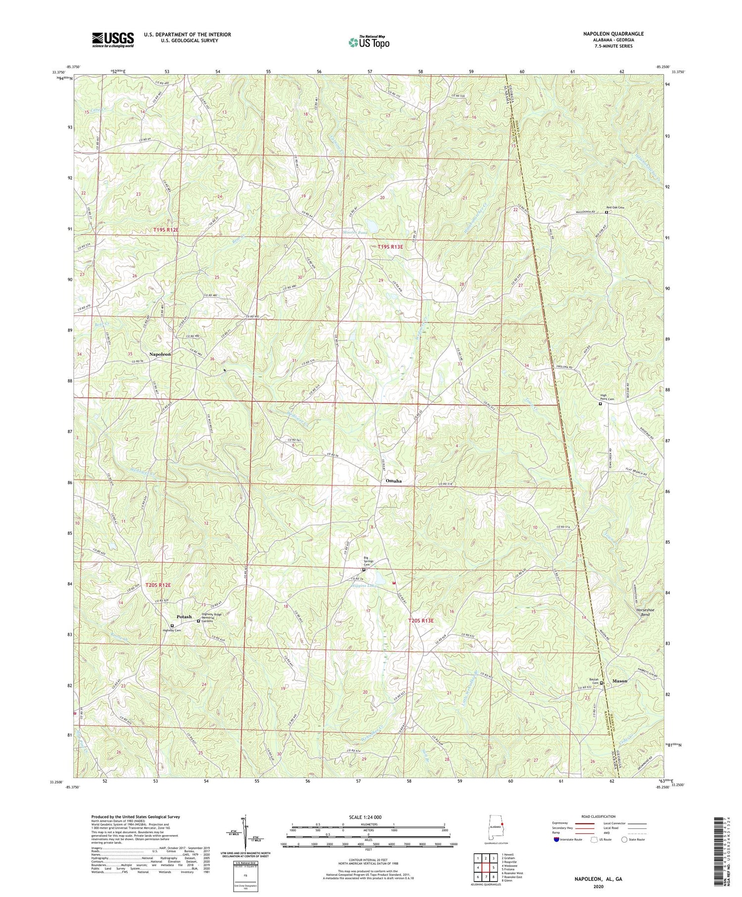
Napoleon Alabama US Topo Map
Couldn't load pickup availability
2024 topographic map quadrangle Napoleon in the states of Alabama, Georgia. Scale: 1:24000. Based on the newly updated USGS 7.5' US Topo map series, this map is in the following counties: Randolph, Heard. The map contains contour data, water features, and other items you are used to seeing on USGS maps, but also has updated roads and other features. This is the next generation of topographic maps. Printed on high-quality waterproof paper with UV fade-resistant inks.
Quads adjacent to this one:
West: Wedowee
Northwest: Newell
North: Graham
Northeast: Roopville
East: Frolona
Southeast: Glenn
South: Roanoke East
Southwest: Roanoke West
Contains the following named places: Beulah Cemetery, Beulah Church, Big Springs, Big Springs Baptist Church, Big Springs Cemetery, Big Springs School, Crain, East Randolph County Fire Department, Flat Rock Church, Gray Hill Church, Higgins Dam, Higgins Lake, High Point Cemetery, High Point Church, High Point School, Highway Cemetery, Highway First Congregational Methodist Church, Highway Ridge Memorial Gardens, Horseshoe Bend, Liberty East Church, Mason, Midway School, Moore Dam, Moores Pond, Mount Carmel Church, Napoleon, Napoleon Church, Neighborhood House of Prayer Church, Omaha, Potash, Potash Church, Red Oak, Red Oak Academy, Red Oak Cemetery, Red Oak Congregational Methodist Church, Tin Shop, Tin Shop Volunteer Fire Department, Waldrep, Woodland Division, Youngs Mill


