MyTopo
Grand Bay SW Alabama US Topo Map
Couldn't load pickup availability
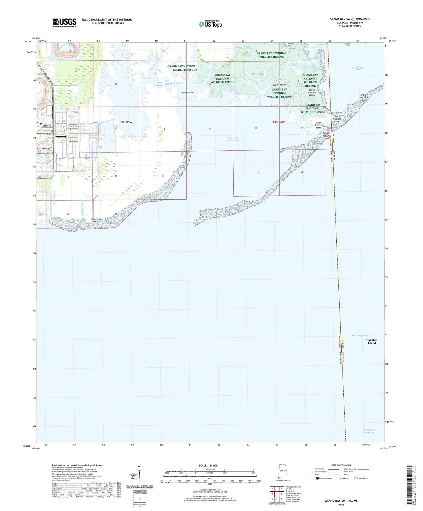
2024 topographic map quadrangle Grand Bay SW in the state of Alabama. Scale: 1:24000. Based on the newly updated USGS 7.5' US Topo map series, this map is in the following counties: Mobile, Jackson. The map contains contour data, water features, and other items you are used to seeing on USGS maps, but also has updated roads and other features. This is the next generation of topographic maps. Printed on high-quality waterproof paper with UV fade-resistant inks.
Quads adjacent to this one:
West: Pascagoula South
Northwest: Pascagoula North
North: Kreole
Northeast: Grand Bay
East: Isle aux Herbes
Southeast: Petit Bois Pass
South: Petit Bois Island
Southwest: Horn Island East
Contains the following named places: Bangs Bayou, Bangs Island, Bangs Lake, Bayou Cumbest, Bayou Rosa, Brown Bayou, Crooked Bayou, Grand Bay, Grande Batture Islands, Jose Bay, Jose Bayou, L'Isle Chaude, L'Isle Chaude Bay, North Bayou, North Rigolets, North Rigolets Island, Point Aux Chenes, Point Aux Chenes Bay, Priest Bayou, South Rigolets, South Rigolets Island, The Prairie, ZIP Code: 39581