MyTopo
Grand Bay Alabama US Topo Map
Couldn't load pickup availability
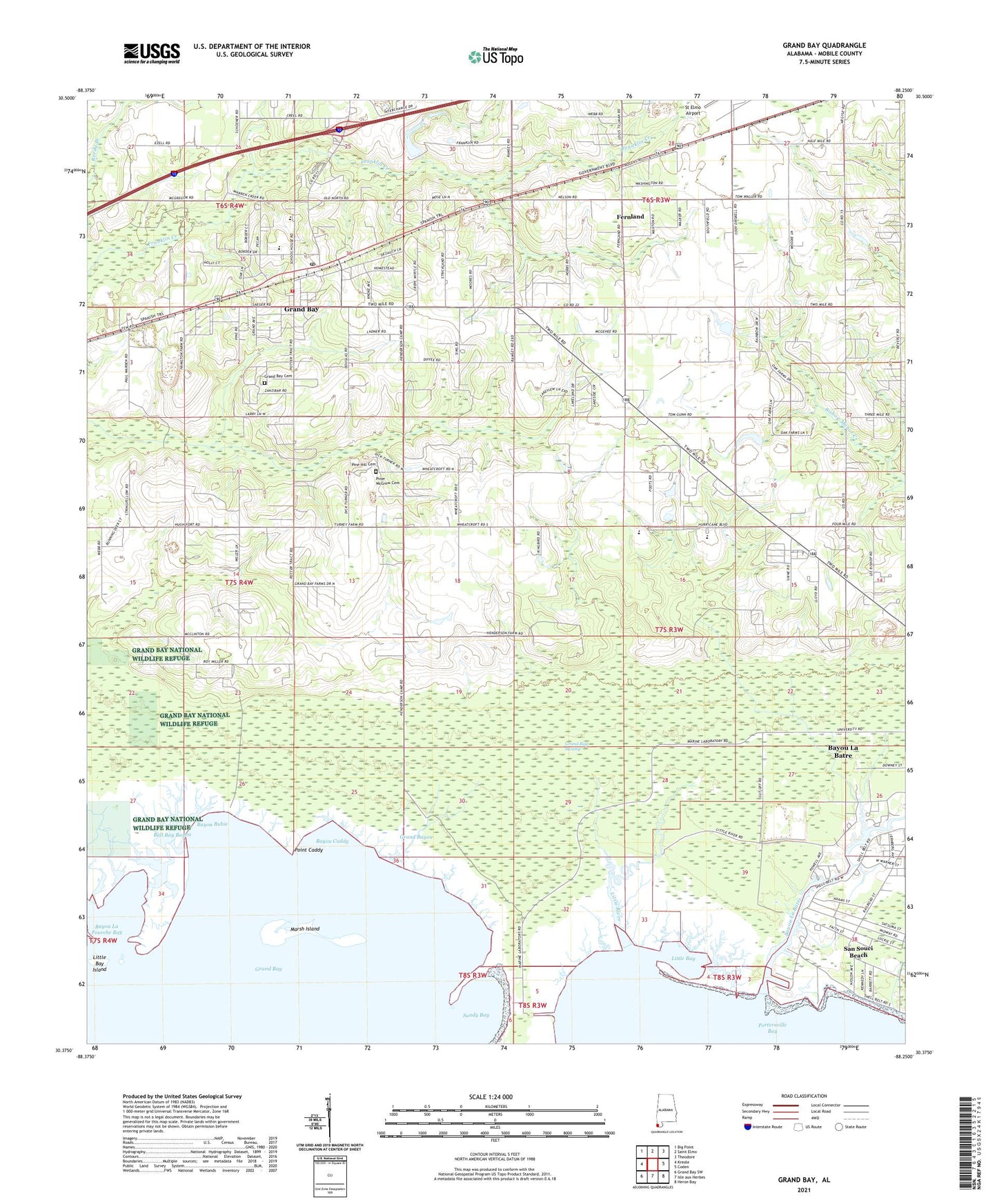
2024 topographic map quadrangle Grand Bay in the state of Alabama. Scale: 1:24000. Based on the newly updated USGS 7.5' US Topo map series, this map is in the following counties: Mobile. The map contains contour data, water features, and other items you are used to seeing on USGS maps, but also has updated roads and other features. This is the next generation of topographic maps. Printed on high-quality waterproof paper with UV fade-resistant inks.
Quads adjacent to this one:
West: Kreole
Northwest: Big Point
North: Saint Elmo
Northeast: Theodore
East: Coden
Southeast: Heron Bay
South: Isle aux Herbes
Southwest: Grand Bay SW
This map covers the same area as the classic USGS quad with code o30088d3.
Contains the following named places: Bayou Bubie, Bayou Caddy, Bayou La Batre, Bayou La Batre Church, Bayou La Fourche Bay, Bull Bay Bayou, Church of Christ, City of Bayou La Batre, Cora Castlen School, Elizabeth Church, Faith Baptist Church, Fernland, First Assembly of God Church, First Baptist Church of Grand Bay, First Church of the Nazarene, First United Methodist Church, Friendship Baptist Church, Grand Bay, Grand Bay Cemetery, Grand Bay Census Designated Place, Grand Bay Church, Grand Bay Division, Grand Bay Post Office, Grand Bay Swamp, Grand Bay United Methodist Church, Grand Bay Volunteer Fire Department, Grand Bayou, Grand Garden Church, H C Farmer Dam, Higher Ground Baptist Church, Holy Assembly Church, J and J Speedway, Lighthouse Church, Little Bay, Little Bay Island, Little River, Little Rock Church, Marsh Island, Mobile County High School, New Beginnings Ministry Baptist Church, Pine Air Church, Pine Hill Cemetery, Pinecrest, Piner McGrew Cemetery, Point Caddy, Saint John's Catholic Church, San Souci Beach, Sandy Bay, Shiloh Church, Summit Mobile Home Park, The Lord Church, ZIP Codes: 36509, 36541