MyTopo
Guin Alabama US Topo Map
Couldn't load pickup availability
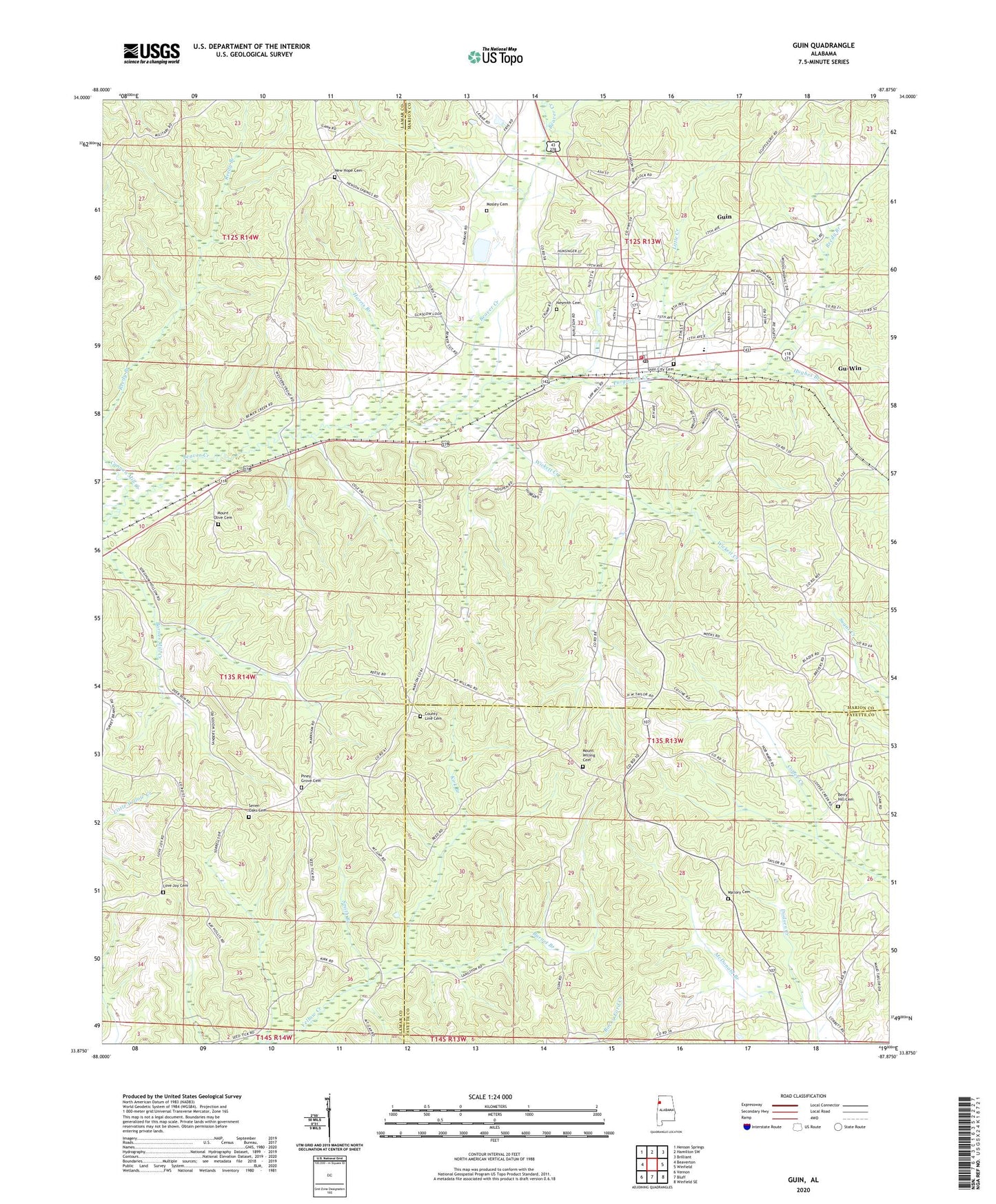
2024 topographic map quadrangle Guin in the state of Alabama. Scale: 1:24000. Based on the newly updated USGS 7.5' US Topo map series, this map is in the following counties: Lamar, Marion, Fayette. The map contains contour data, water features, and other items you are used to seeing on USGS maps, but also has updated roads and other features. This is the next generation of topographic maps. Printed on high-quality waterproof paper with UV fade-resistant inks.
Quads adjacent to this one:
West: Beaverton
Northwest: Henson Springs
North: Hamilton SW
Northeast: Brilliant
East: Winfield
Southeast: Winfield SE
South: Bluff
Southwest: Vernon
This map covers the same area as the classic USGS quad with code o33087h8.
Contains the following named places: Berry Hill Cemetery, Burnet Branch, Cannon Mill Creek, City of Guin, County Line Cemetery, First Freewill Baptist Church, First United Methodist Church, Guin, Guin Church of Christ, Guin City Cemetery, Guin Division, Guin Elementary School, Guin Fire Department, Guin Post Office, Guin Town Police Department, Gu-Win, Harris Branch, Hughes Branch, Kirk Branch, Kirk Branch Gas Field, Little Creek, Love Joy Cemetery, Love Joy Church, Mallory Cemetery, Marion County High School, McDonald Branch, McKay Branch, Mosley Cemetery, Mount Olive Cemetery, Mount Willing Cemetery, Mount Willing Church, Nesmith Cemetery, New Hope Cemetery, New Hope Church, North Blowhorn Oil Field, Oak Grove Church, Piney Grove Cemetery, Piney Grove Church, Purgatory Creek, Reedy Branch, Seven Oaks Cemetery, Smith Branch, W74A-TV (Guin), Wayside, White Rock Church, Wickett Creek, ZIP Code: 35563