MyTopo
Brilliant Alabama US Topo Map
Couldn't load pickup availability
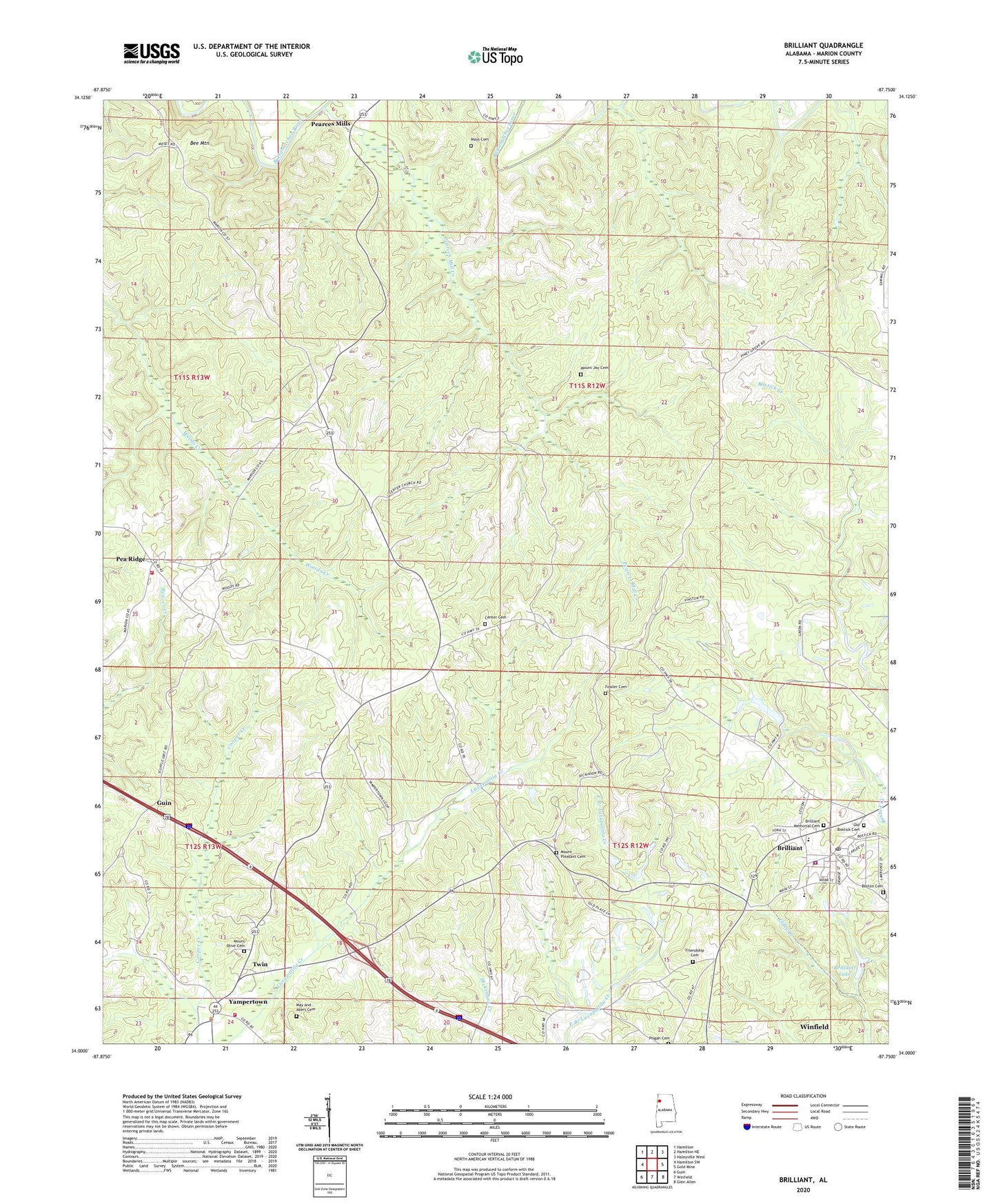
2024 topographic map quadrangle Brilliant in the state of Alabama. Scale: 1:24000. Based on the newly updated USGS 7.5' US Topo map series, this map is in the following counties: Marion. The map contains contour data, water features, and other items you are used to seeing on USGS maps, but also has updated roads and other features. This is the next generation of topographic maps. Printed on high-quality waterproof paper with UV fade-resistant inks.
Quads adjacent to this one:
West: Hamilton SW
Northwest: Hamilton
North: Hamilton NE
Northeast: Haleyville West
East: Gold Mine
Southeast: Glen Allen
South: Winfield
Southwest: Guin
This map covers the same area as the classic USGS quad with code o34087a7.
Contains the following named places: Bee Mountain, Bethlehem Church, Boston Cemetery, Brilliant, Brilliant High School, Brilliant Lake, Brilliant Lake Dam, Brilliant Memorial Cemetery, Brilliant Police Department, Brilliant Post Office, Brilliant Volunteer Fire Department, Center Cemetery, Center United Methodist Church, Douglas Walker Stadium, Fowler Cemetery, Free Waters Church, Friendship Cemetery, Goodwin Creek, Little New River Lake Number 1, Little New River Lake Number 1 Dam, Little New River Lake Number 2, Little New River Lake Number 2 Dam, May and Akers Cemetery, Mays Cemetery, Mount Joy Cemetery, Mount Olive Cemetery, Mount Olive Freewill Baptist Church, Mount Pleasant Cemetery, Mount Pleasant Freewill Baptist Church, Mount Zion Church, Old Bostick Cemetery, Pea Ridge, Pea Ridge Volunteer Fire Department, Pearces Mill Creek, Pearces Mills, Pisgah Cemetery, Pull Tight, Town of Brilliant, Town of Twin, Twin, Twin Fire and Rescue, Yampertown, ZIP Code: 35548