MyTopo
Beaverton Alabama US Topo Map
Couldn't load pickup availability
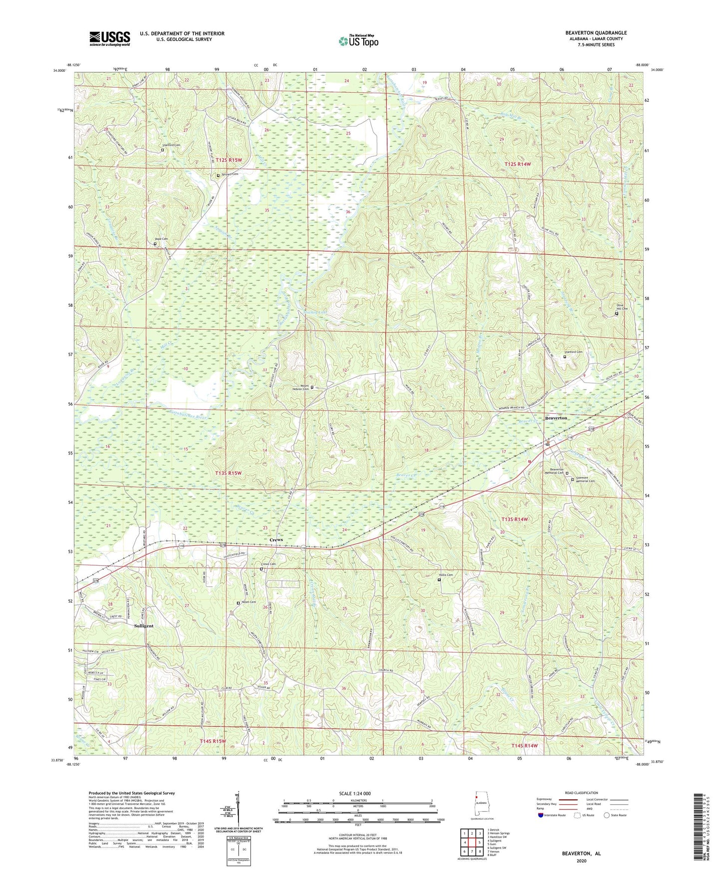
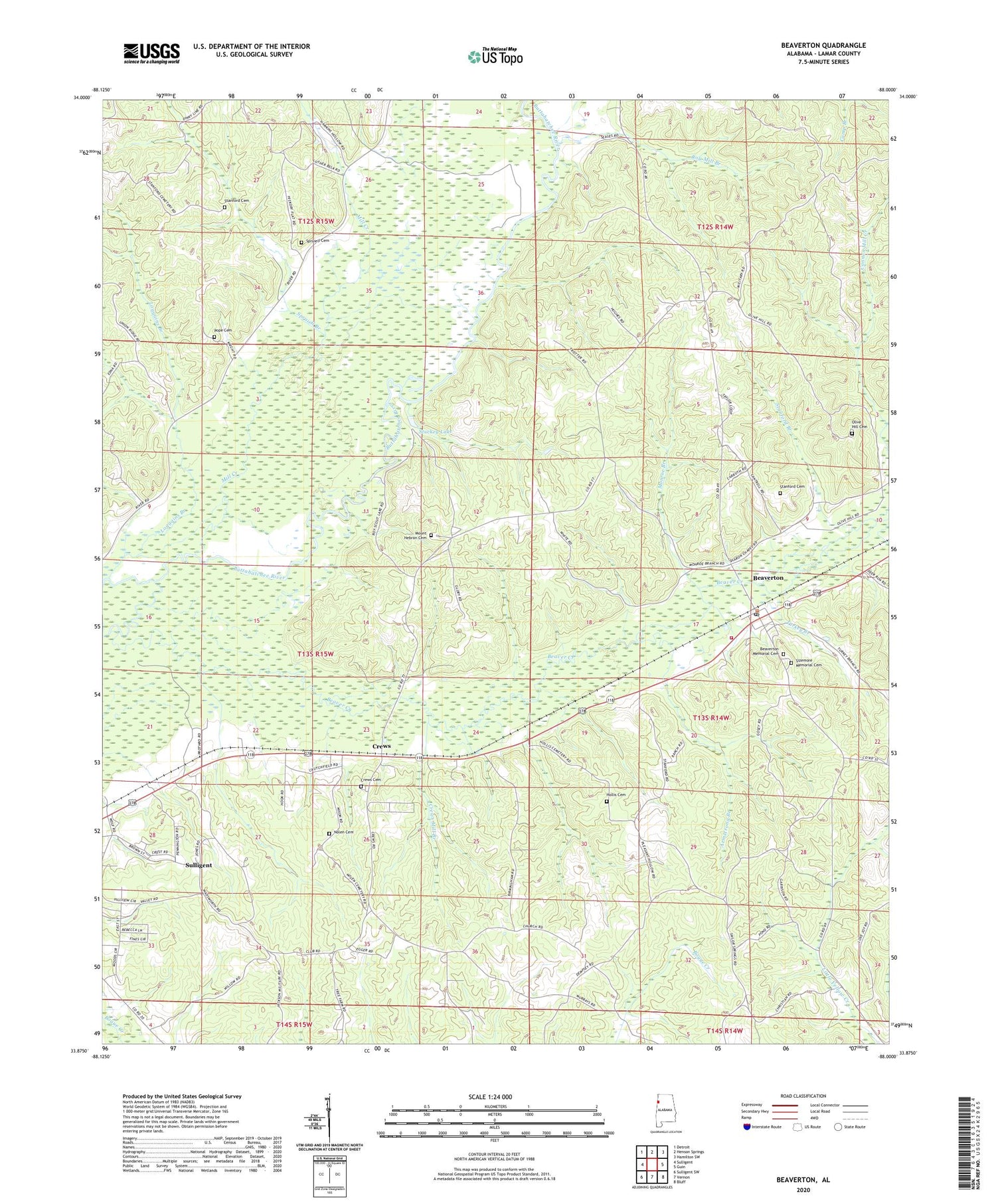
2024 topographic map quadrangle Beaverton in the state of Alabama. Scale: 1:24000. Based on the newly updated USGS 7.5' US Topo map series, this map is in the following counties: Lamar. The map contains contour data, water features, and other items you are used to seeing on USGS maps, but also has updated roads and other features. This is the next generation of topographic maps. Printed on high-quality waterproof paper with UV fade-resistant inks.
Quads adjacent to this one:
West: Sulligent
Northwest: Detroit
North: Henson Springs
Northeast: Hamilton SW
East: Guin
Southeast: Bluff
South: Vernon
Southwest: Sulligent SW
This map covers the same area as the classic USGS quad with code o33088h1.
Contains the following named places: Armstrong Branch, Armstrong Branch Gas Field, Barnes Mill Creek, Beaver Creek, Beaver Creek Gas Field, Beaverton, Beaverton Freewill Baptist Church, Beaverton Gas Field, Beaverton Memorial Cemetery, Beaverton Post Office, Beaverton Volunteer Fire Department, Crews, Crews Cemetery, Crews Methodist Church, Crews Mill Branch, Hawkins Ford, Hays Ford, Hollis Cemetery, Loggains Branch, Lost John, Lost John Church, Mill Creek, Monroe Branch, Mount Hebron Cemetery, Mount Hebron Church, Nolen Cemetery, Olive Hill Cemetery, Pope Cemetery, Pope Church, Prospect Church, Reedy Branch, Roy Mill Branch, Sharon Church, Sizemore Memorial Cemetery, Spruiell Branch, Spruiell Cemetery, Stanford Branch, Stanford Cemetery, Stuckey Lake, Sulligent Division, Town of Beaverton, Turkey Branch, Union Ridge Church, Wayside Gas Field, Wayside Oil Field, ZIP Code: 35544