MyTopo
Hardaway Alabama US Topo Map
Couldn't load pickup availability
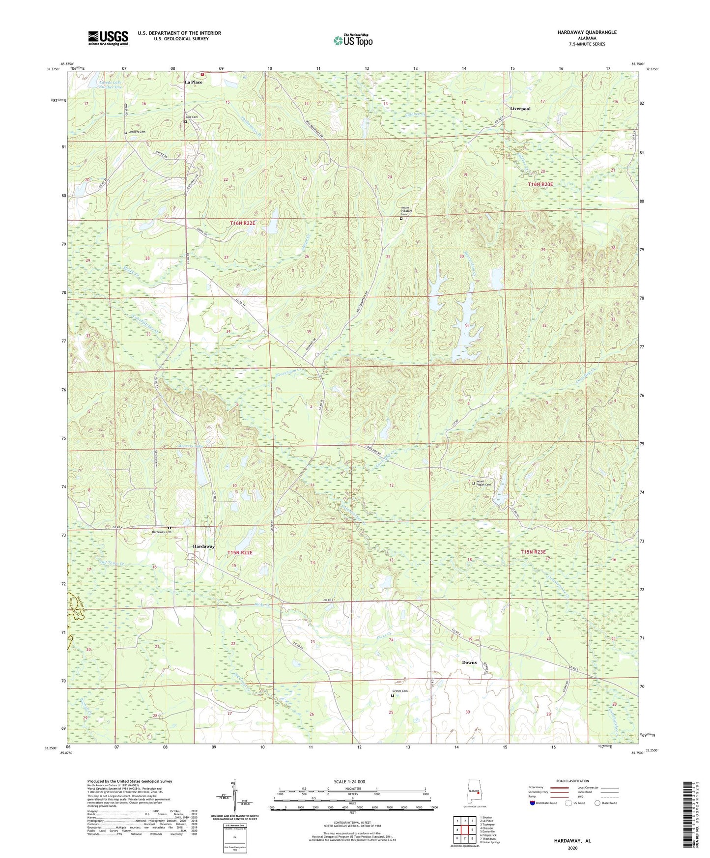
2024 topographic map quadrangle Hardaway in the state of Alabama. Scale: 1:24000. Based on the newly updated USGS 7.5' US Topo map series, this map is in the following counties: Macon, Bullock. The map contains contour data, water features, and other items you are used to seeing on USGS maps, but also has updated roads and other features. This is the next generation of topographic maps. Printed on high-quality waterproof paper with UV fade-resistant inks.
Quads adjacent to this one:
West: Chesson
Northwest: Shorter
North: La Place
Northeast: Tuskegee
East: Davisville
Southeast: Union Springs
South: Thompson
Southwest: Fitzpatrick
This map covers the same area as the classic USGS quad with code o32085c7.
Contains the following named places: Ambers Cemetery, Beaverdam Creek, Beulah Church, Cole Cemetery, Coon Hop Creek, Damascus Church, Damascus School, Dicks Creek, District 3 Volunteer Fire Department, Downs, Edwards, Greater Wesley Chapel, Grimm Cemetery, Hardaway, Hardaway Baptist Church, Hardaway Cemetery, Hardaway Post Office, Jack Lacey Number 1 Dam, John Frank Moorer Dam, Laceys Lake Number One, Lively Hope Church, Liverpool, Moorers Lake, Mount Aaran Church, Mount Pisgah Cemetery, Mount Pisgah Church, Mount Pleasant Cemetery, Mount Pleasant Church, Nebraska Church, Pisgah School, Sweet Gum Church, Sweet Gum School, Union Oak Grove Church, ZIP Code: 36039