
MyTopo
La Place Alabama US Topo Map
Couldn't load pickup availability
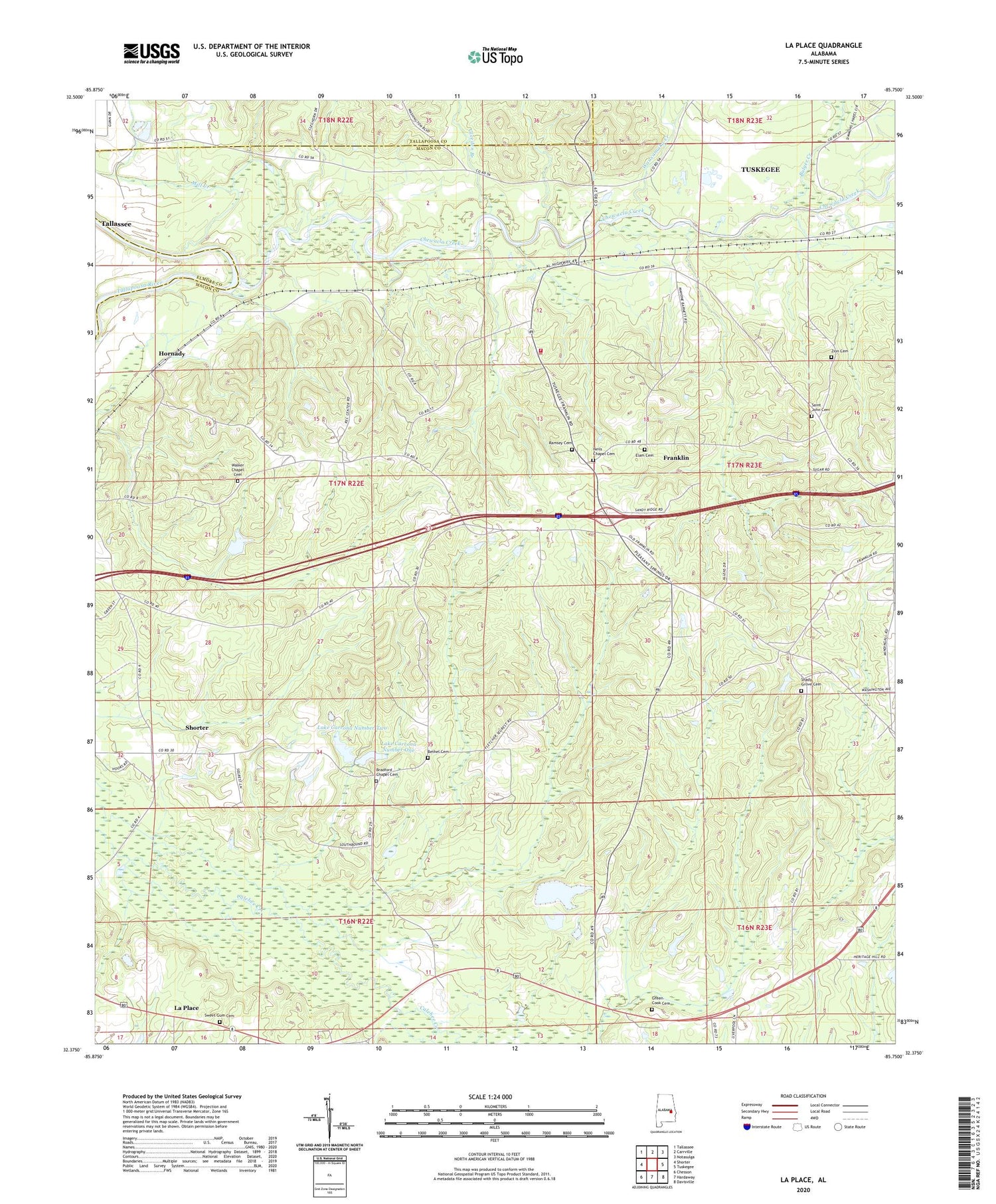
2024 topographic map quadrangle La Place in the state of Alabama. Scale: 1:24000. Based on the newly updated USGS 7.5' US Topo map series, this map is in the following counties: Macon, Tallapoosa, Elmore. The map contains contour data, water features, and other items you are used to seeing on USGS maps, but also has updated roads and other features. This is the next generation of topographic maps. Printed on high-quality waterproof paper with UV fade-resistant inks.
Quads adjacent to this one:
West: Shorter
Northwest: Tallassee
North: Carrville
Northeast: Notasulga
East: Tuskegee
Southeast: Davisville
South: Hardaway
Southwest: Chesson
This map covers the same area as the classic USGS quad with code o32085d7.
Contains the following named places: Antioch Church, Apostolic Faith Mission Church, Baldwin Farms, Baldwin School, Bethel Cemetery, Bethel Church, Bradford Chapel, Bradford Chapel Cemetery, Bradford Chapel School, Bulger Creek, Callabee Battle Ground, Clough, Cole Station School, Devine Bethel Church, Divine Church, Elam Cemetery, Elam Church, Franklin, Franklin School, Franklin Volunteer Fire Department, Gabbett, Gleeden Branch, Green-Cook Cemetery, Harris Barrett School, Holley Mitchell Church, Hornady, La Place, La Place Church, Lake Carrona Number 1 Dam, Lake Carrona Number 2 Dam, Lake Carrona Number One, Lake Carrona Number Two, Mill Creek, Neils Chapel, Neils Chapel Cemetery, Pleasant Springs Baptist Church, Ramsey Cemetery, Ramsey Church, Rising Star School, Saint John Cemetery, Saint John Church, Shady Grove Cemetery, Shady Grove Missionary Baptist Church, Sharpe Field, Simmon Chapel, Sweet Canaan Church, Sweet Gum Cemetery, Tabernacle Church, Talasse, Town of Franklin, Tuckahatchee, Tuskegee Division, Union Church, Uphapee Creek, Walker Chapel, Walker Chapel Cemetery, Wauxamaka Creek, Yufali, Zion Cemetery, Zion Church


