MyTopo
Fitzpatrick Alabama US Topo Map
Couldn't load pickup availability
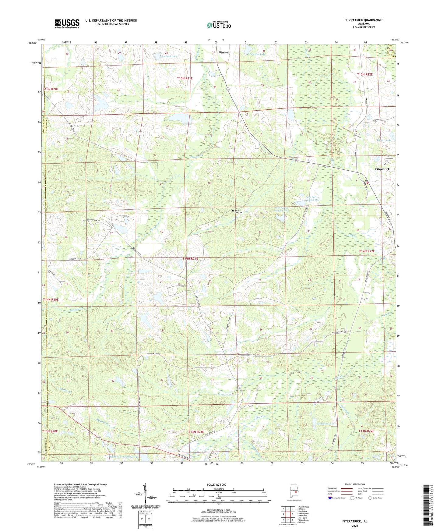
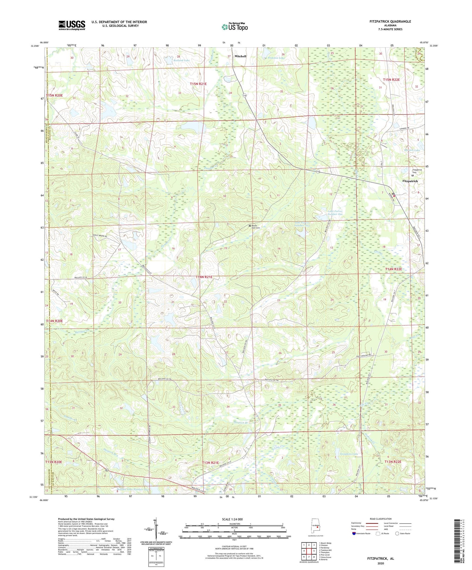
2024 topographic map quadrangle Fitzpatrick in the state of Alabama. Scale: 1:24000. Based on the newly updated USGS 7.5' US Topo map series, this map is in the following counties: Bullock, Montgomery, Macon. The map contains contour data, water features, and other items you are used to seeing on USGS maps, but also has updated roads and other features. This is the next generation of topographic maps. Printed on high-quality waterproof paper with UV fade-resistant inks.
Quads adjacent to this one:
West: Teasleys Mill
Northwest: Mount Meigs
North: Chesson
Northeast: Hardaway
East: Thompson
Southeast: Almeria
South: China Grove
Southwest: Pine Level
This map covers the same area as the classic USGS quad with code o32085b8.
Contains the following named places: Barnett Lake, Bucksnort, Colman Creek, Fitzpatrick, Fitzpatrick Cemetery, Fitzpatrick Census Designated Place, Fitzpatrick Church, Fitzpatrick Division, Fitzpatrick Elementary School, Fitzpatrick Post Office, Forrer Number 1 Dam, Forrer Number 2 Dam, Greenwood - Fitzpatrick Volunteer Fire Department, Greenwood Baptist Church, Greenwood Store, Heron, Highlog, Jinwrights Gin, Lake Forrer Number One, Lake Forrer Number Two, Line Creek Church, McGhee Lake Number Two, Mcghee Pond, Mitchell, Mitchell Lake, Mitchell Lake Dam, Mount Mariah Church, Mount Zion Cemetery, Mount Zion Church, Murray School, New Bethel Church, Oak Grove Church, Oak Grove Number 4 Junior High School, Panther Creek Church, Piney Grove Church, Pinhook Creek, Pinkston Lake, Reynolds Store, Rutland Lake, Rutland Pond Dam, Rutland Store, Shopton Branch, Tompkins Dam, Tompkins Lake, Trinity Church, Turnipseed Lake, Turnipseed Lake Dam, Turnipseeds Store, ZIP Code: 36029