MyTopo
Hodges Alabama US Topo Map
Couldn't load pickup availability
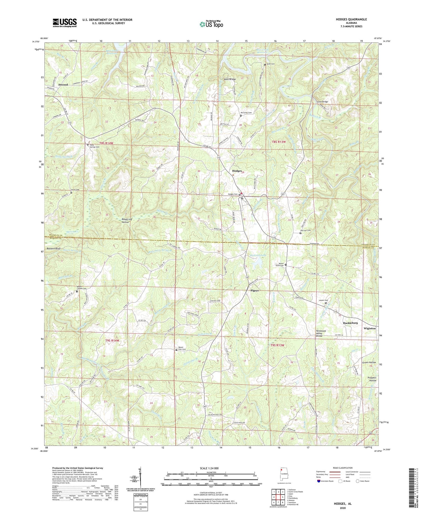
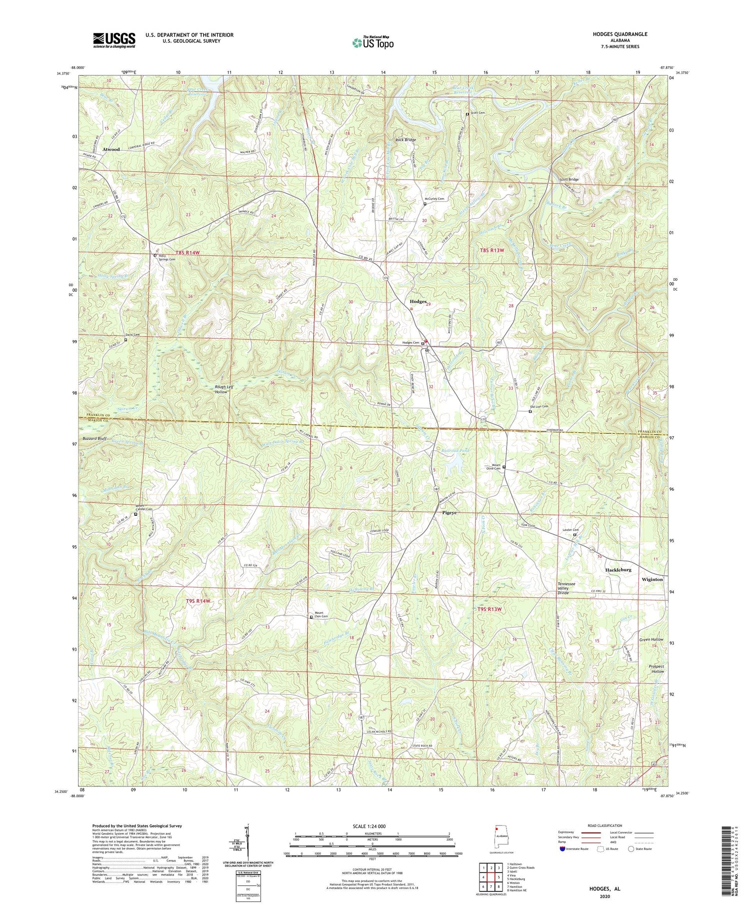
2024 topographic map quadrangle Hodges in the state of Alabama. Scale: 1:24000. Based on the newly updated USGS 7.5' US Topo map series, this map is in the following counties: Marion, Franklin. The map contains contour data, water features, and other items you are used to seeing on USGS maps, but also has updated roads and other features. This is the next generation of topographic maps. Printed on high-quality waterproof paper with UV fade-resistant inks.
Quads adjacent to this one:
West: Vina
Northwest: Halltown
North: Guinn Cross Roads
Northeast: Isbell
East: Hackleburg
Southeast: Hamilton NE
South: Hamilton
Southwest: Weston
This map covers the same area as the classic USGS quad with code o34087c8.
Contains the following named places: Atwood, Atwood Church, Bailey Branch, Bony Bluff Branch, Bridge Branch, Bullock Branch, Buzzard Bluff, Clear Running Branch, Cole Mill Branch, Davis Cemetery, East Fork Cole Mill Branch, Fowler Branch, Gann Branch, Garrett Branch, Green Hollow, Green Spring Branch, Green Williams Ford, Hodges, Hodges Cemetery, Hodges Dam, Hodges Junior High School, Hodges Post Office, Hodges Volunteer Fire Department, Holcomb Branch, Holloway Branch, Holly Spring Church, Holly Springs Cemetery, Hulsey Branch, Jim Williams Ford, Keller Branch, Lawler Cemetery, Lawler Mill Branch, Lime Kiln Branch, Mars Hill Church, McCurley Cemetery, McKelly Spring Branch, Mill Gann Branch, Miller Branch, Mount Carmel Cemetery, Mount Carmel Church, Mount Olive Baptist Church, Mount Olive Cemetery, Mount Zion Cemetery, Mount Zion Church, Mountain View Church, New Home School, Oilwell Branch, Old Line Cemetery, Old Line Church, Old Mount Carmel Church, Pig Branch, Pigeye, Pilot Hill Gas Field, Plum Orchard Branch, Polebridge Branch, Prospect Hollow, Railroad Pond, Raven Branch, Robinson Branch, Rock Bridge, Rock Bridge Canyon Park, Rocky Branch, Rocky Top Church, Rough Leg Hollow, Scott Bridge, Scott Cemetery, Scott Ford, Smith Branch, Steep Hollow Branch, Town of Hodges, Trace Branch, Turner Bobo Branch, Turner Branch, Twomile Creek, Unity Church, Walt Davis Spring Branch, West Fork Cole Mill Branch, West Gowder Branch, Wiginton, Wiginton Junior High School, ZIP Code: 35571