
MyTopo
Isbell Alabama US Topo Map
Couldn't load pickup availability
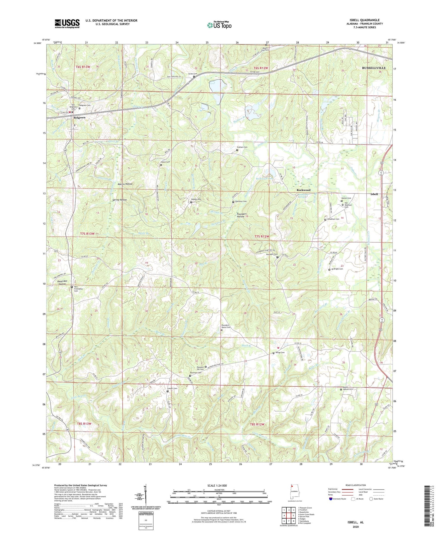
2024 topographic map quadrangle Isbell in the state of Alabama. Scale: 1:24000. Based on the newly updated USGS 7.5' US Topo map series, this map is in the following counties: Franklin. The map contains contour data, water features, and other items you are used to seeing on USGS maps, but also has updated roads and other features. This is the next generation of topographic maps. Printed on high-quality waterproof paper with UV fade-resistant inks.
Quads adjacent to this one:
West: Guinn Cross Roads
Northwest: Pleasant Grove
North: Frankfort
Northeast: Russellville
East: Spruce Pine
Southeast: Phil Campbell
South: Hackleburg
Southwest: Hodges
This map covers the same area as the classic USGS quad with code o34087d7.
Contains the following named places: Bare Field Branch, Belgreen, Belgreen Cemetery, Belgreen Census Designated Place, Belgreen Fire Protection District, Belgreen High School, Big Branch, Bowen Branch, Butler Branch, Camp Branch, Capeland Branch, Cedar Creek Church, Chisholm Creek, Creamos Springs Branch, Desprez Branch, Duncan Branch, Ezzell Branch, Franklin County, Frog Pond Fire Department, Glasgow Corner, Gourd Neck Branch, Graham Branch, Graham Cemetery, Grissom Branch, Hamilton Branch, Hamilton Cemetery, Hamilton Creek, Hickory Flat Church, Isbell, Keelen Cemetery, Lawler Cemetery, Long Branch, Lucas Branch, Mack Branch, Madden Branch, Martin Hollow, McWright Cemetery, McWright Creek, Moorman Cemetery, Mount Hebron Cemetery, Mount Hebron Church, Mount Zion Cemetery, Mud Creek, New Friendship Cemetery, New Friendship Church, New Pleasant Church, Nix Branch, Old Belgreen Cemetery, Old Robinson Cemetery, Parrish Branch, Parrish Pond, Piney Creek, Pleasant Hill, Pleasant Hill Cemetery, Pleasant Hill Church, Pleasant Hill School, Pounders - Quinn Cemetery, Pounders Cemetery, Pounders Hollow, Quinn Memorial Church, Ray Branch, Robinson Creek, Rockwood, Rockwood Church, Rockwood Junior High School, Rockwood Lake, Rockwood Spring, Rocky Branch, Sawmill Branch, Shingle Branch, Smith Cemetery, Sol Martin Branch, Spring Hollow, Steadham Cemetery, Steele Branch, Stone Branch, Strickland Branch, Tompkins Cemetery, Upper Field Branch, Walden Cemetery, Welch Cemetery, Wingo Cemetery, ZIP Code: 35585


