MyTopo
Jones Crossroads Alabama US Topo Map
Couldn't load pickup availability
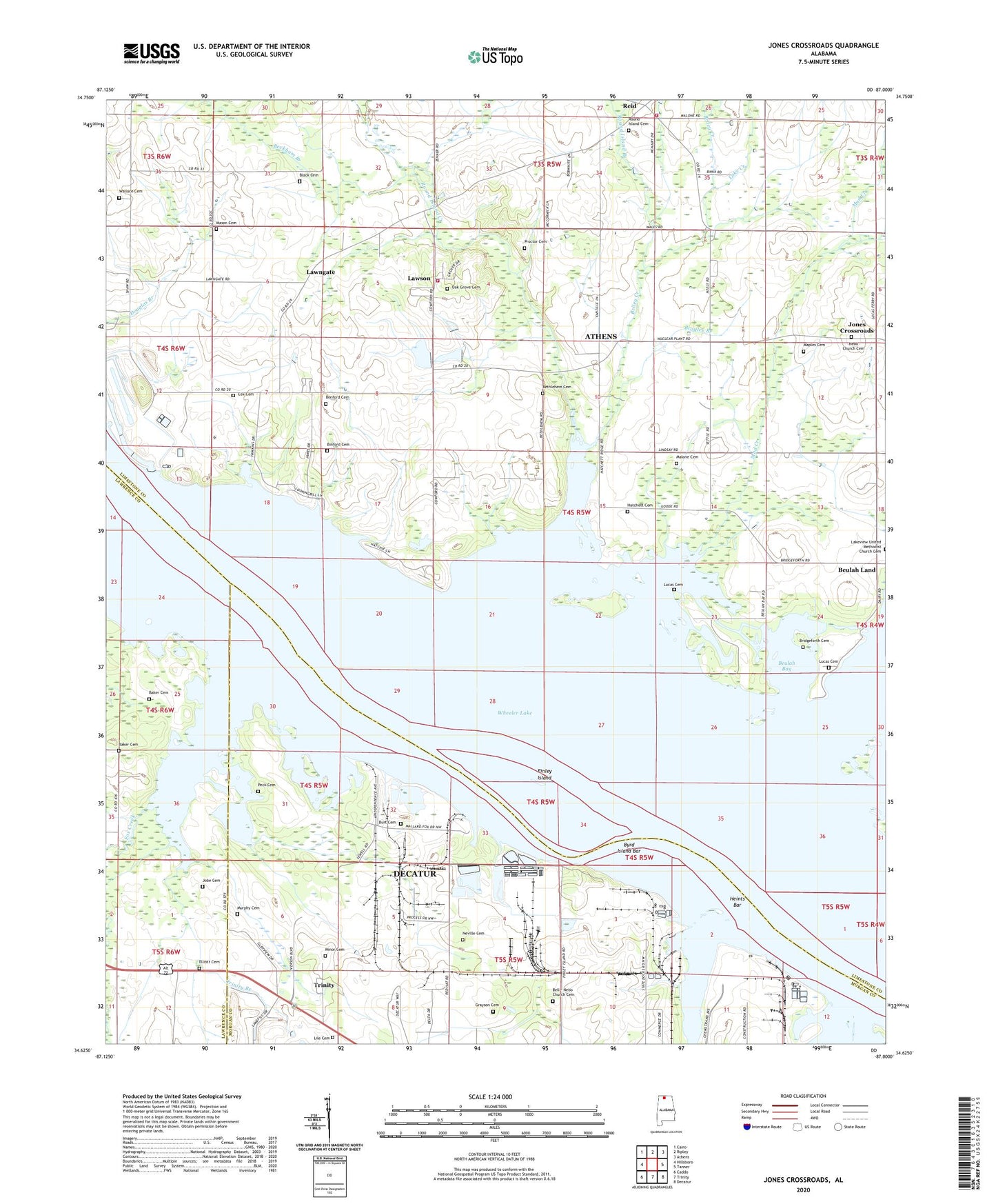
2024 topographic map quadrangle Jones Crossroads in the state of Alabama. Scale: 1:24000. Based on the newly updated USGS 7.5' US Topo map series, this map is in the following counties: Limestone, Morgan, Lawrence. The map contains contour data, water features, and other items you are used to seeing on USGS maps, but also has updated roads and other features. This is the next generation of topographic maps. Printed on high-quality waterproof paper with UV fade-resistant inks.
Quads adjacent to this one:
West: Hillsboro
Northwest: Cairo
North: Ripley
Northeast: Athens
East: Tanner
Southeast: Decatur
South: Trinity
Southwest: Caddo
This map covers the same area as the classic USGS quad with code o34087f1.
Contains the following named places: Baker Cemetery, Beckham Branch, Bell - Nebo Church Cemetery, Bell Church, Bells School, Benford Cemetery, Bethlehem Cemetery, Bethlehem Church, Beulah Bay, Beulah Land, Beulah Land Fishing Camp, Binford Cemetery, Bridgeforth Cemetery, Bridgeforth Farms, Briley Creek, Browns Ferry, Browns Ferry Nuclear Plant, Broyles Branch, Burt Cemetery, Byrd Island Bar, Cox Cemetery, Decatur State Docks, Douglas Branch, Dry Creek, Elliott Cemetery, Ezekiel Church, Finley Island, Finley Island Cabin Site Area, Fox Creek, Grayson Cemetery, Hatchett Cemetery, Heints Bar, Heints Landing, Hines Mill, Jobe Cemetery, Jones Crossroads, Lake Creek, Lakeview Church, Lawngate, Lawson, Lawson Lake Number 2, Lawson Lake Number 2 Dam, Lile Cemetery, Lucas Cemetery, Mallard-Fox Creek Industrial Park, Malone Cemetery, Mason Cemetery, Mason Island, Minor Cemetery, Mount Pisgah Church, Mud Creek, Murphy Cemetery, Nebo Church, Nebo Church Cemetery, Nebo Presbyterian Church, Nebo School, Neville Cemetery, Oak Grove Church, Old Browns Ferry Landing, Paynes Landing, Peck Cemetery, Pecks Landing, Pine Ridge School, Proctor, Proctor Cemetery, Reid, Riverview, Riverview School, Round Island Baptist Church, Round Island Branch, Round Island Cemetery, Round Island Creek, Round Island Creek Public Use Area, Saint Luke School, South Worth Landing, Tanner Volunteer Fire Department Station 2, Trinity Branch, Wallace Cemetery, Wheeler Lake, Wheeler Memorial School